.jpg)
Roe Plains
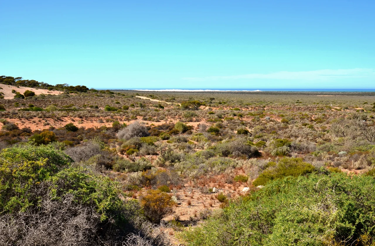
Stand on the Roe Plains and you are standing on the bottom of a sea that drained away. The flat green country running along the Great Australian Bight, hemmed in by cliffs that were once the coastline, is a landscape caught in slow motion: an ancient seabed exposed when the water fell back and the shore moved south. Above it rises a pale wall of limestone, the Hampton Tableland, and beyond that the treeless immensity of the Nullarbor. The plain is the quiet bench at the foot of all that height, a sliver of low ground between the cliffs and the bight.
When the Sea Pulled Back
The Nullarbor Plain above is itself a former seabed, lifted out of the ocean during the Miocene epoch. As the sea later withdrew, its old coastal cliffs were abandoned and stranded inland, hardening into the Wylie and Hampton scarps. The Roe Plains were carved during that long retreat, shaped by coastal erosion through the Pliocene as the cliffs wore back and the waterline crept seaward. The result is a coastal plain made largely of marine dunes, geologically young, late Neogene in age. Like the cave-riddled tableland above it, the Roe Plains hold fossils, the remains of creatures from when this was open ocean rather than dry scrub. The whole region is underlain by Cenozoic limestone, riddled with the karst and caves that form when rainwater slowly dissolves stone. There are no rivers here, no surface streams; water vanishes underground through the rock, which is part of why the landscape feels so still and so silent.
Walls of Stone
The plain is fenced in by some of the most dramatic coastline in Australia. To the west run the Baxter Cliffs, marching nearly 200 kilometres along the bight. To the east, the Bunda Cliffs extend another 210 kilometres from near Eucla into South Australia, a continuous rampart of fossiliferous limestone dropping straight into the Southern Ocean. To the north, the Hampton Tableland escarpment climbs to meet the Nullarbor. These cliffs are the same geological story told three ways, the edges of an uplifted seafloor, and the Roe Plains lie cupped within them like the inside of a vast natural amphitheatre opening to the sea.
Greener Than You Expect
The Nullarbor's name comes from Latin words meaning no trees, but the Roe Plains quietly break that rule. Sheltered at the base of the escarpment, the plains make up most of the Hampton bioregion and carry coastal scrub, mallee woodland, and stands of tall eucalypts, unexpectedly green country in a place better known for emptiness. The shelter of the cliffs and the nearness of the sea soften conditions just enough for woodland to take hold where the open tableland above stays bare. The western edge falls within Nuytsland Nature Reserve, home to the Eyre Bird Observatory, where birdwatchers come to a remote outpost on the very margin of the continent. The plain reaches further west than most travellers realise, all the way to Twilight Cove, far past the point where the Eyre Highway has already climbed back onto the Nullarbor.
The Few Who Live Here
Almost no one lives on the Roe Plains. The Eyre Highway crosses them between Madura Pass in the west and Eucla Pass in the east, and along that thread the only settlements are the roadhouses at Madura and Mundrabilla, with the pastoral stations that share their names. They are dots of human presence on a plain that swallows scale. A driver descending Madura Pass watches the whole expanse open out below, the road dropping off the tableland onto the old seabed, the green plain running away toward a horizon where land and the Great Australian Bight finally blur together.
From the Air
The Roe Plains run along the southeastern coast of Western Australia, centred near 32.11 degrees south, 126.81 degrees east. From the air the defining features are unmistakable: the long line of the Baxter and Bunda cliffs plunging into the Great Australian Bight, and the abrupt step of the Hampton escarpment separating the low green plain from the pale Nullarbor above. The Eyre Highway threads the plain, and widened sections at Madura and Mundrabilla serve as Royal Flying Doctor Service emergency airstrips, marked directly on the road. The nearest serviced aerodrome is Forrest Airport (ICAO: YFRT) on the Nullarbor to the north; Kalgoorlie-Boulder (ICAO: YPKG) lies far to the west. The plain sits near sea level beneath cliffs rising 60 to 90 metres; a coastal approach at 2,000 to 4,000 feet best reveals the contrast between cliff, plain, and sea. Sea breezes can bring haze near the coast, but inland visibility is usually long.
Nearby Stories
- Hampton Tableland 11 km away
- Arubiddy Station 27 km away
- Mundrabilla, Western Australia 62 km away
- Trans-Australian Railway 94 km away
- Old Homestead Cave 99 km away
- Baxter Cliffs 138 km away
- Point Culver 202 km away
- Great Australian Bight 266 km away