.jpg)
Mundrabilla, Western Australia
In 1966, two geologists surveying the Nullarbor came across a slab of iron lying on the plain that weighed more than twelve tonnes. It had been there for at least a million years, a fragment of the solar system resting quietly on the desert until R. B. Wilson and A. M. Cooney walked up to it. The Mundrabilla meteorite, as it became known, is the largest meteorite ever found in Australia, and the country around this scattered settlement is still littered with its broken pieces. Mundrabilla is barely a place at all, a population of 23 at the last count, yet the sky once delivered something extraordinary to its doorstep.
Iron From the Sky
The main mass weighs 12.4 tonnes and now rests in the Western Australian Museum. It was not alone: a second giant fragment of more than five tonnes lay close by, the two found about 180 metres apart, together making up the Mundrabilla Mass. In all, more than twenty tonnes of fragments have been recovered, scattered across roughly 60 kilometres, which makes this one of the largest meteorite sites anywhere on Earth. The pieces fell at least a million years ago, long before any human eyes were here to see them streak down. The Nullarbor turns out to be a near-perfect place to find such things: its flat, pale, largely unchanging surface preserves dark iron meteorites and makes them easy to spot, so the plain has become one of the world's richest hunting grounds for fallen stone. For perspective, this single iron visitor outweighs a fully grown elephant several times over, and it arrived from beyond the planet entirely.
Two Irishmen and a Scot
Long before the meteorite was found, this was pioneer pastoral country. Mundrabilla Station was the first sheep station in the Nullarbor region, established in 1872 by William Stuart McGill, a Scotsman, together with the Irish brothers Thomas and William Kennedy. Getting there was an ordeal in itself: they drove some 1,500 sheep and eight horses roughly 1,200 kilometres overland from Albany to reach this grazing land. The frontier exacted its price. McGill's first wife, Annie Harkness, died in childbirth in 1879, and Thomas Kennedy died in 1896. Both Annie and Thomas are buried on the station, two graves marking the human cost of settling one of the loneliest corners of the continent.
Cooled by the Sea, Yet Scorching
Mundrabilla has an arid climate, but its position near the Great Australian Bight keeps its summers milder than the deep interior of the Australian desert. Milder is relative. On 3 January 1979, the thermometer at Mundrabilla Station reached 49.8 degrees Celsius, which stands as the equal sixth-hottest temperature ever recorded anywhere in Australia. It is a place of extremes wearing a modest face, cooled by an ocean that lies only about 20 kilometres to the south, yet still capable of heat that would stop most landscapes cold.
Life Beside the Highway
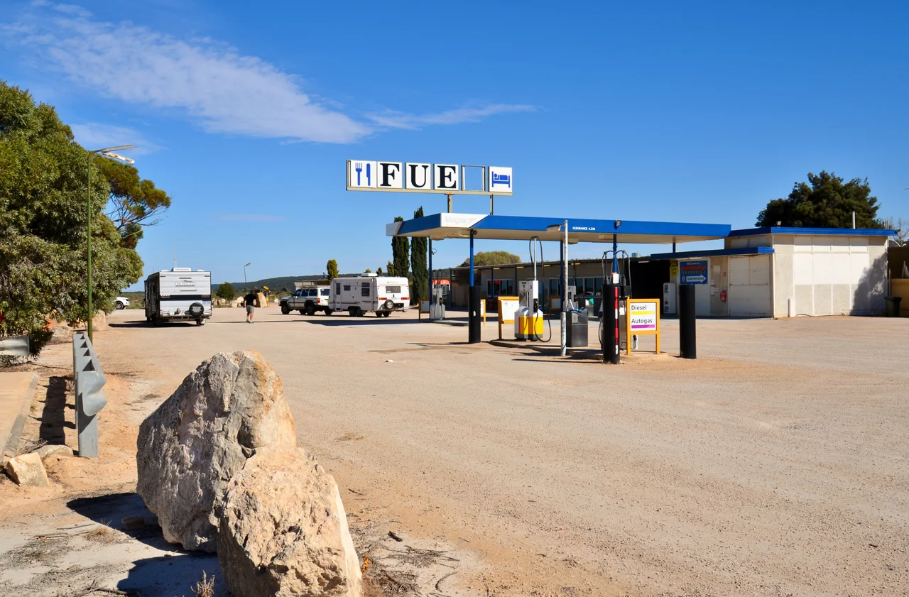
Today, like every settlement strung along this stretch of the Eyre Highway, Mundrabilla amounts to little more than a roadhouse, open from early morning until half past nine at night. It was built by Roger and Pat Warren-Langford, who had managed the station before turning to travellers. Like its neighbours along this stretch, it keeps the unofficial local time of UTC+8:45, the Nullarbor's curious 45-minute clock that no government formally recognises. The roadhouse keeps a small wildlife park with emus, camels, and an aviary, a touch of company on a route where the next stop can be an hour or more away. The roadhouse and the historic station sit about 35 kilometres apart, two points of the original holding, while pastoral work carries on across the surrounding plain much as it has for 150 years.
From the Air
Mundrabilla lies at 31.84 degrees south, 127.86 degrees east, on the Roe Plains south of the Nullarbor, about 66 kilometres west of Eucla and only some 20 kilometres north of the Great Australian Bight. From the air the orientation is clear: the pale Nullarbor tableland to the north, the lower green coastal plain below the Hampton escarpment, and the cliffs of the bight to the south. The roadhouse sits beside the Eyre Highway, and a widened section of that road serves as a Royal Flying Doctor Service emergency airstrip, marked with runway lines on the pavement. The nearest serviced aerodrome is Forrest Airport (ICAO: YFRT) to the north on the rail corridor; Ceduna (ICAO: YCDU) lies well to the east in South Australia. Note the local unofficial time zone UTC+8:45. Terrain is low and flat near the coast, rising at the escarpment; visibility is usually long, though extreme summer heat, the site once recorded 49.8 degrees Celsius, drives strong thermals. Recommended viewing altitude 2,500 to 4,500 feet along the line of the bight.
Nearby Stories
- Madura Station 23 km away
- Abrakurrie Cave 32 km away
- Old Homestead Cave 57 km away
- Loongana railway station 80 km away
- Bunburra Rockhole Meteorite 89 km away
- Eyre Telegraph Station 91 km away
- Twilight Cove 165 km away
- Great Australian Bight 183 km away