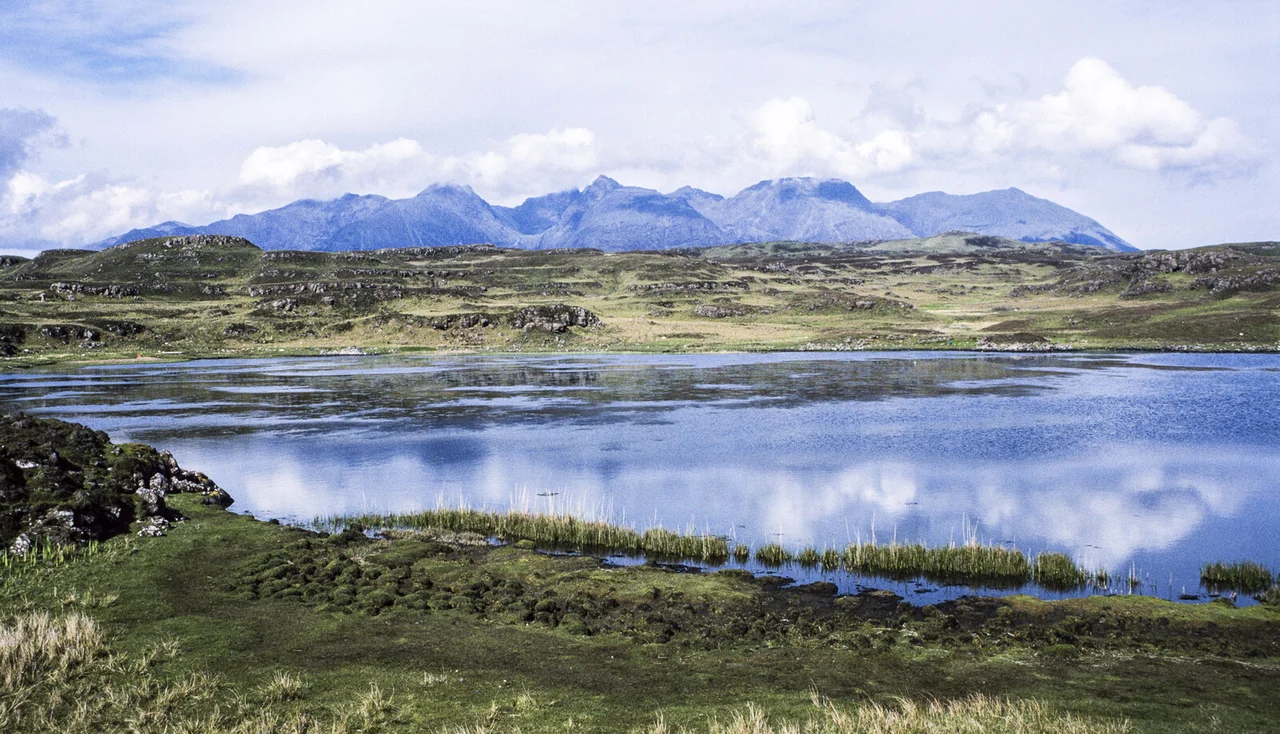

Rubha an Dunain
In 2000, a local archaeologist reached into the silt of a small inland loch on a peninsula south of the Cuillin and pulled out a piece of timber. The wood was a clinker-built faering plank - the side of a small Norse-style boat. Carbon dating placed it around AD 1100. Nine years later, a Historic Scotland survey of the same loch revealed something nobody had expected: stone-built quays, boat noosts cut into the shore, a system of sluices to maintain water level, and an artificial canal connecting the loch to the sea. The Vikings had built a hidden inland harbour on Rubha an Dunain, and used it for centuries.
A Highway into History
Marine archaeologist Dr Colin Martin called the discovery 'a highway into history' and noted that no other site quite like it has been identified anywhere in Scotland. Loch na h-Airde is a small body of water near the western tip of the peninsula, separated from the sea by only a few hundred metres of land. The canal that the Vikings dug along the line of the natural outflow stream allowed boats - faerings, birlinns, larger galleys - to be floated into the calm inland water at high tide. Once inside, they could be repaired, refitted, hauled out onto stone slipways, or simply moored out of weather. Historic Environment Scotland now lists the site as 'a rare medieval harbour complex' with quays, noosts, canal, and boat fragments likely surviving in the loch bed. In 2017 it was designated a historic monument of national importance.
Older Layers
The Viking harbour is only the most recent significant archaeology. The peninsula contains a Mesolithic rock shelter dating back perhaps eight or nine thousand years, used by the first known human inhabitants of Skye. A chambered cairn from the 2nd or 3rd millennium BC sits to the north of the loch - Neolithic farmers buried their dead inside it. A passage grave nearby reflects the same culture's funerary practices. South of the loch, an Iron Age dun - a small defensive enclosure - gave the peninsula its name: Rubh' an Dunain means 'point of the dun'. The site has been occupied or used by sea-people, in one form or another, for almost the entire span of human presence in Scotland.
The MacAskills
After the Vikings the peninsula passed into the hands of Clan MacAskill, a sept of Clan MacLeod. They were Coast Watchers and bodyguards to the MacLeod chiefs at Dunvegan - hereditary defenders of the western seaboard, well placed to spot trouble approaching from the Atlantic. By the early 19th century the Rubha an Dunain farm extended to 37,500 acres and supported about seventy men plus families. Then came the Highland Clearances. The MacAskill leaders emigrated to the United States, New Zealand, and Cape Breton in Nova Scotia. By 1861 the census recorded nobody living on the peninsula. The 18th-century tacksman's house still stands in ruin, along with the stone walls of crofts that once held families now scattered across the New World.
Walking to the Edge
There is no road. To reach Rubha an Dunain you walk - about five miles each way from the end of the road at Glen Brittle, along a rough track that follows the coast around the southern flank of the Cuillin. The path crosses bog, scrambles over rocky shoulders, and skirts the foot of Sgurr nan Eag. Looking inland, the Black Cuillin rise nearly vertically above; looking out, Rum and Eigg sit on the horizon across the sea. The peninsula itself is low - rising only to thirty metres above sea level - with the loch lying like a green disc in a hollow. Otters fish along the burns. A small empty bothy stands where the MacAskill farm once was. Down at the canal, the stones the Vikings cut a thousand years ago still hold their courses, waiting for tides that no longer matter.
From the Air
Rubha an Dunain extends southwest from the foot of the Cuillin at 57.17 N, 6.32 W. Recommended viewing altitude 1,500-3,000 ft AGL. The peninsula is low (max ~30 m) with Loch na h-Airde visible as a small inland water near the western tip. The Cuillin ridge rises immediately to the north and east - the Black Cuillin peaks tower over the peninsula. Nearest airports: Inverness (EGPE) ~100 nm east, Oban (EGEO) ~50 nm south, Glasgow (EGPF) ~140 nm south. The Sea of the Hebrides west of the peninsula provides clearer flying than the Cuillin region to the north. Strong westerlies and Atlantic squalls common.
Nearby Stories
- Bernera Barracks 0.3 km away
- Storr Lochs Hydro-Electric Scheme 1.9 km away
- Eigg 6 km away
- Torridon 10 km away
- Glenfinnan Railway Station 14 km away
- German submarine U-722 16 km away
- Lochmaddy 32 km away
- SS Seniority 46 km away