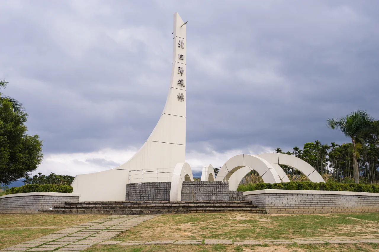

Ruisui Tropic of Cancer Marker
Once a year, on the 22nd of June, at exactly noon, the monument disappears. Not literally—it still stands on its terrace above the highway in Ruisui Township, Hualien County—but its shadow vanishes. The sun, at that precise moment, is directly overhead. It crosses the Tropic of Cancer at 23.5 degrees north latitude, and this small corner of Taiwan's East Rift Valley sits precisely on that line. For a few minutes, a concrete marker that usually looks like a modest piece of civic infrastructure becomes something stranger: a sundial that shows the sun is not east or west, not north or south, but perfectly, vertically above.
A Line Drawn by the Sun
The Tropic of Cancer is one of the five major circles of latitude, marking the northernmost point at which the sun appears directly overhead—an event that occurs once per year at the June solstice. For most people, it is an abstraction, a dotted line on a globe. On Wuhe Terrace in Ruisui Township, it becomes physical. The marker was originally built in 1933, during Taiwan's period of Japanese colonial administration, and placed west of Ruisui Railway Station. When the Hualien–Taitung rail line underwent track replacement work in 1981, the monument had to move. It was relocated to Wuhe Terrace and positioned along Provincial Highway 9, where it stands today, flanked by the Coastal Mountain Range to the east and the broad Xiuguluan River plain spreading toward the Pacific. The terrace itself is a raised benchland formed by ancient river action—a geological accident that gives the monument a commanding view over the valley floor.
Built in the Time of Administration
The 1933 construction date places the marker in the later decades of Japanese colonial rule, a period when the administration was systematically surveying, cataloguing, and developing eastern Taiwan. The Japanese named the valley the Nakasendō Plain and organized it into agricultural townships, building the rail infrastructure that still defines movement through the region. Erecting a monument to an astronomical datum—23.5 degrees north—was part of that same impulse toward measurement and documentation. The colonial period ended in 1945, the marker endured, and the 1981 relocation gave it a new address but not a new meaning. What the original builders understood, and what subsequent generations preserved, is that a line running through a specific place can make the abstract concrete: you can stand on the Tropic of Cancer, and standing on it changes how you think about where you are.
The Solstice Moment
June 22nd is the day that draws visitors to Wuhe Terrace specifically to witness the shadow vanish. At noon on the summer solstice, when the sun reaches its zenith directly above the Tropic, vertical objects in the zone around 23.5 degrees north latitude cast no shadow—or the smallest possible shadow, depending on the precision of your position relative to the line. The effect is brief and subtle. There is no flash of light, no ceremony of nature. But for people who have come to see it, the absence of shadow where a shadow should be feels genuinely uncanny, a reminder that the planet is tilted on its axis and that tilt governs almost everything: seasons, climate, agriculture, the migration of birds, the ripening of rice. Ruisui is not alone on the Tropic—the line crosses fourteen countries—but this terrace above the East Rift Valley offers one of the more dramatic settings for the experience, with mountains rising on both sides of the valley.
By Train, Through the Valley
The monument is accessible on foot from Ruisui Station on the Taiwan Railway. The station sits south of the terrace, connected by a short walk that passes through the small township before climbing to the Highway 9 viewpoint. Ruisui itself is a quiet place—a hot-spring resort town, a farming community, a stop on the East Rift Valley route where travellers sometimes spend a night to soak in the sodium bicarbonate springs. The marker draws visitors year-round, but most come either for the solstice or simply as part of moving through the valley between Hualien and Taitung. Cyclists on the Highway 9 corridor pass it regularly. It sits at the intersection of geography and astronomy, which makes it an odd destination to seek out specifically—but a resonant one to encounter unexpectedly, when you realize you are standing on a line that the sun itself marked out.
From the Air
The Ruisui Tropic of Cancer Marker sits at approximately 23.47°N, 121.36°E on Wuhe Terrace in Ruisui Township, Hualien County. From the air, look for the terrace benchland just east of the Highway 9 corridor, south of Ruisui Station, on the western edge of the East Rift Valley. The Xiuguluan River is visible to the southeast. Nearest airport is Hualien Airport (RCYU), roughly 40 km to the north. At low altitude—2,000 to 3,000 feet—the valley setting is clear: mountain ranges rising on both sides, rice paddies on the valley floor, and the terrace terrace landform standing slightly above the surrounding agricultural plain. Best visibility in the morning before afternoon cloud builds along the Coastal Range.
Nearby Stories
- Lulin Observatory 6.6 km away
- Sanxiantai 10 km away
- Ci En Pagoda 13 km away
- 2024 Hualien Earthquake 14 km away
- Baolai Spring Park 26 km away
- Twin Forts of Romblon 1182 km away
- Sinking of MV Sewol 1228 km away
- Sibuyan Island 1230 km away