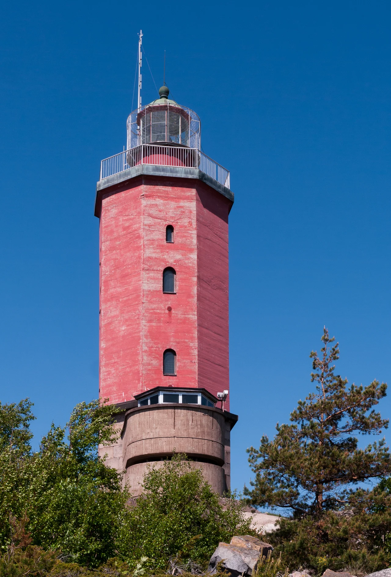

Russarö Lighthouse
Finnish sailors gave it a name that has outlasted three regimes: *Hangon silmä*, the Eye of Hanko. It has been open for more than a century and a half, four white flashes every forty-five seconds from a red octagonal tower standing on a low granite skerry a few miles south of Finland's southernmost town. What has closed instead is everything around it. The island of Russarö belongs to the Finnish Defence Forces, the door at the base of the tower is shut to visitors, and the eye keeps watching a stretch of water that every ship bound for the Gulf of Finland must cross.
Before the Light
Something has been standing on this rock since 1815 — first unilluminated daymarks, shapes painted and raised purely to be recognised in daylight, then early lighthouses. A navigator coming up from the Baltic in the years before the present tower had to identify the skerry by silhouette alone, and hope the weather held long enough to do it. One of those earlier beacons survives in a drawing made for *Finland framställdt i teckningar*, the illustrated survey of the country published between 1845 and 1852, back when the island's name was still written in older forms that have since fallen out of use.
Built to Burn in January
The present tower went up in 1863: brick and mortar over a granite base, octagonal in plan, five storeys, rising 21 metres with its light 34.2 metres above the sea. The paintwork is a red tower over a base left the colour of the stone. What made it genuinely unusual was not the height but the calendar. Russarö was the first lighthouse in Finland to operate through the winter months as well as the summer, which sounds technical until you remember why Hanko exists at all. The port was built because the sea here freezes last, and a winter port is worth nothing without a winter light. Somebody had to live out on the rock and keep it burning through the dark half of the year. The keepers finally came off in 1949, when the light was automated.
The First of December, 1939
By the 1930s the island carried Finnish coastal artillery — heavy 234-millimetre guns sited to command the approaches. On 1 December 1939, the second day of the Winter War, the Soviet light cruiser *Kirov* came south of Hanko with the destroyers *Stremitelny* and *Smetlivy* and engaged the battery. The exchange did not last long. The Soviet ships broke off and withdrew, and *Kirov* went back to base carrying seventeen dead and thirty wounded — men who had been at war for roughly thirty-six hours. Ashore, the gunners kept their guns. The lighthouse, standing among the batteries, survived a naval action fought at the range its own beam was designed to cover.
A Closed Island, a Long Record
Russarö remained a military island and remains one. That closure has had one civilian by-product: the Finnish Meteorological Institute's weather station here has been recording an exposed, unshadowed patch of the outer Baltic for decades, and the numbers describe a place with a genuinely maritime temperament. The 1991–2020 records run from −33.6°C at the coldest to 30.5°C at the warmest — a wide span in absolute terms, but far narrower than what the mainland a few dozen kilometres north endures, because open water is slow to warm and slow to let go.
Close Enough to See
In summer, day cruises run out to Russarö from Hanko's Eastern Harbour, and passengers can walk a little of the island. What they cannot do is climb the tower. The interior has deteriorated badly enough that entry is no longer permitted, so the Eye of Hanko is now something to be looked at rather than looked out of — a working navigational aid that has quietly become a monument to itself. From the deck of the boat you get the view that matters anyway: a low grey skerry with a red column on it, the Baltic running away south with nothing in the way until Estonia, and the light doing what it has done since 1863.
From the Air
Russarö Lighthouse stands at 59.767°N, 22.948°E, roughly 5 km south of Hanko on the island of Russarö — a restricted military area, so respect any published prohibited or restricted airspace and do not overfly at low level. Hanko Airfield (EFHN) lies about 12 km northeast; Helsinki-Vantaa (EFHK) is around 125 km northeast and Turku (EFTU) about 135 km northwest. From 2,000–4,000 ft offshore the island reads as a small, low, largely bare skerry with a distinct red tower and visible military infrastructure, set apart from the denser skerry chains closer to the peninsula. The light shows four white flashes every 45 seconds after dark. Sea fog is frequent here from spring into early summer; late autumn typically offers the sharpest visibility across the mouth of the Gulf of Finland.
Nearby Stories
- Jussarö 3.1 km away
- German submarine U-745 10 km away
- Teijo National Park 12 km away
- Junkarsborg 13 km away
- Battle of Lemo 32 km away
- Archipelago National Park 35 km away
- Peter the Great's Naval Fortress 50 km away
- Sinking of the MS Estonia 52 km away