San Luis Rey River
In the summer of 1769, Franciscan missionary Juan Crespi wrote in his diary about a valley the Portolà expedition had reached on their way north through Alta California: '...we descended to a large and beautiful valley, so green that it seemed to us that it had been planted.' The party camped there two nights, July 18–19, near pools of water on the valley floor. On the return journey the following January, they stopped again. The river they were camped beside would not have its current name for another 29 years. When Mission San Luis Rey de Francia was founded east of the river in 1798, the name of Saint Louis, King of France, attached itself to the water that had drawn the Portolà party to that valley.
The People of the West
Long before the Portolà expedition, long before the mission, the San Luis Rey River watershed was the homeland of the Luiseño people — the Payómkawichum, meaning 'People of the West' in their language. They lived along the river and its tributaries for many centuries, organizing their lives around the water that moved through the coastal foothills and the valley floors where Crespi's diary described two large villages at the river's edge.
The Spanish presence transformed the watershed in ways the Luiseño people did not choose and could not control. The mission system enrolled thousands of converts, reorganized the local economy around agriculture and livestock, and claimed the land for a different set of purposes. The river the Payómkawichum had known became infrastructure for a colonial project. The mission that took the river's name — or gave it its name, depending on how you reckon these things — became one of the largest of the California missions before the secularization acts of 1833 began its decline.
Course and Character
The San Luis Rey River rises in two main branches in the Palomar Mountain Range and Cleveland National Forest. The mainstem starts east of Rocky Mountain in the National Forest and flows generally south-southwest. The West Fork's headwaters rise as Fry Creek and Iron Springs Creek on Palomar Mountain, combining into the West Fork, which flows southeast through the Mendenhall Valley before joining the main stem at Lake Henshaw.
From Lake Henshaw, the river winds west along the foot of the Palomars, following California State Route 76 before bending southwest through a gorge into the Pauma Valley, where it becomes a wash bordered by agricultural fields. It passes through Pala, crosses under Interstate 15, and exits the mountain foothills near Bonsall. From there it flows southwest through Oceanside, reaching the Pacific at the river's mouth — the tidal lagoon north of the Oceanside Pier. The total length exceeds 69 miles; the watershed covers 562 square miles.
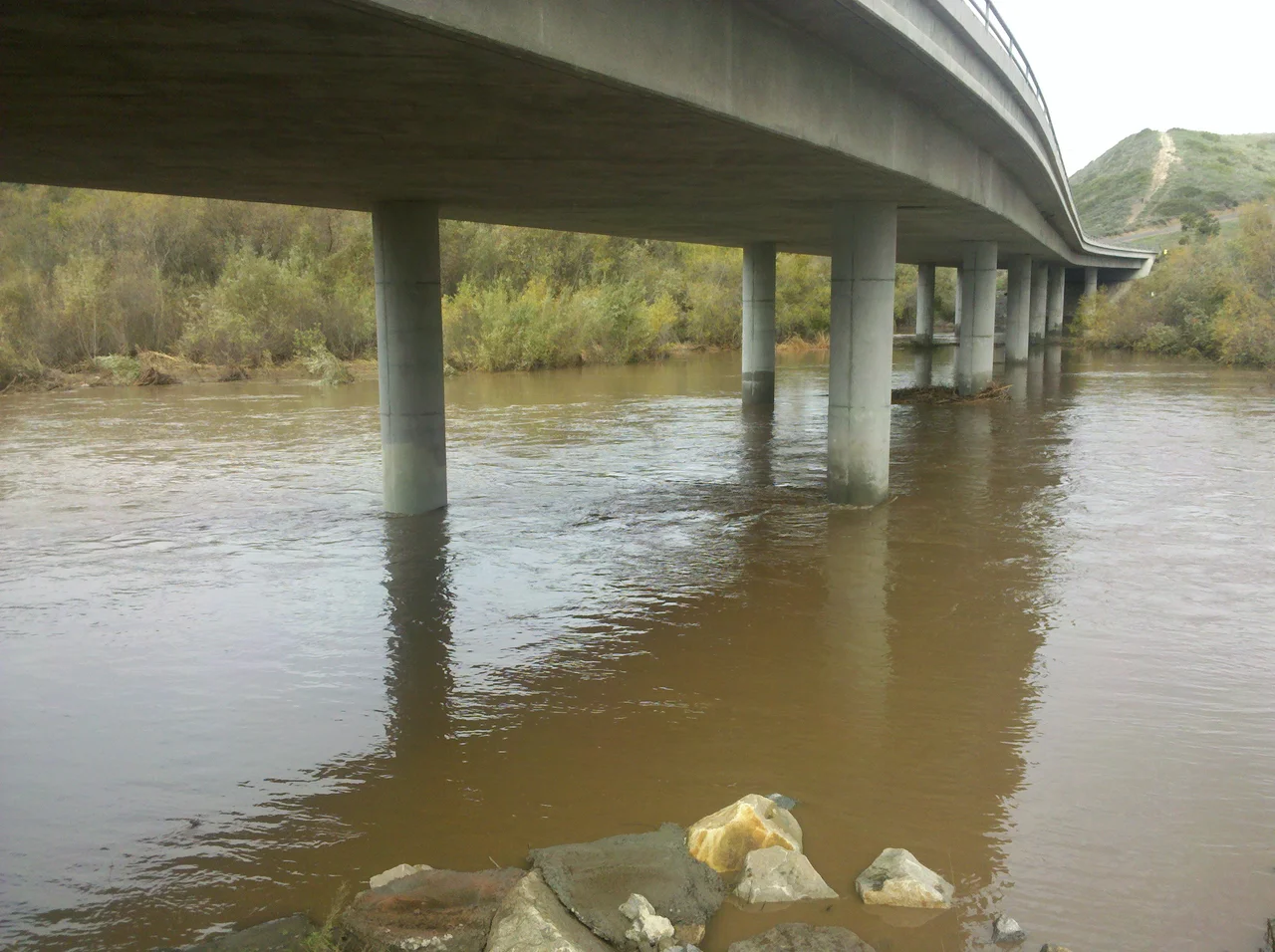
A Dry River with Wet Surprises
For most of the year, the San Luis Rey is dry. The desert interior of San Diego County receives little summer precipitation, and the river's flow depends primarily on winter storms — which, when they arrive, can produce very large flows indeed. The last seven miles of the river's course run through a 400-foot earthen channel with levees, an infrastructure investment designed specifically to prevent the stormwater that arrives in those winter events from flooding Oceanside.
The dam at Lake Henshaw, relatively close to the headwaters, functions as a drinking water source. Below Henshaw, the water quality has been degraded by urbanization, mining, and agriculture, and the lower reaches of the river are used for groundwater recharge rather than direct consumption. A bridge near the river mouth was completed in 2009, replacing a small causeway that had washed away in storms — a reminder that even a dry river can reassert itself.
The Bike Path and the Border
The San Luis Rey River Bike Path runs along the river for its last nine miles, from the inland areas of Oceanside to the river mouth at the Pacific. The path follows a corridor that would have been familiar to the Luiseño people, then to Spanish missionaries, then to Californio ranchers, and now to cyclists, joggers, and walkers navigating the urban edge where the river meets the city.
The river's name crossed one additional cultural boundary in 2010, when Rockstar Games released Red Dead Redemption, a Western set in a fictionalized version of the frontier Southwest. The game features a 'San Luis River' that serves as the border between the Western Border States and Mexico — a river named for the same saint, standing in for the same geography, this time drawn in pixels rather than water.
From the Air
The San Luis Rey River is visible from altitude as a dry wash and riparian corridor running west from the Palomar Mountain foothills to its mouth at Oceanside. The river mouth at 33.20°N, 117.39°W is clearly identifiable where it meets the Pacific, just north of the Oceanside Pier. Lake Henshaw is visible approximately 40 miles east-northeast in the mountains. The river corridor parallels State Route 76. McClellan-Palomar Airport (CLD) is approximately 8 miles south of the river mouth. Best viewed at 3,000-6,000 feet AGL.
Nearby Stories
- Where Hollywood Came Home to Make Theater 0.5 km away
- Viejas Band of Kumeyaay Indians 3.4 km away
- Santa Ysabel Asistencia 3.8 km away
- Cahuilla Band of Indians 14 km away
- Tenaja Fire 15 km away
- Laguna Art Museum 16 km away
- Balboa Island Ferry 54 km away
- USS Agerholm 165 km away