
Shirley, British Columbia
Shirley got its name from homesickness. When the post office opened on 1 May 1894, the postmaster's wife, Mrs. G. Clark, suggested naming it for her native town near Southampton, England, and the label fastened itself to a scatter of homesteads on the far side of the world. Nothing here resembles Hampshire. The coast is dark timber running down to grey water, Kirby Creek cutting through to the sea, and on clear days the Olympic Mountains standing up across the Strait of Juan de Fuca like a second country — which, in fact, they are. But the name held. That is how most place names on this coast came to be: somebody's memory of elsewhere, filed with the government, then permanent.
The Road Past Sooke
Shirley lies 57 kilometres west of Victoria on Highway 14, the two-lane road that runs out along Vancouver Island's southwest shoulder toward Port Renfrew. Past Sooke, the traffic thins and the pavement starts to behave like a country road, bending with the shoreline, dipping through creek gullies, opening now and then onto the full width of the strait. Shirley arrives without ceremony. There is no town centre, no municipal boundary, no mayor — it is an unincorporated locality, a legal category that amounts to a name on a map and a community that agrees to use it. The Strait of Juan de Fuca lies immediately to the south, twenty kilometres of open water separating the island from Washington's Olympic Peninsula. It is one of the busiest shipping approaches on the Pacific coast, and from the bluffs above Shirley you can watch freighters slide east toward Puget Sound all day long.
A Name From Southampton
Settlement in this area picked up after British Columbia joined Canada in 1871, when the terms of union promised a railway and the province began to feel less like a distant colonial outpost and more like a place with a future. Families took up land along the coast west of Sooke — logging, fishing, clearing enough ground for a garden. The post office that Edwin Clark opened in 1894 was the moment the community became official, because a post office meant a name, and a name meant you existed in the records of the Dominion. Shirley is, in that sense, a perfectly ordinary story of Vancouver Island settlement. What makes it worth noticing is how little has changed. The population has never grown into anything a census would call a town, and the highway still carries more logging trucks and surfers than commuters.
The Light at Sheringham Point
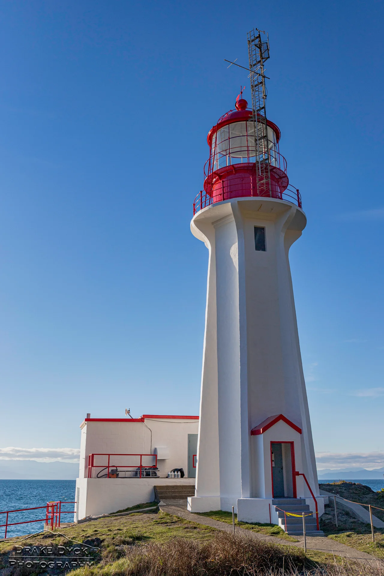
In 1912 the Department of Marine and Fisheries put a lighthouse on the rocky point at Shirley's southern edge. Sheringham Point Light was designed by William P. Anderson, the department's chief engineer, and built in reinforced concrete — a material Anderson favoured for its ability to shrug off Pacific weather. The tower stands 19.5 metres tall, with its light 22 metres above the water. For 77 years, keepers lived on the point and tended it, through two world wars and the endless procession of fog that gives this coast its reputation. The light was automated and de-staffed in 1989. Rather than let it decay, the community organized: the Sheringham Point Lighthouse Preservation Society took ownership from the federal government, and the site reopened to the public in 2016. The Canadian government had already designated it a Heritage Lighthouse on 16 April 2015. Walk out to it on a windy afternoon and the point does all the work a lighthouse is supposed to do — it makes the size of the water obvious.
Cell Service, 2023
For a community this small, Shirley has an improbable reach. The Shirley Delicious cafe, a roadside operation with picnic tables and a counter, has been written up by The Huffington Post, The Guardian, and The New York Times — international attention arriving at a place with no traffic light. The community hall is roughly ninety years old and still the centre of local life, and the fire hall is staffed by volunteers who cover a long, thinly populated stretch of highway where help from Victoria would arrive far too late. And in 2023, after years of dead zones, Shirley finally got cellular service. It is a small thing and an enormous one. On a coast where the nearest hospital is an hour away and the weather closes the road with some regularity, a working phone signal is not a convenience. It is infrastructure, arriving 129 years after the post office.
From the Air
Shirley sits at 48.3833 degrees north, 123.9000 degrees west, on the southwest coast of Vancouver Island. Best viewed from 2,500 to 4,000 feet AGL on a southwest track that follows the Highway 14 corridor west from Sooke. The unmistakable landmark is Sheringham Point Light on its rocky headland — a white concrete tower with a red lantern, roughly midway between Sooke Basin and Jordan River. Kirby Creek marks the community's eastern edge; the Strait of Juan de Fuca opens to the south with the Olympic Mountains filling the horizon beyond. Nearest airports: Victoria International (CYYJ) about 65 km east, Victoria Harbour water aerodrome (CYWH), and William R. Fairchild International (KCLM) at Port Angeles, Washington, directly across the strait. Expect frequent marine fog and low stratus along this shoreline from June through September, often burning off by early afternoon; winter brings strong southeasterlies and heavy rain.
Nearby Stories
- Victoria Harbour 0.8 km away
- Portland Island (British Columbia) 4.3 km away
- Lyre River 7.2 km away
- Skutz Falls 10 km away
- Makah Museum 13 km away
- Ozette Lake 15 km away
- Cheewhat Giant 21 km away
- Hurricane Ridge 27 km away