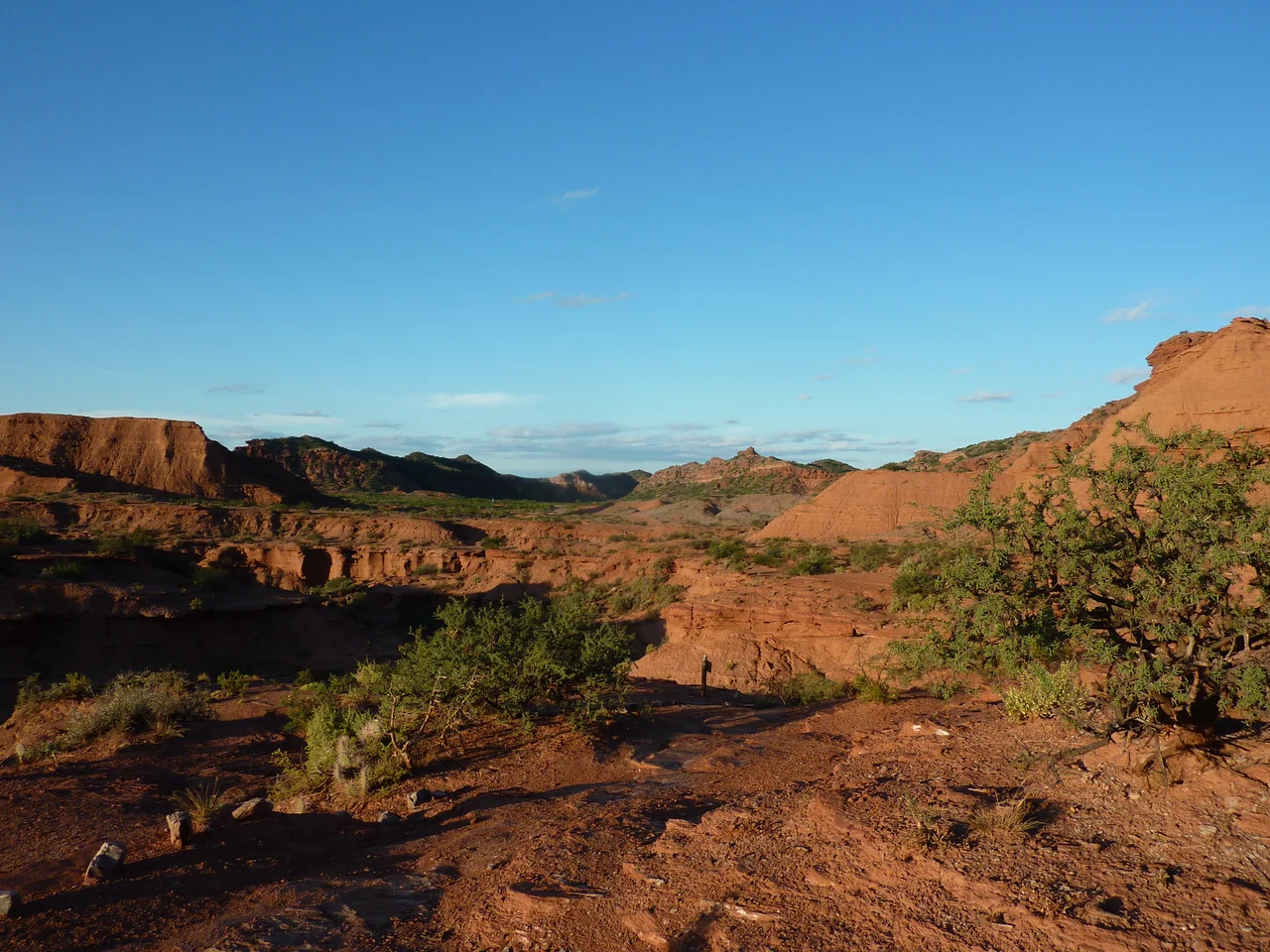

Sierra de las Quijadas National Park
Late in the afternoon, the rock begins to burn. The cliffs of Sierra de las Quijadas turn the deep umber red of old brick, and the shadows pooling in the ravines go violet. This is high desert in the province of San Luis, a place of wide silence where the only sounds are wind and the occasional clatter of a guanaco picking its way along a ledge. The name means "jaws" - a fitting word for a landscape of jagged ridges and dark cave mouths bitten out of the cliffs.
The Great Amphitheatre
At the heart of the park lies the Potrero de la Aguada, a vast natural amphitheatre that water and wind have carved over millions of years. Stand at its rim and the scale is hard to absorb: tiered terraces of red and ochre rock fall away in every direction, sculpted into towers, fins, and hollows. Trails thread down through the formations, past outcroppings shaped like melting candles and ledges that glow at sunset. Argentina set this 73,533-hectare expanse aside as a national park in 1991, protecting a rare transition zone where the thorny scrub of the Chaco gives way to mountain and plain. Only about 300 millimetres of rain fall here in a year, and the dryness is part of the spell - it keeps the air clear and the colours sharp.
A Sky Full of Teeth
Long before the canyons formed, this was the floor of an ancient lake, and it preserved one of paleontology's strangest creatures. Pterodaustro guinazui was a flying reptile of the Early Cretaceous, roughly 105 million years ago, with a long upturned beak packed with more than a thousand fine, bristle-like teeth. It used them the way a flamingo uses its bill - sieving plankton and tiny crustaceans from shallow water. Hundreds of specimens have come out of the rock here, with wingspans ranging from hatchlings barely wider than a hand to adults stretching close to three metres. Walking the Las Huellas del Pasado trail, you pass fossilized footprints and the very ground where these animals were unearthed. The desert that feels so empty was once a teeming, watery world.
Life in the Dry Country
Survival here is an art of restraint. The algarrobo tree endures long droughts on roots that reach deep for buried moisture, and the chica bush dispenses with leaves entirely, photosynthesizing through thorny green branches and flowering only once every few years. Guanacos browse the grassier flats, while maras - long-legged rodents that look like a cross between a hare and a small deer - get by on almost no water at all. In the rocky heights, pumas hunt. Some 270 vertebrate species have been recorded across the park, and when large wings circle overhead, they are usually vultures, though the endangered Andean condor passes through too. The Chilean tortoise burrows into the sand to wait out both summer heat and winter cold, a quiet casualty of poaching for the exotic pet trade.
Walking the Jaws
The park rewards those who arrive on foot. A short floral trail introduces the plants and their water-saving tricks; the three-hour Guanacos trail leads into the country where the herds graze; and the longer Farrallones route traces the cliff edges with guides who read the rock like a book and know exactly where the light falls best. Summer days climb toward 35 degrees Celsius and winter nights drop below freezing, so water and timing matter. Camping is free at a small campground near the entrance, with twelve cleared sites and a shared bathhouse. Come in the late afternoon, when the heat eases and the canyons catch fire, and the reason people drive into this remote corner of Argentina becomes obvious.
From the Air
Sierra de las Quijadas sits at 32.55 degrees south, 67.06 degrees west, in northwestern San Luis Province, about 125 km northwest of the city of San Luis. From the air, look for a sharply eroded block of deep-red badlands rising out of pale, flat scrubland - the Potrero de la Aguada reads as a great scalloped bowl carved into the high ground. The nearest airport with scheduled service is Brigadier Mayor Cesar Raul Ojeda Airport at San Luis (ICAO: SAOU), roughly an hour and a half by direct flight from Buenos Aires. Córdoba's Taravella International (ICAO: SACO) lies farther to the northeast. Recommended viewing altitude is 7,000-10,000 feet AGL; the dry climate yields excellent visibility, and low sun angles in early morning or late afternoon throw the canyon relief into dramatic shadow.
Nearby Stories
- San Luis 49 km away
- Tragedy of Alpatacal 82 km away
- Battle of Rodeo del Medio 111 km away
- Mendoza 127 km away
- San Juan, Argentina 133 km away
- Villa de Merlo 134 km away
- LADE Flight 072 151 km away
- Villa San Agustín 196 km away