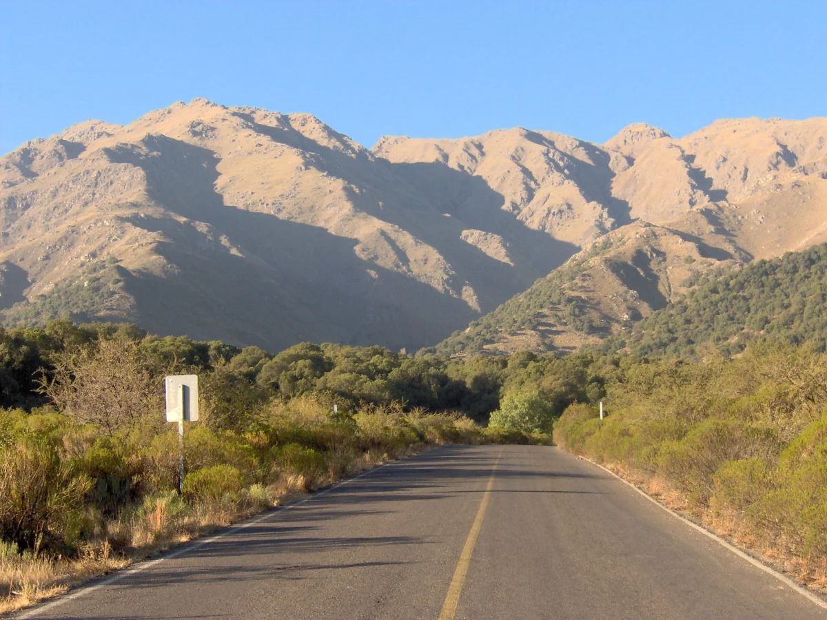

Villa de Merlo
People come to Villa de Merlo to breathe. Tucked against the western flank of the Sierra de los Comechingones, this small city in San Luis Province trades on something most places take for granted: its air. Locals proudly call it the third-best microclimate in the world, behind only spots in California and Switzerland - a claim rooted in the high concentration of negatively charged ions in the atmosphere, said to soothe the lungs and lift the mood. Whether or not the ranking holds up, the effect is real enough. The weather stays mild and dry, the wind keeps still, and clear streams run down out of the hills.
The Grandfather Tree
On the edge of town stands a carob tree so old it predates the Spanish entirely. The Algarrobo Abuelo - the "grandfather carob" - is reckoned to be roughly a thousand years old, its trunk thick and gnarled, five massive branches sprawling outward until some of them rest on the ground. It belongs to the species Prosopis chilensis and has been declared a provincial historic monument. For generations it was known as the Algarrobo de los Aguero, after the family that settled in its shade more than two centuries ago. To stand beneath it is to feel the long arc of the valley's history - a living thing that was already ancient when the town's founders arrived.
Two Towns in One
Merlo wears its past in two layers. The colonial heart, La Villa Colonial, grew up at Piedra Blanca at the close of the eighteenth century, and at its center stands the chapel of Nuestra Senora del Rosario - Our Lady of the Rosary - one of the oldest buildings in all of Argentina and a national monument. The formal founding came on New Year's Day, 1797, when townsfolk gathered before that very chapel. The settlement was first christened Villa de Melo, in honour of the Portuguese official Pedro Melo; over time the name softened into Merlo. Around this old core spread La Villa Veraniega, the summertime town, with the hotels and infrastructure built to welcome the visitors who keep arriving.
The Valley of the Sun
The land around Merlo invites motion. The Conlara valley opens below the town, and lookouts like the Penon del Colorado near Pasos Malos take in its full sweep. At the Rincon del Este resort, El Rincon stream carves swimming holes worth seeking out on a hot afternoon. The thermals rising off the sierras make this a favoured spot for paragliders, who launch from the slopes and ride the air the condors use. Pumas still move through the high country, and condors ride the updrafts overhead. The town's calendar fills with festivals - among them the Fiesta Nacional del Valle del Sol, the National Festival of the Valley of the Sun, and, fittingly, a Fiesta Nacional del Microclima devoted to the very air that made the place famous.
A Quiet Discovery
Merlo is well loved by Argentines and still largely unknown abroad, though a small community of American, German, and British expats has quietly put down roots here, drawn by the climate and the slow rhythm of the place. The 2010 census counted about 17,000 residents across the town and its outlying villages - Piedra Blanca, Barranca Colorada, El Rincón, and El Rincón del Este. Set 796 metres above sea level, Merlo sits within a day's drive of much of central Argentina: some 250 kilometres from Córdoba, around 750 from Buenos Aires by the main highways, and a comparable distance from Mendoza, San Juan, and La Rioja. The Valle del Conlara Airport, opened at the end of 2001, brings it closer yet. For all its growing infrastructure, Merlo keeps the feel of a place people retreat to rather than rush through - and the locals have a name for themselves that fits the easy pace. A person from Merlo is a Merlino.
From the Air
Villa de Merlo lies at 32.34 degrees south, 65.01 degrees west, on the western slope of the Sierra de los Comechingones in northeastern San Luis Province, at about 796 metres elevation. From the air, look for the town pressed against the foot of the long north-south Comechingones ridge, with the broad Conlara valley spreading to the west. The nearest airport is Valle del Conlara (ICAO: SAOS, near Santa Rosa del Conlara), about 16-18 km from town. San Luis city's Brigadier Mayor Cesar Raul Ojeda Airport (ICAO: SAOU) lies to the southwest, and Córdoba's Taravella International (ICAO: SACO) to the northeast. Recommended viewing altitude is 6,500-9,500 feet AGL. The mountain wall to the east generates strong afternoon thermals - excellent for soaring, and the reason paragliders favour these slopes - so expect lift and some turbulence near the ridgeline on warm days.
Nearby Stories
- Cerro Champaquí 6.7 km away
- Fábrica Argentina de Aviones 61 km away
- National University of Córdoba 92 km away
- San Luis 124 km away
- Sierra de las Quijadas National Park 161 km away
- Villa San Agustín 248 km away
- Tragedy of Alpatacal 253 km away
- Battle of Cepeda (1820) 317 km away