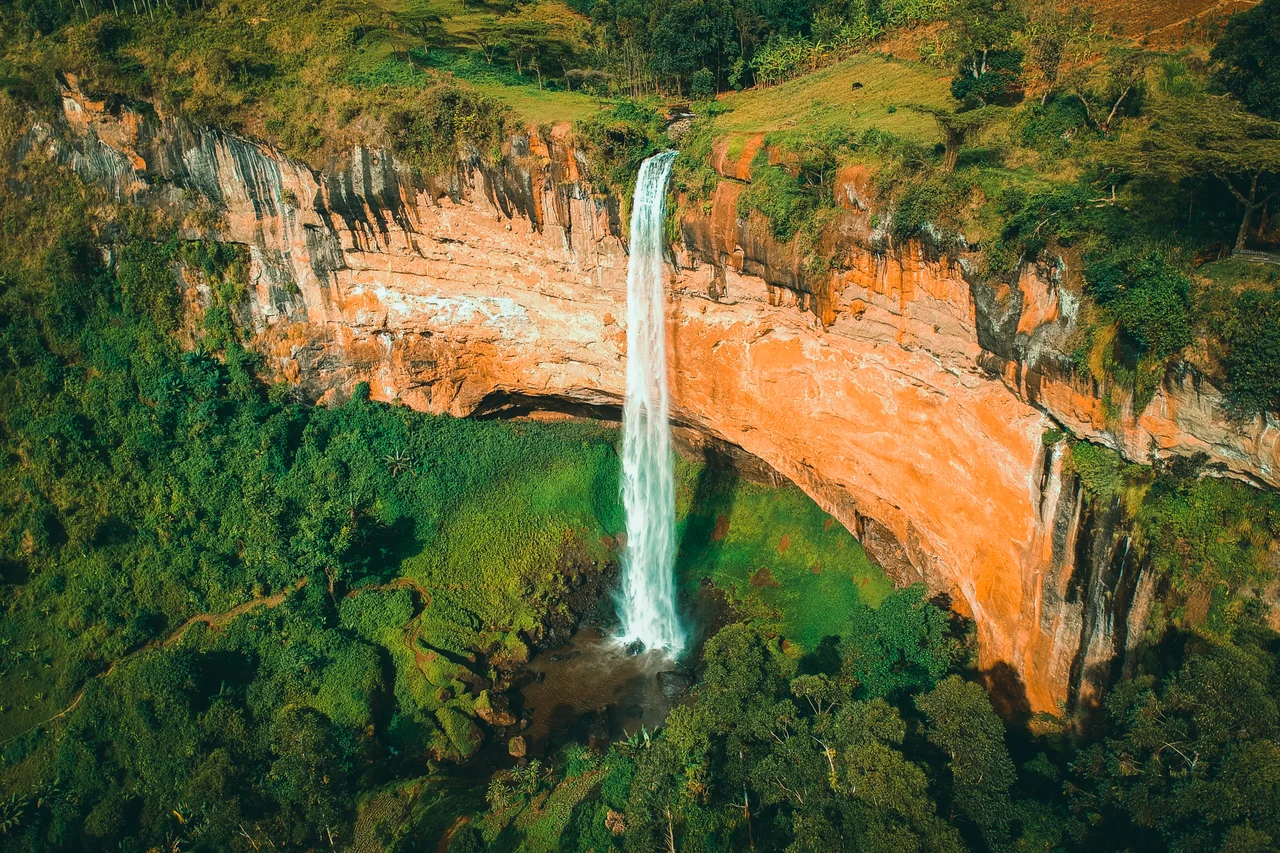

Sipi Falls
From a ridge on the slopes of Mount Elgon, you can stand above the clouds and watch a river throw itself off the mountain. Sipi Falls is not one waterfall but three, strung down the northwestern flank of an extinct volcano in eastern Uganda, each dropping from a different height as the Sipi River races toward the lowlands. The tallest plunges some ninety-five meters - a single white ribbon falling past a rock wall draped in moss and ferns. Beyond the lip of the escarpment, the land falls away for miles toward the dry, golden Karamoja plains, so that the falls seem to hang at the very edge of the highlands, where green mountain meets open savanna.
Three Falls, One River
The name Sipi belongs properly to the largest and most famous of the trio, the ninety-five-meter giant that draws most visitors and most photographs. But the river stages its descent in acts. Upstream to the east lies Simba Falls, with a drop of about seventy-four meters, and higher still on the mountain is Ngasire Falls, plunging roughly eighty-five meters. To see all three is to follow the Sipi River down the mountainside, each cascade carved into a different shelf of volcanic rock, each framed by the dense green of the Elgon foothills. Trails link the viewpoints, and the more adventurous abseil down the cliff face beside the falling water.
Born of a Volcano
Mount Elgon is the reason the falls exist at all. The mountain is an ancient, deeply eroded shield volcano on the Uganda-Kenya border, and the Sipi River gathers from its upper slopes before cutting down through the hanging beds of pyroclastic rock that the volcano laid down long ago. Those hard volcanic shelves are what give the river its dramatic, stepped descent. After its leaps over Ngasire, Simba, and Sipi, the water continues down off the mountain and out across the plains, eventually feeding into the basin of Lake Kyoga in central Uganda. The falls sit just beside Mount Elgon National Park, barely a mile from the Kenyan frontier.
Coffee Country
The slopes around Sipi are famous for something besides water. This is Bugisu coffee country, where the rich volcanic soil and high elevation - the prized arabica grows here between roughly 1,600 and 1,900 meters - produce some of Uganda's most celebrated beans. Smallholder farmers tend coffee gardens on the steep hillsides, and a visit to the falls often comes paired with a coffee tour: watching ripe cherries picked by hand, pulped, dried in the sun, roasted over a fire, and ground for a cup drunk within sight of the mountain that grew it. The cool, misty climate that feeds the waterfalls is the same climate that makes the coffee thrive.
What the Name Remembers
The word "Sipi" reaches back into the local language, to a plant the people here call sep. It is an indigenous species that grows along the riverbank, recognizable by its translucent green fronds and a single crimson rib running through each leaf, giving it the look of a wild banana. The plant is more than scenery: it has long been used as a traditional medicine to treat fevers and measles. So the falls carry, in their name, a small piece of the everyday knowledge of the community that has lived beside them - a reminder that this is not only a postcard view but a working landscape, with a river that waters crops, a name rooted in healing, and people who have called the mountainside home for generations.
From the Air
Sipi Falls lies at about 1.34°N, 34.38°E on the northwestern slopes of Mount Elgon in eastern Uganda, near the Kenyan border and just outside Mount Elgon National Park. From the air, the great eroded bulk of Mount Elgon is the dominant landmark; look for the abrupt edge of the highlands where green slopes drop toward the tan Karamoja plains, with the Sipi River's gorge cut into the escarpment. The nearest sizable town is Mbale to the southwest. Entebbe International Airport (HUEN) near Kampala is the main gateway, roughly 270 km to the southwest; Eldoret (HKEL) in Kenya lies to the east. Mornings are clearest - mist and cloud often build around the mountain by midday.
Nearby Stories
- Nyero Rock Paintings 28 km away
- Kitum Cave 34 km away
- Kapenguria 36 km away
- Eldoret 80 km away
- Bujagali Hydroelectric Power Station 92 km away
- Kanapoi 162 km away
- Murchison Falls National Park 232 km away
- Nataruk 242 km away