
Sisaket
In 1962, the International Court of Justice handed down a ruling that Thailand refused to accept but could not undo: the great cliff-top sanctuary of Preah Vihear, accessible only through Thai territory, legally belonged to Cambodia. The case turned on a hundred-year-old French survey map that both countries had agreed to, then disagreed about. The temple itself perches on the edge of the Dongrek escarpment in precisely the position that made the dispute intractable — spiritually and strategically significant, physically on the border, and stunningly beautiful. The gateway to reach it is Sisaket, a provincial town in Thailand's northeastern Isaan region that most travelers pass through rather than to. They are missing something.
A Province That Outlasted Empires
The area around Sisaket has been continuously inhabited for over a thousand years, long predating the Thai state that now administers it. When the Khmer Empire was at its height — building Angkor Wat, extending its influence across mainland Southeast Asia — this region was part of that world. The evidence is everywhere: Sisaket Province contains more Khmer ruins than any other Thai province, a scattered landscape of brick stupas, laterite walls, carved sandstone bas-reliefs, and ancient reservoirs called barai. Four distinct ethnic communities — Khmer, Suay, Lao, and Yer — settled here over the centuries, each leaving a cultural imprint that persists in the local festivals and handicrafts. The town itself became a formal administrative center in 1759 during the Ayutthaya period, and was relocated to its current position during the reign of King Rama V in the early twentieth century. Every move preserved something; nothing was quite erased.
Ruins Across the Landscape
The largest and most complete Khmer complex in the province is Sra Kampaeng Yai — three stupas on a north-south axis within laterite walls, originally a shrine to Shiva, later converted to a Mahayana Buddhist temple in the 13th century. Nearby, Sra Kampaeng Noi once contained a community hospital, the Arokaya Sala, built in the Bayon architectural style. Plang Ku features a stupa of gigantic proportions fronted by a pond where ducks and geese gather from February onward. The smallest ruins are barely more than remnants — a single stupa, a carved door frame, a wall — but each one marks a place where a community once organized itself around shared belief. The red sandstone cliff at one site preserves bas-relief carvings of three gods in Khmer style; craftsmen are thought to have practiced here before undertaking the actual work at Preah Vihear.
The Temple at the Edge of the World
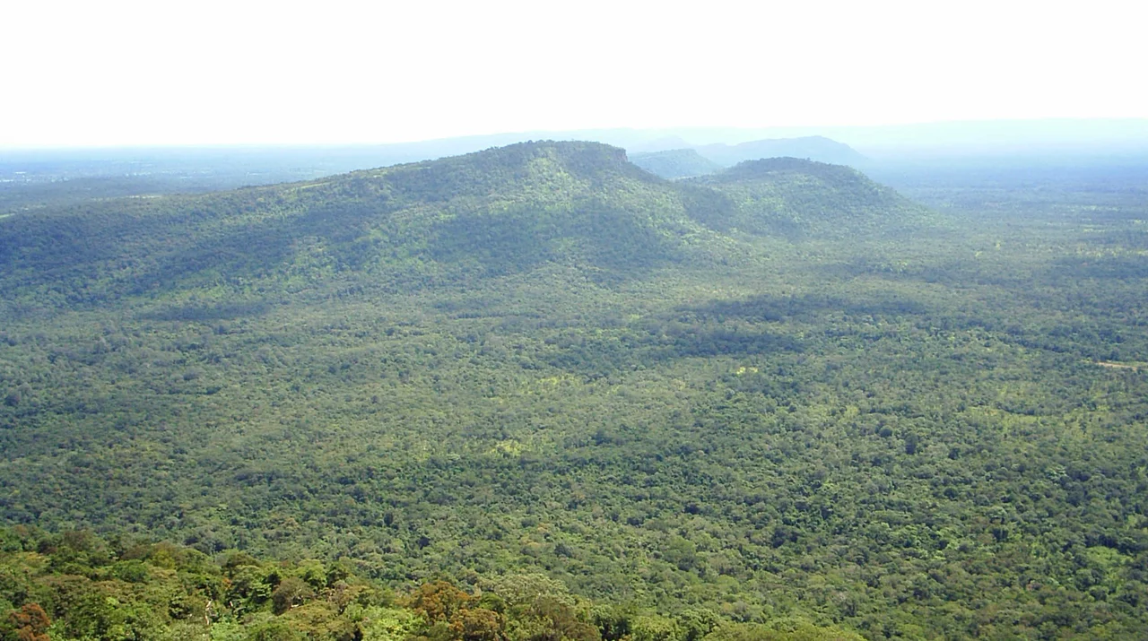
Preah Vihear sits at the rim of the Dongrek escarpment, looking out over the Cambodian plains 525 meters below. From the Thai approach, the ascent through Khao Phra Wihan National Park passes through dry evergreen forest, home to gibbons, barking deer, and civets. The red rock cliff of Mo E-Dang — one of the finest viewpoints in all of northeastern Thailand — lies along the way, with the Thai-Cambodian border running along its edge. The temple complex itself dates to the 9th through 12th centuries and is dedicated to the Hindu god Shiva. Its main tower and causeway survive in remarkable condition given the centuries of exposure and the sporadic conflict that has made the surrounding area tense at intervals since the 1962 ruling. The Cambodian plains stretch to the horizon from the sanctuary's edge — a view that explains, without requiring further comment, why both nations wanted it.
What the Province Grows and Makes
Beyond its ruins, Sisaket has a gentler, more domestic character. The province grows rambutan and durian in the orchards of Kantaralak District, both fruits ripening from May through July — which is also when the provincial Rambutan and Durian Fair brings flower floats, documentary exhibitions, and competitive fruit tastings to the fairgrounds. Silk and cotton cloth woven in the khit pattern are produced primarily in Bung Boon and Uthumporn Pisai, intricate geometric textiles that represent a living continuation of the region's weaving tradition. In March, the Dok Lamduan Festival celebrates the bloom of the lamduan trees in Somdet Sri Nagarin Park with cultural performances by all four local ethnic groups — Khmer, Suay, Lao, and Yer — in one of the few events in Thailand where these distinct communities publicly share a stage. The evening market beside the train station, open from 17:00 to 21:00, draws together the town's food culture in a way that no restaurant can quite replicate.
A Borderland at Rest
Sisaket is only about an hour's drive east of its larger neighbor Ubon Ratchathani, and sits close to the Cambodian and Lao borders — geography that has made it both a crossroads and, in the 20th century, a place touched by the political tensions of the region. Today it is unhurried in the way that provincial Thai towns tend to be, navigable by motorbike-taxi or samlor, organized around its market and its train station and its cluster of Khmer-era wat. The Sisa Asoka community, a model of Buddhist self-sufficiency that has attracted scholars from across the country to study its methods, reflects the quieter spiritual ambition that underlies much of Isaan life. For travelers willing to slow down and look carefully, Sisaket rewards patience in exact proportion to the effort.
From the Air
Sisaket lies at 15.11°N, 104.33°E in Thailand's northeastern Isaan plateau, near the Cambodian border. From altitude, the flat agricultural plains of Isaan extend in every direction, the Mun River corridor visible as a darker line of vegetation to the north. The Dongrek escarpment — the ridge forming the Thai-Cambodian border — appears as a clear topographic break to the south. Recommended viewing altitude 5,000–8,000 feet for regional context. Sisaket has no commercial airport; the nearest is Ubon Ratchathani Airport (VTUU), approximately 60 km to the east. Surin Airport (VTUJ) is roughly 120 km to the west.
Nearby Stories
- Wat Pah Nanachat 15 km away
- Wat Pa Maha Chedi Kaew 25 km away
- Ban Singh Tha 56 km away
- Emerald Triangle (Southeast Asia) 68 km away
- Kaeng Tana National Park 76 km away
- Scam Centers in Cambodia 175 km away
- Killing Caves of Phnom Sampeau 233 km away
- Ban Chiang 254 km away