
Kaeng Tana National Park
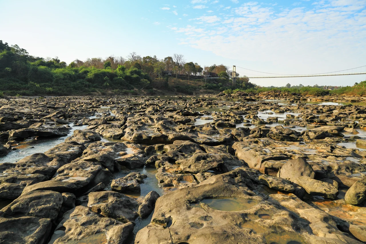
Somewhere on the Mun River, the water runs out of patience. For most of its length the Mun flows placidly east across the broad plateau of Ubon Ratchathani, barely distinguishable from the flat farmland on either side. Then it reaches Kaeng Tana, and everything changes. The river hits a shelf of sandstone and explodes into the widest, most turbulent rapids on its entire course — a churning stretch where a single massive boulder splits the current into two separate channels, each raging around the obstacle before rejoining downstream. Standing at the edge of Kaeng Tana's rapids, you feel the ground tremble slightly with the weight of the water. Established as a national park on 13 July 1981, these 80 square kilometres of highland forest and river canyon protect one of northeastern Thailand's most distinctive natural spectacles.
The River's Greatest Rapids
The park takes its name from the Kaeng Tana rapids — *kaeng* meaning rapids in Thai — and the spectacle lives up to the billing. At the heart of the torrent sits a massive sandstone boulder, immovable despite centuries of current, dividing the Mun River into two violent streams that roar past on either side. Nearby, barely visible amid the white water, stands a small concrete block. It dates to the French colonial period, placed to mark a navigable channel for river traffic passing between French Indochina and Siam. Empires have come and gone; the boulder remains. Midstream, just downstream of the main rapids, lies Don Tana — an island 450 metres wide and 700 metres long, lush with vegetation, sitting in the river like a landlocked nature reserve within the park itself. During the dry season, the island is accessible and offers quiet contrast to the roaring water upstream.
Forest, Ridge, and Hidden Cave
Above the riverbanks, the park climbs through a landscape of plateaux and gently undulating hills, with the highest point, Ban Tad, reaching 543 metres. The dominant vegetation is deciduous forest — *Shorea obtusa*, *Shorea siamensis*, and *Dipterocarpus obtusifollius* — the same slow-growing hardwood species that once covered much of mainland Southeast Asia. In shaded gullies and along streambanks, pockets of dry evergreen forest offer cooler shelter. Wildlife includes wild pigs, barking deer, civets, macaques, and gibbons; the birdlife alone draws dedicated naturalists from across the region. Tucked into the park's limestone outcrops is Tham Phra, also known as Tham Phu Ma Nai — a cave where a stone inscription and a Lingam base dating to the 7th or 8th century were discovered. The originals now rest in Ubon Ratchathani's National Museum, but the cave itself remains, its sandstone walls still bearing the cool quiet of a place once considered sacred.
Walking the Cliff's Edge
The Namtok Rak Sai Nature Trail offers the park's most intimate encounter with its landscape. Starting 500 metres from park headquarters, the path hugs the cliff face above the Mun River for a kilometre, threading through a micro-world of lichens, mosses, and ferns — plants that cling to bare rock and thrive on the perpetual spray from below. The trail is short enough to walk in an hour, but the views down to the river and across to the forested far bank are expansive, and the cliff-edge vegetation rewards slow, attentive walking. Further into the park, Namtok Tat Ton waterfall — off Highway 217 on Road 2173 — provides a different character entirely: a broad cascade that fills the surrounding forest with sound during the wet season and slows to a more contemplative trickle when the rains ease.
At the Edge of Two Nations
Kaeng Tana sits in Khong Chiam District, the easternmost point of mainland Thailand, where the Mun River flows into the Mekong. Just a few kilometres east, the confluence of the two rivers — one clear green, one brown — creates the phenomenon the Thais call *Mae Nam Song Si*, the Two-Colour River. The park exists at the edge of Thailand in every sense: geographically, culturally, and ecologically, it sits at the meeting point of the Khorat Plateau and the Mekong basin, where the flora and wildlife reflect both worlds. Visitors arriving from Ubon Ratchathani city drive roughly 75 kilometres east to reach the park — a journey through rice fields and riverside towns that makes the transition from urban province to protected wilderness feel earned.
From the Air
Kaeng Tana National Park lies at approximately 15.30°N, 105.47°E in Khong Chiam District, northeastern Thailand. The Mun River's confluence with the Mekong is visible roughly 10 km east at the Thai-Lao border. From the air at 4,000–6,000 feet, the park appears as a forested highland area divided by the distinct silver ribbon of the Mun River; the Kaeng Tana rapids show as a roughened texture in the water at lower altitudes. Nearest airport: VTUU (Ubon Ratchathani, ~75 km west). The Laos border and the Mekong River are visible to the east.
Nearby Stories
- Pakse 15 km away
- Tadlo 20 km away
- Bolaven Plateau 29 km away
- Ubon Royal Thai Air Force Base 30 km away
- Sam Phan Bok 31 km away
- Saravan 32 km away
- Amnat Charoen 59 km away
- Sisaket 85 km away