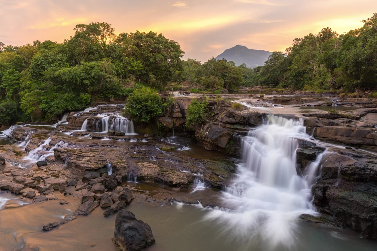

Bolaven Plateau
The coffee growing on the Bolaven Plateau was planted during the French colonial period, and it is still here — a living remnant of the occupation that outlasted everything else the French left behind. Arabica and robusta grow in the cool, wet air of the highlands, tended by farming families in villages where English is rarely spoken and tourists are still a novelty. The plateau sits at roughly 1,200 meters above sea level, which in southern Laos means a climate that travelers emerging from the Mekong lowlands experience almost as a shock: cooler temperatures, misty mornings, the smell of vegetation rather than dust. The French understood the agricultural potential. What they could not have predicted is that this highland would become one of Southeast Asia's most beloved motorcycle routes.
A Plateau Defined by Water
The Bolaven Plateau's most dramatic feature is the sheer number of waterfalls that cascade off its edges where streams meet the plateau's steep rim. The falls cluster around the 35–40 kilometer mark east of Pakse, where the road climbs onto the highland and rivers begin their drop toward the Mekong lowlands below.
Tad Yuang, 40 kilometers from Pakse, is generally considered the most impressive of the group known as the Four Sisters, featuring multiple viewing paths and platforms above and below the main plunge. Tad Fan, a few kilometers closer to Pakse, drops in a pair of parallel cascades and has become one of the most photographed waterfalls in Laos, with a small hotel perched at the rim. Tad Champee offers a more raw experience — no infrastructure except a bridge downstream and some basic safety signs — while Tad E-Tu, the closest of the group, has seen better days. Each charges entry and parking fees, which as of 2025 run between 5,000 and 40,000 kip per person.
The Bolaven Loop
Most travelers experience the plateau by doing what has become known as the Bolaven Loop: renting a motorcycle in Pakse and riding a circuit that takes two to three days, covering waterfalls, coffee plantations, ethnic minority villages, and some of the more remote roads in southern Laos. The loop is not a single fixed route — different operators mark it differently, and riders can extend or abbreviate depending on time and ambition.
The road conditions vary considerably. Some stretches are excellent sealed highway; others are, in the honest assessment of travelers who have attempted them, bone-judderingly poor. The atmosphere throughout is worlds away from the humid, chaotic lowlands. Extended sections of the plateau are given over to cassava plantations, which dominate the scenery in ways that can disappoint travelers expecting unbroken jungle. The most interesting routes and the villages worth stopping in require local knowledge — the kind that comes from asking at the guesthouse rather than following a standard map.
Coffee and the Colonial Inheritance
The coffee that made the Bolaven Plateau internationally known was established during the French colonial period, when the highlands' climate and altitude were recognized as ideal for arabica cultivation. Today the plateau produces a significant share of Laos's coffee output, much of it drunk locally at roadside stalls and small cafes in Paksong, the main town on the plateau.
Stopping for coffee at Paksong is a ritual of the Bolaven Loop — strong, dark, and often served over ice with sweetened condensed milk in the Lao style, or black and bitter for those who want it closer to how it was grown. The Paksong market serves as a hub for the plateau's farming communities. Lao coffee has gained considerable recognition in specialty coffee circles over the past decade, and some of the plantation tours available through guesthouses in Pakse offer a genuine look at the full chain from tree to cup. The planting began as an act of colonial extraction. It has outlasted the colony and become part of the region's identity.
Remnants of the War
For those extending the loop east into Attapeu province, the plateau's remoteness gives way to a different kind of history. Near Pa-Am, a former section of the Ho Chi Minh Trail, a large surface-to-air missile left over from the Vietnam War era sits beside the road — an incongruous remnant of the secret war that ravaged much of this part of Laos. Laos remains one of the most heavily bombed countries per capita in history, and while the Bolaven Plateau's waterfall-and-coffee reputation dominates its modern identity, the war's physical traces are not far from the tourist trail.
The road beyond Pa-Am follows old military infrastructure into the mountains, eventually connecting back toward Paksong via two unnamed waterfalls — one of them among the highest in Laos — down a rough track that requires a full day and dry-season timing. This is not a route for casual riders. But for those willing to take it slowly and ask directions at every junction, the plateau's interior reveals a Laos that organized tourism has not yet fully reached.
From the Air
The Bolaven Plateau sits at approximately 15.11°N, 106.44°E, in Champasak and neighboring provinces of southern Laos. From the air, the plateau is unmistakable: a broad, elevated tableland rising sharply from the Mekong lowlands, with a distinctly darker, greener vegetation profile than the surrounding plains. The plateau's western edge, where the major waterfalls drop, is about 35–40 kilometers east of Pakse. Recommended viewing altitude is 4,000–6,000 feet to appreciate the full geographic contrast between lowland and highland. The nearest airport is Pakse International Airport (PKZ), approximately 40 km west of the plateau's edge. Visibility is best from November through February; haze and monsoon cloud obscure the plateau from May through October.
Nearby Stories
- Pakse 11 km away
- Tadlo 28 km away
- Pha Taem National Park 35 km away
- Virachey National Park 51 km away
- Phu Chong–Na Yoi National Park 53 km away
- Dong Ampham National Biodiversity Conservation Area 60 km away
- Khong Island 90 km away
- 1968 Kham Duc C-130 Shootdown 100 km away