
Phu Chong–Na Yoi National Park
The cliff called Phu Hin Dang is brightly coloured — reds, oranges, and yellows banded into the rock face — and geologists have an explanation for this: millions of years ago, when this part of Asia was sea floor rather than mountain, mineral residues from seawater were absorbed into the sediment. Dry periods catalysed those minerals into the pigments now visible in the stone. The cliff did not intend to be beautiful. It simply recorded its own history in a way that anyone standing at the top can read. That quality — spectacle that turns out to be evidence — runs through much of Phu Chong–Na Yoi National Park, at the far eastern end of the Dângrêk Mountains where Thailand edges against both Laos and Cambodia at once.
At the End of the Mountains
Phu Chong–Na Yoi was established in 1987, covering 428,750 rai — roughly 686 square kilometres — across the Buntharik, Na Chaluai, and Nam Yuen districts of Ubon Ratchathani Province. It is designated IUCN Category II, the same classification as most national parks worldwide: a protected area managed primarily to preserve natural ecosystems and provide a base for scientific research and environmental education.
The park sits at the eastern terminus of the Dângrêk Range, the same mountain chain that further west defines the Thai-Cambodian border and shelters the ruins at Preah Vihear. Here, the mountains dwindle toward the Mekong basin, and the park's terrain reflects that transition — a mix of elevated forest, river valleys, and the dramatic cliff formations that mark where the plateau meets the lower ground of both Laos and Cambodia.
Water Falling in Three Steps
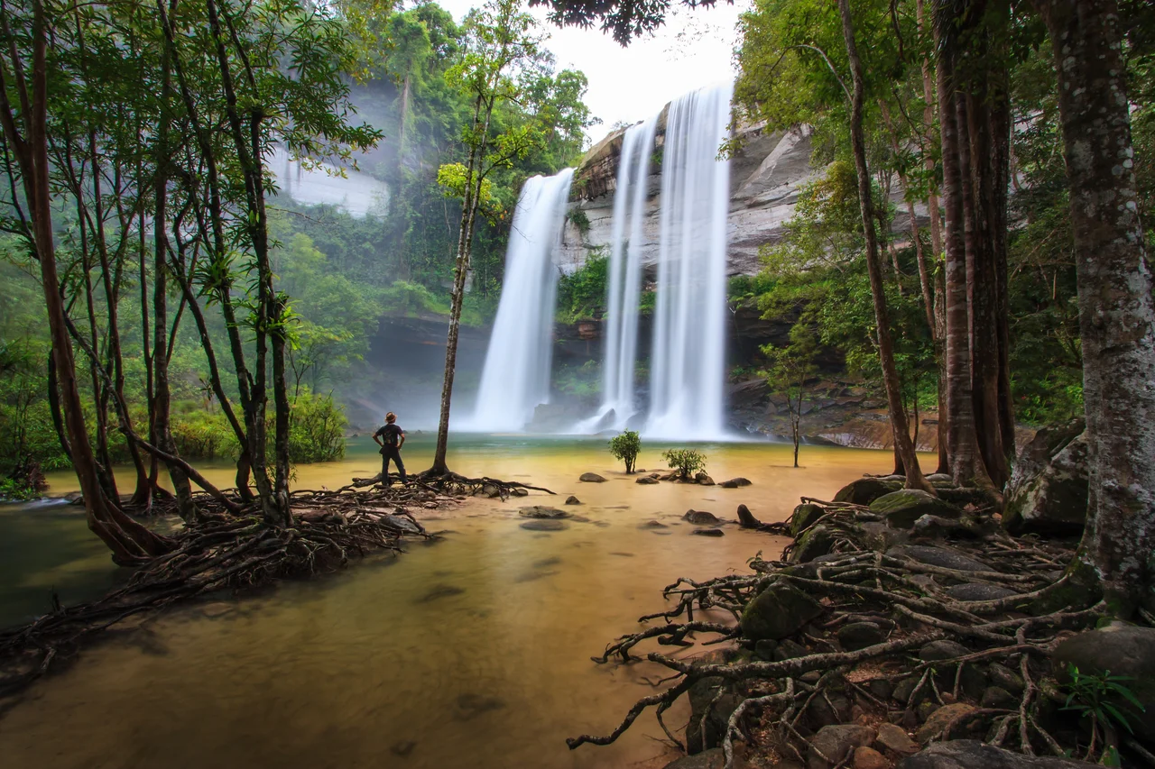
The park's most visited natural feature is Namtok Huai Luang, also known as Namtok Bak Teo — a waterfall that drops from an elevation of 30 metres in three distinct stages. Below the last step, a small pool forms beside a white sand beach, its water running turquoise. That combination — the sound of falling water, the unexpected white sand, the colour of the pool — draws visitors consistently through the rainy season, when the flow is at its strongest.
Nine kilometres south along the nature trail, Namtok Koeng Mae Phong offers a quieter alternative, fed by the Lam Dom Noi Stream rather than the main Huai Luang watercourse. Between the two waterfalls, the trail passes through Kaeng Sila Thip, where the Huai Luang Stream runs across a broad rock terrace. The current here carved holes of varying size and depth into the rock surface over centuries — formations the locals call *kumphalak*.
Rock Gardens and Ancient Shelter
The Phlan Yao Rock Garden is not a garden in any cultivated sense. It is a stretch of terrain where rocks in different formations have accumulated naturally, scattered across the ground in arrangements that suggest something deliberate without being so. The Pha Phueng Viewpoint stands adjacent to it, offering views across the forest canopy toward the international border.
Further on, Phlan Kong Kwian — the Cart Terrace — is a vast flat rock surface edged by stone shelters. Travellers in earlier centuries stopped here to rest; the name records that history. Wild flowers and plants grow in the cracks and depressions across the terrace. The sense of the place as a waypoint persists, even though the travellers who sheltered here were moving between kingdoms that no longer exist in the same form.
A Frog That Nobody Had Described
In 2004, a researcher working in Phu Chong–Na Yoi collected a specimen that turned out to belong to a species unknown to science. The frog, later named *Fejervarya triora*, was formally described in a 2006 paper titled "Three New Species of Frogs and a New Tadpole from Eastern Thailand." It belongs to the genus *Fejervarya*, a group of ditch frogs distributed widely across South and Southeast Asia, but this particular species had never been identified before.
A national park of 686 square kilometres on a mountainous border harbouring an animal that science had not yet named is a reminder of how much the forest still contains. The park's terrain — forest that moves freely across the Thai, Lao, and Cambodian sides of a porous border — creates exactly the kind of continuous habitat where undescribed species persist. *Fejervarya triora* was found here. There is no particular reason to think it was the only one waiting to be found.
From the Air
Phu Chong–Na Yoi National Park is centred at approximately 14.533°N, 105.386°E at the eastern end of the Dângrêk Mountains in Ubon Ratchathani Province, Thailand. The escarpment edge is visible from altitude as a clear topographic break between the Thai plateau and the lower terrain of Laos and Cambodia. The brightly coloured cliff of Phu Hin Dang may be distinguishable in good visibility at lower altitudes. Recommended viewing altitude: 3,000–5,000 feet. Nearest airports: Ubon Ratchathani Airport (UBP) approximately 80 km to the west; Pakse Airport (PKZ) in Laos is across the border to the northeast. The park borders both Laos and Cambodia — maintain appropriate airspace awareness near the international boundary.
Nearby Stories
- Khao Phra Wihan National Park 7.2 km away
- Khong Island 12 km away
- Champasak 14 km away
- Si Phan Don 50 km away
- Koh Ker 57 km away
- Vat Phou 57 km away
- Sisaket 60 km away
- Preah Vihear province 62 km away