
Pakse
The French built Pakse in 1905 not because the location was beautiful, but because it was useful. At the confluence of the Xe Don and the Mekong — *pak xe* means "mouth of the river" — this was the natural place to anchor colonial administration over a vast territory. The city that grew here never quite shed that utilitarian purpose. Pakse is still, above all else, a place where journeys begin and end. But there is something compelling about a city that exists purely to dispatch travelers into more magnificent country: the ruins of a Hindu temple-mountain an hour south, a plateau of waterfalls and coffee fields to the east, and river islands stretching south toward Cambodia. Pakse is the hinge on which southern Laos turns.
The River and the Name
The Xe Don comes out of the highlands to the east and joins the Mekong here, just below the old French bridge. On a clear evening, sitting along the Mekong waterfront south of the bridge with a cold Beer Lao, you can watch the two rivers merge — the Xe Don's darker, faster water folding into the Mekong's broad, slow-moving flow. The confluence determined everything: it put Pakse on the colonial map, made it the transport hub it remains today, and gave the city its name.
The French established Pakse as the administrative capital of Champasak province in 1905, replacing older centers that had served successive kingdoms for centuries. It served as the capital of the Lao Kingdom of Champasak under French colonial rule until 1946, when a unified Kingdom of Laos was formed. Prince Boun Oum of Champasak, who relinquished his dynastic right to rule in 1945 in favor of that unified state, would later lead the rightist faction during the Lao civil war that began in 1953 — the province's royalist history casting a long shadow over mid-twentieth-century Lao politics.
Gateway to the South
Every serious journey through southern Laos passes through Pakse. Head south and you reach Champasak town and Wat Phou, the great Khmer temple-mountain that predates Angkor. Go further and the Mekong widens into Si Phan Don — the "Four Thousand Islands" — where the river spreads across the Lao lowlands before crossing into Cambodia. Turn east from Pakse and the road climbs steadily toward the Bolaven Plateau, where coffee grows in the cool air and waterfalls tumble off the plateau's edge in almost embarrassing abundance. The nearest of the famous falls is about 35 kilometers from the city center.
For those arriving overland from Thailand, Pakse is accessible through the Chong Mek border crossing, approximately three hours by bus from Ubon Ratchathani. The city's small international airport also connects with Bangkok and regional destinations. It is the largest city in southern Laos — a fact that reveals more about southern Laos than it does about Pakse itself, which remains modest in scale, navigable on foot in its older center, and genuinely uncrowded compared to Luang Prabang or Vientiane.
What Pakse Keeps for Itself
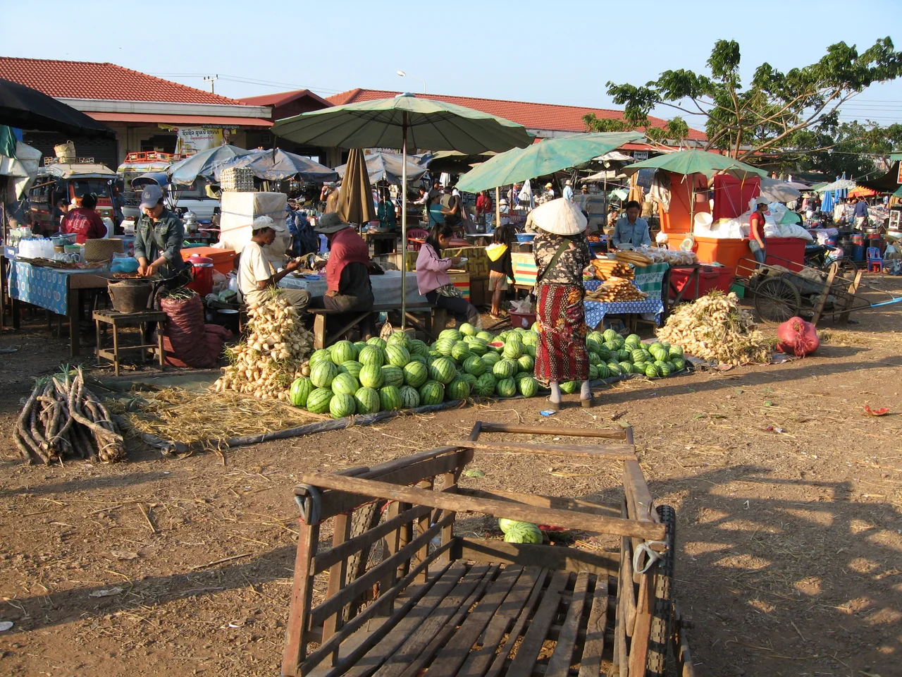
The guidebooks call Pakse a transit stop, and that framing sells the city somewhat short. The morning market, Dao Heuang, is one of the largest in southern Laos and worth an early visit — produce, fish, textiles, and hardware stacked together in the Mekong-town tradition. The Champasak Provincial Museum introduces the region's deep archaeological history before you set out to see Wat Phou in person. A string of restaurants lines the road parallel to the Mekong, where Lao and Vietnamese cuisine dominate at prices that remain refreshingly low.
More than fifty restaurants concentrate along this riverside stretch — a density that surprises in a city of Pakse's size. The old French bridge, connecting the city's commercial center to the eastern bank, frames the Mekong in a particular way at dusk, the brown water catching the light. Monks from Wat Luang, the main temple in the city center, walk the streets in the early morning. These are not sights in the conventional sense, just the daily texture of a working Lao city going about its business — which is, at heart, connecting the rest of the south to itself and to the wider world.
Where Things Spread Out From Here
Pakse's position as a regional hub shapes its character in both practical and atmospheric ways. The tuk-tuks clustered near the bridge, the two bus stations at opposite ends of the city, the variety of VIP bus companies running overnight sleepers north to Vientiane and south to Phnom Penh — all of it reflects a place organized around movement. Three other countries are within a few hours by road: Thailand to the west, Vietnam via mountain passes to the east, Cambodia directly south.
The island of Don Kho, a small silk-weaving village in the Mekong about 15 kilometers north of the city, is reachable by songthaew from the morning market and a short boat crossing. It offers a glimpse of Mekong island life largely unchanged by tourism — because very few tourists come. Wat Phou is 43 kilometers south, requiring a full day. The Bolaven Plateau loop, done by motorbike over two or three days, begins with a straight east road out of the city that climbs imperceptibly before the highlands reveal themselves. All these roads lead back to Pakse, which waits with its riverside bars, its busy market, and its efficient, unpretentious hospitality.
From the Air
Pakse sits at approximately 15.12°N, 105.78°E, at the confluence of the Xe Don and Mekong rivers in Champasak province, southern Laos. From the air, the city is unmistakable: the Mekong bends here, and the Xe Don joins from the east just below the old French bridge, which is visible from altitude as a distinct crossing. Pakse International Airport (PKZ) is located on the northeastern edge of the city and serves regional and international flights. Recommended viewing altitude 1,500–2,500 feet for the river confluence and city layout. The Mekong floodplain spreads wide to the south and west; Phou Khao mountain, where Vat Phou sits, is visible on the southern horizon in clear conditions.
Nearby Stories
- Pha Taem National Park 18 km away
- Paksong 18 km away
- Tadlo 29 km away
- Wat Nong Pah Pong 34 km away
- Phu Chong–Na Yoi National Park 38 km away
- Khao Phra Wihan National Park 55 km away
- Amnat Charoen 84 km away
- Virachey National Park 102 km away