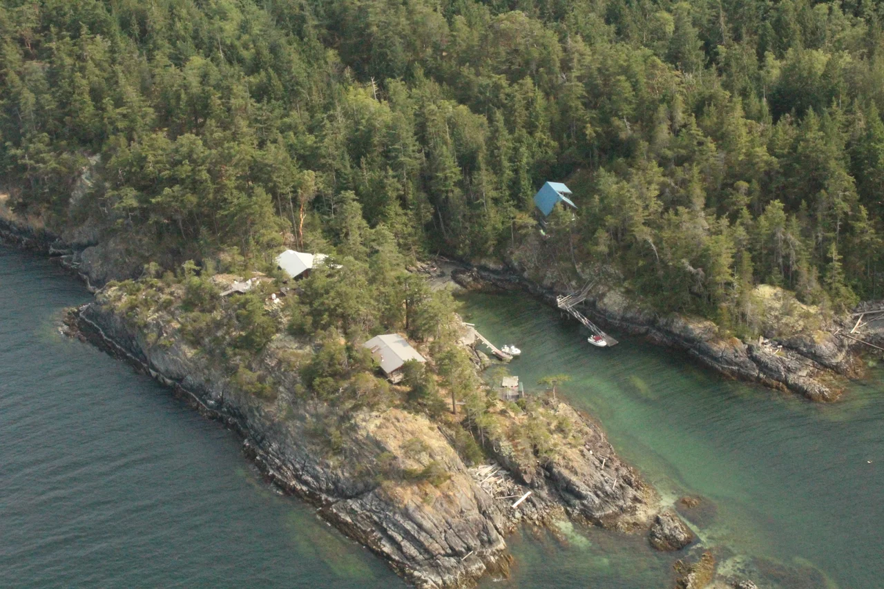

South Thormanby Island
Captain George Henry Richards had the Royal Navy's authority to name whatever he charted, and in 1860 he was thinking about horses. Thormanby had just won the Epsom Derby, so Thormanby went on the chart. The following year a horse called Buccaneer took the Royal Hunt Cup at Ascot, and a bay on this island became Buccaneer Bay. Other names in the group carry the same enthusiasm. It is an odd inheritance for a place seventeen kilometres west of Sechelt in the Strait of Georgia, which the shishalh had called sx̱welap for a very long time, and which a Spanish officer had already named Isla de San Ignacio on 12 July 1791. Three naming systems, stacked on one small island, and only one of them was ever about the island itself.
The Village at Buccaneer Bay
South and North Thormanby - sx̱welap together - lie within the shared territories of the Tla'amin Nation and the shishalh Nation. The bay that Richards named for a racehorse held klayahkwohss, a village that served as a principal site for winter dances and ceremonies, along with sex̱wʔamin at Garden Bay to the north. Winter on this coast is the ceremonial season; the fishing and gathering year ends and the longhouse year begins. At least five archaeological shell middens are known on South Thormanby, the accumulated kitchen record of generations - clam and oyster and mussel shell packed metres deep, which is how you date continuous occupation on a coast that keeps few other monuments. The village names are still in use. So is the language they come from.
Two Hills and a Sand Bridge
The island is built around two rises: Mount Seafield at the southern end and Spy Glass Hill toward the north. South of Seafield, in a basin locals simply call The Farm, there is a lake. The south island is markedly rockier than its northern neighbour, and at low tide the two connect by a sand bridge you can walk across - a detail that makes the pair behave like one island twice a day. Welcome Passage separates the group from the mainland shore of the Sunshine Coast. Mariners pay attention to Tattenham Ledge, a long shallow rock shelf reaching out from the island's northern side and a genuine hazard rather than a charted curiosity. Pirate Rock and Merry Island - nepshilin in she shashishalhem - sit off the southern end.
The Shopkeeper Who Bought an Island
In 1892 Calvert Simson, who kept shop at the Hastings Mill Store in Gastown, secured rights to most of South Thormanby through a crown grant. Around 1912 he drained and cleared the southern swamp to make a farm and orchard - an ambitious thing to attempt on an island with no road and no neighbours. The farm was abandoned in 1948; the buildings came down through the 1960s and 1970s. But semi-wild apple and cherry trees still fruit in that clearing, which is the most persistent thing anyone ever left here. Through the 1920s and 1930s the Union Steamship Company ran a float in Buccaneer Bay and made regular sailings from Vancouver, and trails were cut and bays named in that era. Selective logging ran from 1951 to 1981, taking mostly Coastal Douglas-fir. In 1986 the southern part of the island became Simson Provincial Park, named for the shopkeeper.
The Smallest Zone in the Province
British Columbia sorts itself into sixteen biogeoclimatic zones, and the Coastal Douglas-fir is both the smallest and the most imperilled. It holds more species at risk than any other - twenty-four of them globally imperilled, 282 provincially listed, plus forty-four ecological communities in trouble. Thormanby sits squarely inside it. Along Buccaneer Bay and Vaucroft Beach a rare coastal sand ecosystem supports two further red-listed communities: large-headed sedge, and dune wildrye with beach pea. Inland the forest is second growth now, Douglas-fir and western red cedar with hemlock, red alder, arbutus, lodgepole pine and bigleaf maple mixed in, and an understorey heavy with salal, salmonberry, thimbleberry and huckleberry. Roughly three hundred Columbian black-tailed deer live on the islands. Beavers were introduced in 1984 and 1985, promptly dammed the old Simson meadow, and made the lake that is there today.
From the Air
South Thormanby Island lies at 49.4861 N, 123.9689 W, in the Strait of Georgia off the Sunshine Coast. A pass at 1,500 to 3,000 feet AGL shows the structure clearly: two wooded humps - Mount Seafield south, Spy Glass Hill north - with the pale crescent of Buccaneer Bay between South and North Thormanby, and the sand bridge showing as a bright bar at low water. Tattenham Ledge appears as a green-water shelf extending north from the island; Merry Island and its light sit off the southern end, and Welcome Passage runs between the group and the mainland shore. Sechelt Aerodrome (CAP3) is roughly 11 nm east, Nanaimo Airport (CYCD) about 26 nm south across the strait, and Vancouver International (CYVR) approximately 35 nm southeast. Summer brings excellent visibility with a reliable afternoon northwesterly through the strait; autumn and winter mean low cloud, rain, and outflow winds funneling down the mainland inlets.
Nearby Stories
- Skookumchuck Narrows 1.1 km away
- Pacific Biological Station: A Century of Counting Fish 2.3 km away
- Bowen Island 11 km away
- Powell River, British Columbia 11 km away
- Qualicum National Wildlife Area 13 km away
- Iona Island (British Columbia) 14 km away
- Alberni Inlet 30 km away
- Garibaldi Provincial Park 50 km away