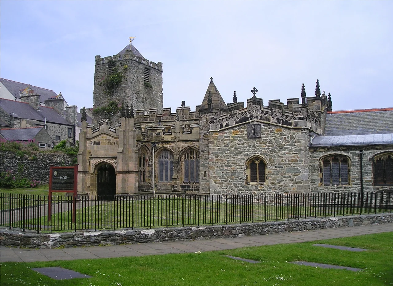

St Cybi's Church
The walls around St Cybi's Church in Holyhead are not the church's walls. They are Roman. Built between the 3rd and 4th centuries as a small naval fort guarding the Irish Sea coast against pirates and raiders, the rectangular enclosure of Caer Gybi is one of the very few coastal Roman fortifications still standing anywhere in Britain. The Romans left in the early 5th century. The fort fell empty for about a hundred years. Then, around 540 AD, a Welsh monk named Cybi - a cousin of Saint David - was given the abandoned ruin by King Maelgwn Gwynedd and decided that walls already designed to keep people out would do nicely for a monastic community as well. The church inside has been rebuilt, sacked, burned, garrisoned, and rebuilt again, but the boundary of the Christian site has not moved in nearly fifteen hundred years.
Cybi, Cousin of David
Cybi was born somewhere in Cornwall in the late 5th century, travelled widely through Wales, Ireland, and Brittany, and arrived on Holy Island in middle age looking for a final base. The monastery he founded inside the Roman walls in 540 was small - a wooden church, some cells for the brothers, a well. He died on 8 November 555 and was buried in the churchyard. A tiny separate chapel called Eglwys y Bedd (the Church of the Grave) still stands a few metres from the main church on what is thought to be his original tomb. The island took his name - Caer Gybi means Cybi's Fort - and in Welsh the whole town of Holyhead is still called Caergybi. He is remembered in Wales as one of the seven blessed cousins of Saint David, the patron saint of the country.
Three Centuries of Hard Use
In the 10th century, Viking raiders working the Irish Sea coast sacked the original church and the monastic buildings. The community rebuilt. In 1405, the church was burned again, this time by Henry IV's English army, who had crossed from Ireland to put down the Welsh rebellion of Owain Glyndwr; the soldiers carried off Cybi's shrine and his relics, which were never recovered. The present church was built in stages between the 13th and 16th centuries, with the chancel - the eastern, altar end - dating to the 13th century and counting as one of the oldest parts of the building. Then came the worst visit of all. In the 1650s, during the English Civil War, Oliver Cromwell's Parliamentary army quartered itself in the church. The soldiers smashed statues, defaced the font, broke the memorials, and shattered the stained glass. They also added 17 feet to the height of the tower so they could use it as a lookout over the harbour. The improvised garrison block is still there above the original tower, the join clearly visible in the stonework.
Stanley's Marble and the Sun Dial
In 1897 the church gained an extension that would not have looked out of place in a Westminster cathedral. The Stanley Chapel, designed by the Victorian architect Sir Gilbert Scott, was added to the south side for the prominent local Liberal politician William Owen Stanley. Inside it stands a life-size figure of Stanley carved from Carrara marble by Hamo Thornycroft - the same sculptor who did the bronze of Oliver Cromwell that stands outside Parliament. The juxtaposition is quietly ironic: Cromwell's army wrecked the church; two centuries later, Cromwell's sculptor adorned it. On the south transept wall a sundial bears the Welsh inscription Yr hoedl ar hyd ei haros a dderfydd yn nydd ac yn nos - life, though long it stays, will end in night and day. In 2024, archaeologists excavating in the churchyard for restoration work turned up Roman pottery and medieval burials, and confirmed that the long thread of continuous Christian use - from Cybi to today - is one of the longest documented anywhere in Wales.
From the Air
St Cybi's Church sits at 53.311N, 4.633W in the centre of Holyhead, on the southern flank of Salt Island and the harbour. From the air, the church and its surrounding Roman fort walls form an unmistakable rectangle in the town centre, with the ferry terminal and breakwater visible to the north. Nearest airfield is RAF Valley (EGOV) 6 nm southeast; Caernarfon (EGCK) 18 nm south-southeast. Best viewed at lower altitudes (1,500-2,500 ft AGL) to see the geometry of the surviving Roman walls; the four corners and most of the perimeter are still intact. In clear weather, the lighthouse at South Stack is visible 3 nm to the northwest.
Nearby Stories
- Snowdon Mountain Railway 8 km away
- German submarine U-1051 8.3 km away
- German submarine U-246 11 km away
- Trwyn Du Lighthouse 13 km away
- Irish Sea Bridge 20 km away
- HMS Manners (K568) 34 km away
- HMS Tyler 47 km away
- Birkdale Palace Hotel 79 km away