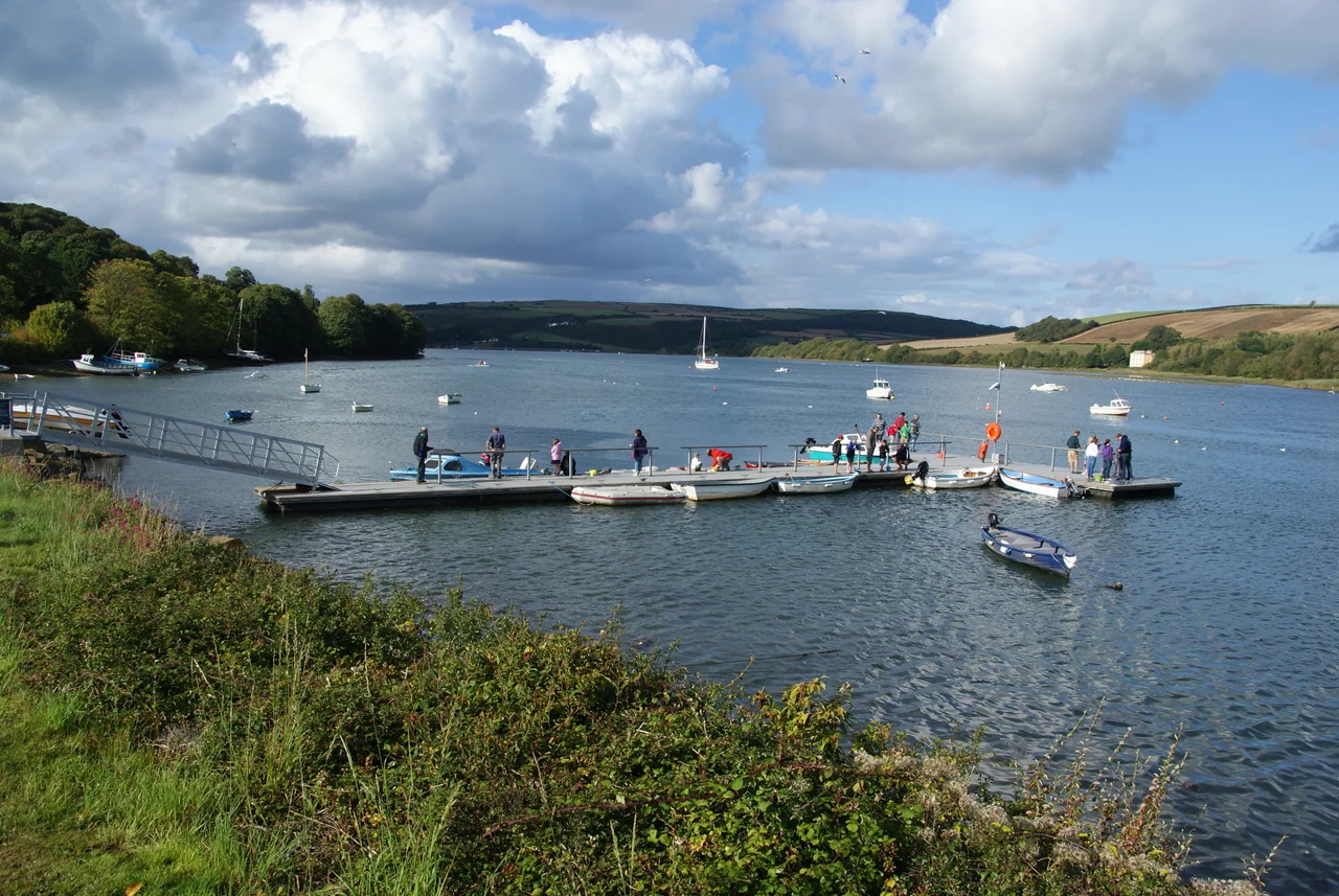

St Dogmaels
Stand on the quayside at St Dogmaels and you can see two counties at once. The village clings to the Pembrokeshire bank of the Teifi estuary; across the tidal water, scarcely a mile upriver, lies Cardigan in Ceredigion. The boundary has moved back and forth across this parish for nearly two centuries, splitting it, reuniting it, and splitting it again, while St Dogmaels itself has stayed exactly where it always was: a long ribbon of stone cottages strung between an abbey ruin and a working flour mill, looking out toward the open sea.
The Tironensian Foundation
St Dogmaels Abbey was founded in the early 12th century by Robert FitzMartin, a Norman lord granted these lands after the Conquest of west Wales. He brought monks from the abbey of Tiron in France, making St Dogmaels the first Tironensian house in Britain. The Tironensians were a reform offshoot of the Benedictines, austere by reputation and skilled in practical crafts, and their abbey at the mouth of the Teifi grew wealthy on river trade, fisheries, and the surrounding farmland. By the time of the Dissolution it was among the richer monasteries in Wales. What remains is fragmentary but striking: roofless walls of red and grey stone, the worn tracery of a window, the outline of a chapter house. Beside the ruins stands the small Victorian parish church of St Thomas, which holds the Sagranus Stone, a 6th-century pillar carved with both Latin and Ogham script. The same name appears in both, in two different languages and two different alphabets, set down side by side on the same stone.
The River That Won't Decide
The Teifi is the reason St Dogmaels exists, and the reason its boundaries have been so restless. In 1832 the hamlets of Bridgend and Abbey were swept into the parliamentary constituency of Cardigan; four years later they joined Cardigan's municipal borough. By 1888, a new act forbade boroughs from straddling counties, and the line was redrawn straight through the village, leaving St Dogmaels split between Pembrokeshire and Cardiganshire. Only in 2003 was most of the old parish reunited under a single community council, though Bridgend remained on the Ceredigion side. The estuary itself ignores all of it. Curlews work the mudflats, the tide rises and falls, and the river keeps doing what rivers do, carving the same channel between two counties that have spent two centuries arguing about where exactly it runs.
Y Felin, Still Grinding
On the lane down to the abbey stands Y Felin, the village mill. It is one of more than thirty listed buildings in the parish, and unlike most of them, it still works. Water from a leat drives a great cast-iron wheel, the wheel turns French burr stones, and the stones turn locally grown grain into wholemeal flour that bakers across west Wales come to collect. There has been a mill on this site since the medieval period, when the monks of the abbey ground their own grain. Walking inside on a working day, the building shakes gently, the wooden floors hum, and fine pale dust hangs in the shafts of sunlight from the windows. The wheel sounds patient and unhurried, the way it would have sounded eight hundred years ago.
Shakespeare in the Ruins
Since 1987, the Abbey Shakespeare Players have staged a play each summer inside the open-air shell of the abbey. Local actors share the stage with visiting performers from across Britain; the lines of Twelfth Night or A Midsummer Night's Dream rise into walls that once heard the Latin of the Tironensian psalter. In 2006 the village won the Wales Calor Village of the Year competition, beating Trefriw of Snowdonia in the final. The judges noted the same things visitors notice: the care taken with the old buildings, the energy of community life, and the fact that St Dogmaels marks the official northern terminus of the Pembrokeshire Coast Path, the 186-mile route that begins down at Amroth and ends here at a small slate marker unveiled in July 2009.
Coracles and Coast Path
The Teifi is famous for its salmon and sewin (sea trout), and for the ancient round boats called coracles once used to net them. Coracle fishing has all but disappeared, but you can still sometimes see the small leather-hulled craft pulled up on the bank between St Dogmaels and Cardigan, a few licences still held by river families. The Pembrokeshire Coast Path heads west from the village to climb past Poppit Sands toward Cemaes Head, where the cliffs rise more than 500 feet above the Irish Sea and the path runs along the spine of one of the most dramatic stretches of coastline in Wales. Just to the south of the village lies the small settlement of Cippyn, and the parish twins itself with Trédarzec in Brittany, another Celtic community on another tidal river, a long way and not so far at all.
From the Air
Located at 52.08 degrees north, 4.68 degrees west on the south bank of the Teifi estuary in Pembrokeshire. Cruise altitude 3,000-5,000 feet gives a clear view of the river splitting Pembrokeshire from Ceredigion, with Cardigan visible upstream and Poppit Sands and Cemaes Head down toward the open sea. The MoD Aberporth range lies northeast and may be active; check NOTAMs. Nearest civil airport is Haverfordwest (EGFE), with Swansea (EGFH) further east.
Nearby Stories
- HMS H47 4.6 km away
- National Botanic Garden of Wales 5 km away
- Narberth 6.3 km away
- Aberystwyth Lifeboat Station 9.3 km away
- Skomer 13 km away
- Diamond (1823 ship) 21 km away
- Talley Abbey 22 km away
- HMS Tyler 32 km away