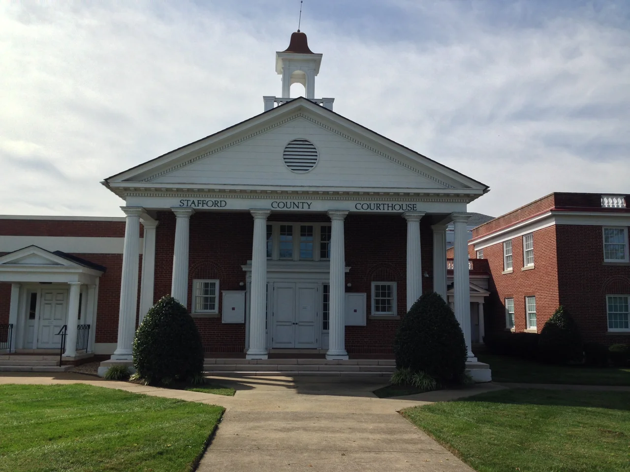

Stafford County, Virginia
The sandstone in the walls of the U.S. Capitol and the White House was quarried from a single small island in Stafford County, Virginia. Government Island, six acres of bedrock in Aquia Creek, supplied the warm reddish-tan stone that gave the new nation its earliest federal buildings their faces. The quarry was active by the 1790s. Stafford County had also been one of the first places the English colonists landed in the upper Chesapeake, the place where Samuel Argall captured Pocahontas in 1613, and the home of two of the Founding Fathers' formative years. By the Civil War, the county had been carrying federal history for two and a half centuries. The war added one more chapter.
From Patawomeck to Stafford
For thousands of years before the English came, the lower Potomac watershed was home to Algonquian-speaking peoples - in particular the Patawomeck, whose principal town was Passapatanzy in what is now eastern Stafford County. John Smith of Jamestown made the first recorded English contact in the area in 1608. Five years later, in March 1613, the colonial officer Samuel Argall sailed up the Potomac, lured Pocahontas - then living at Passapatanzy with her husband Kocoum - aboard his ship under false pretenses, and abducted her. She was taken to the English settlement at Henricus, where Alexander Whitaker converted her to Christianity. She took the baptismal name Rebecca. In April 1614 she married John Rolfe at Jamestown. Stafford County itself was created from Westmoreland County in 1664 and named for Staffordshire, England. Its original boundaries were vast - they later supplied the territory for Arlington, Fairfax, and Prince William counties and for the City of Alexandria. George Mason, the Founding Father who wrote the Virginia Declaration of Rights, spent his formative years in the county. The Patawomeck nation was formally recognized by the Commonwealth of Virginia in 2010.
Aquia Creek Sandstone
Stafford County's earliest export to the new federal government was geological. Government Island, a six-acre outcrop of pale brownstone in Aquia Creek about ten miles southeast of present-day Stafford, was quarried beginning in 1791 to supply the cornerstone and walls of the U.S. Capitol and the White House. Enslaved people worked the quarry alongside paid laborers. The stone was loaded onto schooners and shipped up the Potomac to the new capital. Aquia sandstone is soft when first cut and hardens with exposure to weather; it is also distinctive in color, ranging from cream to peach to a dusky red. Repeated use of it in the new federal buildings is part of why early Washington has a unified palette. The island is now preserved as a public park, with the surviving quarry walls still visible. Aquia Church, built in 1757 nearby on the plan of a Greek cross rather than the standard Roman cross, is a National Historic Landmark for its three-tiered pulpit and architectural rarity.
The Civil War Winter Camp
During the Civil War, more than 100,000 troops occupied parts of Stafford County for years at a stretch. The Army of the Potomac spent the winter of 1862-1863 in the county after the disaster at Fredericksburg, with vast tent cities and corduroy roads cut into the Piedmont mud. Chatham Manor, the 1771 Georgian plantation on the north bank of the Rappahannock directly opposite Fredericksburg, served as a Union signal station, headquarters, and field hospital - Clara Barton and Walt Whitman both tended the wounded there. The Battle of Aquia Creek was fought along the Potomac in May 1861; the strategic Potomac Creek Bridge was destroyed and rebuilt by both sides as the lines shifted. In 1862, in the months around the Battle of Fredericksburg, approximately 10,000 enslaved people from the surrounding region crossed the Rappahannock to Union lines and freedom. The Trail of Freedom historical markers along both banks remember them. Falmouth, on the river just north of Fredericksburg, later became the home of American Impressionist Gari Melchers; his house Belmont is preserved as a museum.
Quantico and the Federal Footprint
The federal presence in Stafford County continued into the twentieth century. Marine Corps Base Quantico occupies a substantial slice of the county's north, and the FBI Academy, the FBI Laboratory, and the Naval Criminal Investigative Service headquarters all sit on the Stafford side of the base. The county is now one of the highest-income counties in the United States; Forbes ranked it 11th in 2009, and the Census Bureau in 2019 placed it sixth. Much of the income comes from federal employees and military families commuting along Interstate 95 and the Virginia Railway Express. Stafford is also one of the few counties in America where Black households have higher median incomes than white households. Population has grown rapidly in the past three decades; the 2020 census counted nearly 157,000 residents. Politically the county leans Republican but is increasingly contested; in 2020 Joe Biden became the first Democratic presidential candidate to carry it since Jimmy Carter in 1976.
From Above
From the air Stafford County reads as suburban subdivisions threading between protected federal land and the green river-edged corridors of the Potomac, the Rappahannock, and Aquia Creek. Interstate 95 cuts north to south through the western middle of the county, lined with shopping and housing. Marine Corps Base Quantico occupies the north - its restricted airspace is impossible to miss. Government Island sits in Aquia Creek about ten miles east of the I-95 corridor, a small rectangular green dot in the tidal water. The county seat at Stafford is a low-rise commercial center with brown highway signs marking the historic district. The Patawomeck homeland that Argall sailed into in 1613, the quarry that built early Washington, the camps that fed the Union army through the winter of 1862-1863 - all of it lies under the same Northern Virginia sky, much of it now under subdivisions but with patches of preserved ground still readable from above.
From the Air
Stafford County, Virginia, occupies roughly 38.46 N, 77.46 W in Northern Virginia, about 40 nm south of Washington, D.C. Recommended viewing altitude is 3,500 to 5,000 feet AGL to see the layout - the Potomac River and Aquia Creek to the east, the Rappahannock to the south, Marine Corps Base Quantico in the north, and Interstate 95 running through the middle. The nearest airports are Stafford Regional (KRMN) near the county seat and Shannon (KEZF) just south in Fredericksburg. Quantico MCAS (KNYG) restricted airspace covers much of the northern county - check current NOTAMs. Best light for Government Island and the Aquia Creek tidal flats is mid-morning. The Trail of Freedom markers cluster along the Rappahannock near Falmouth.
Nearby Stories
- Battle of Cedar Mountain 1.8 km away
- The Inn at Little Washington 11 km away
- Prince William County, Virginia 11 km away
- Surratt House Museum 13 km away
- Menokin 22 km away
- John Wilkes Booth 25 km away
- Battle of Rio Hill 38 km away
- Columbia Air Center 46 km away