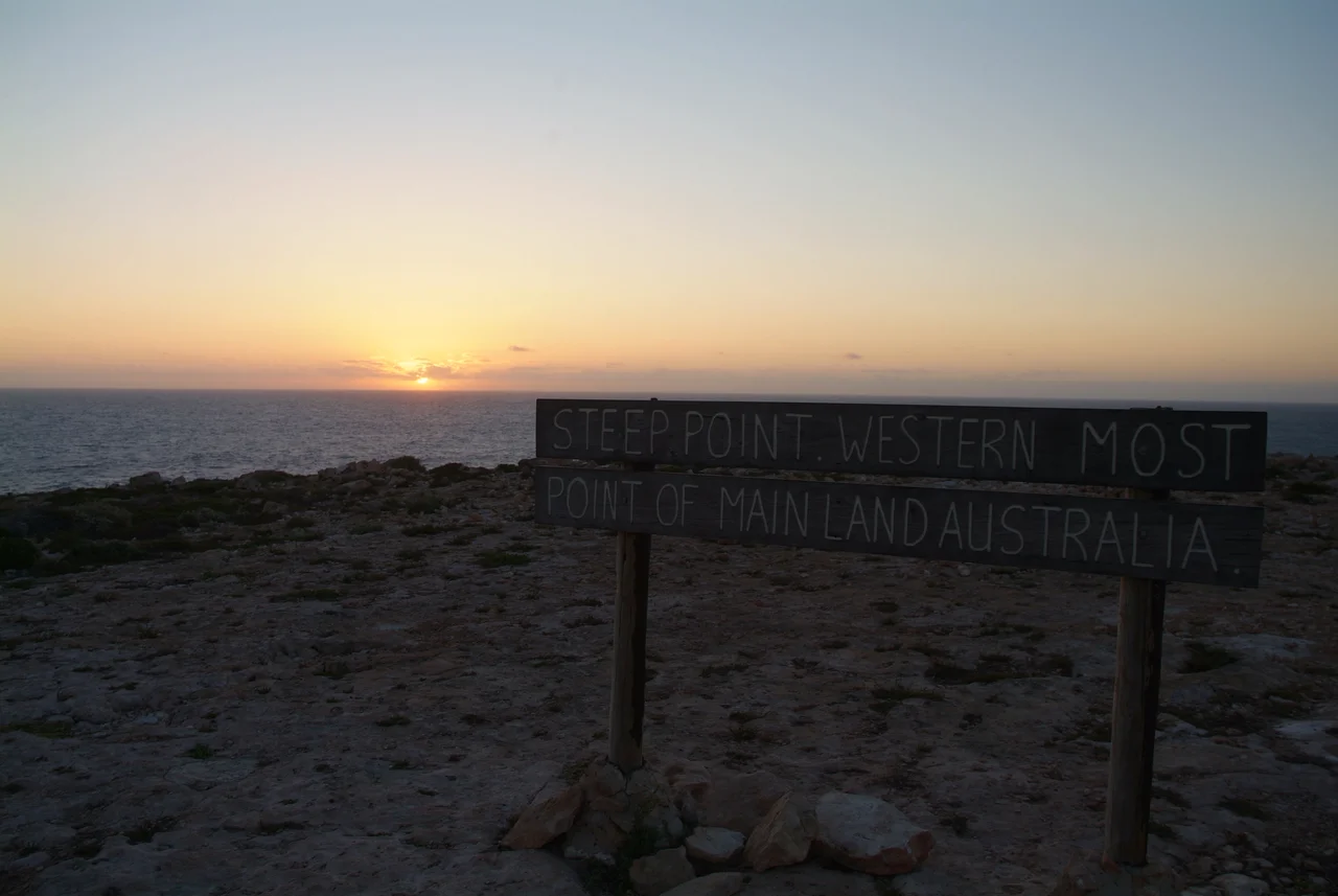

Steep Point
Stand here at dusk and you are watching the last of Australia. Steep Point is the westernmost place on the entire mainland, a low headland of cliff and dune at the tip of the Edel Land peninsula, and the sun that drops into the Indian Ocean in front of you is the final sunset the continent will see that day. There is no road to this edge — only sand. The nearest sealed highway is two hundred kilometres east, and every traveller who reaches the point has earned it across soft dune tracks in a four-wheel drive, chasing the simple, irresistible idea of standing at the end of the land.
The Long Track West
Getting to Steep Point is half the point of going. The North West Coastal Highway, the last strip of bitumen, lies a full 200 kilometres to the east, and from there the route degrades into tracks that wind through sand dunes passable only by four-wheel drive. A permit is required to come at all, bought at the ranger's house in Edel Land National Park about twenty kilometres back, where you also arrange a campsite among the basic facilities scattered along the coast. None of this is incidental. The difficulty is the filter that keeps Steep Point wild — a remote fishing and camping pilgrimage at the literal end of the continent, where the reward for the long, grinding drive is to stand somewhere almost no one else ever will.
The Day the Ocean Climbed the Cliff
The sea here is not always content to stay below. On 17 July 2006, the largest tsunami ever recorded striking Australia surged up against Steep Point and was measured at 7.9 metres high — a wall of water that ran startlingly far up the land. It was born far away, off the coast of Java in Indonesia, where the Pangandaran earthquake had ruptured the seabed and sent waves racing south across the open ocean. By the time the energy reached this exposed western headland it had crossed thousands of kilometres, and it arrived with enough force to mark Steep Point in the record books. On a coast this remote, with no town to swallow, the wave's main witness was the cliff itself.
Fourteen Days in an Icebox
No story binds itself to this coast like that of Jack Drinan. On 25 April 1963, the steel prawn trawler Nor 6 ran onto the Zuytdorp Cliffs just south of Steep Point on her maiden voyage from Fremantle. Three of her crew were lost. Drinan, her skipper, survived — but only by an ordeal almost beyond belief. He kept himself afloat in the open ocean inside the vessel's icebox, drifting for fourteen days off one of the most pitiless coasts in Australia. When the box began to fail he tore part of its lid into a crude raft and paddled toward land, finally dragging himself ashore near the South Passage lighthouse on 11 May, just inside Shark Bay. The raft survives in the Western Australian Museum; a memorial stands on the clifftop just south of the point. It is a monument to three men who did not make it home, and to one who, against everything, did.
The Edge as a Landmark
Because it is the continent's outermost corner, Steep Point has become a kind of fixed mark that the rest of the coast is measured against. Old accounts locate nearby shipwrecks by their distance and bearing from the point; a 1994 booklet on the wrecks that litter this coast was framed the same way. The headland gives this dangerous shore a reference, an anchor — a place definite enough to navigate by on a coastline otherwise made of unbroken cliff. To arrive at Steep Point is to reach not just a geographic extreme but a kind of full stop. West of here there is only the island of Dirk Hartog across the passage, then open water all the way to Africa, and the long red emptiness of Australia at your back.
From the Air
Steep Point sits at 26.15°S, 113.16°E — the westernmost point of mainland Australia, at the tip of the Edel Land peninsula about 670 km north of Perth. From the air it is the place where the continent simply ends: a low cliffed headland with the deep, dark Indian Ocean and its surf to the west, and the sheltered turquoise waters of Shark Bay curling away to the east. Dirk Hartog Island lies just across the South Passage to the north — the key navigational landmark. The sandy 4WD tracks of the peninsula thread south and east toward the ranger station; the sealed North West Coastal Highway is roughly 200 km inland to the east. Nearest field is Shark Bay Airport at Denham (YSHK / MJK) across the bay; Carnarvon (YCAR / CVQ) lies to the north. Recommended viewing altitude is 1,500–3,000 ft AGL along the cliff line, climbing to 4,000–5,000 ft to frame the headland against the Shark Bay seagrass banks and Dirk Hartog Island. This is the spot to catch Australia's 'final sunset' from the air. Expect strong, gusty onshore westerlies and turbulence near the cliffs; visibility over the open ocean is generally excellent.
Nearby Stories
- Dirk Hartog Island 5 km away
- Peron Peninsula 11 km away
- Monkey Mia 17 km away
- Hamelin Pool Marine Nature Reserve 61 km away
- Zuytdorp Cliffs 128 km away
- Battle of Christmas Island 1854 km away
- Christmas Island 1881 km away
- Chatham Islands 6544 km away