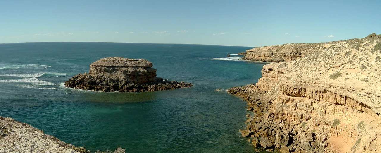

Streaky Bay, South Australia
On 5 February 1802, Matthew Flinders looked out from the deck of HMS Investigator at a sheet of water marked with pale, drifting bands and reached for his logbook. "The water was much discoloured in streaks," he wrote, "and I called it Streaky Bay." For two centuries people assumed the streaks were oil or some trick of the light. The likeliest answer is humbler and stranger: oils released by certain seaweeds in the bay, smoothing the surface into ribbons. The name stuck - far better than the town's official title for its first seventy years - and today Streaky Bay is a town of around 1,400 people on the wild western edge of the Eyre Peninsula, where wheat country meets the Southern Ocean.
Two Captains, One Coast
Flinders was not alone in these waters in 1802. As his British expedition charted the southern coast sailing east, the French captain Nicolas Baudin was mapping the same shore from the opposite direction, and the two men met by chance further down the peninsula - rival empires comparing notes on the edge of the known world. The names they left behind still share the map. The first Europeans to explore the land itself arrived in 1839: John Hill and Samuel Stephens, working for the Secondary Towns Association, sailed in on the brig Rapid that August. A fortnight later the overland explorer Edward John Eyre walked in from Port Lincoln and set up a supply base a few kilometres from the modern town. The spot, Eyre's Waterhole, still sits just off the Flinders Highway, now listed on the state heritage register.
A Harder History
The arrival of settlers brought conflict that the gentle name of the bay does nothing to soften. As pastoralists pushed into the country from the 1850s, violence flared along this coast between Aboriginal people - the Wirangu, Nauo and Kokatha among them - and the newcomers who were taking their land and water. The most notorious episode happened on the cliffs of Waterloo Bay near Elliston, to the south, in May 1849. The death toll is bitterly contested: the thin colonial records note a handful killed, while local oral tradition and accounts circulating since the 1880s speak of as many as two hundred Aboriginal people driven over the cliffs. For generations this stretch of coast was held as forbidden ground in Aboriginal memory. In 2017, after long campaigning by Wirangu people, the Elliston council placed a memorial on those cliffs that names the killing plainly - a small, hard-won act of acknowledgement.
Wheat, Wool and a Late Renaming
Once the land was taken, the town settled into the rhythms that still define it. It was officially proclaimed in 1872 under the rather grand name of Flinders, though almost nobody used it; locals called the place Streaky Bay, and in 1940 the authorities finally bowed to common usage and made the popular name the official one. Wheat growing took hold in the 1880s, and the harbour did the rest. By 1906, ships had carried 31,000 bags of wheat and 470 bales of wool out of the bay, a telegraph office had opened, and the mail came in regularly from Port Lincoln. Grain and sheep remain the backbone of the district to this day, worked with dryland farming techniques suited to the dry, unpredictable climate caught between the Outback and the sea.
The Shape of the Land
Streaky Bay's setting is a study in contrasts. The bay itself is sheltered and calm, edged with quiet beaches, while just beyond it the coast throws itself open to the swells of the Southern Ocean - sea cliffs, surf, and tide-filled rock basins like Smooth Pool and The Granites. Inland the country is pastoral and dry, broken by reserves such as Calpatanna Waterhole, a surviving pocket of the original salt-lake landscape where wildlife still gathers. The town sits at the southern end of the bay on a sheltered inlet that early surveyors named Blanche Port, after Lady Blanche MacDonnell, wife of a colonial governor. And scattered across a nearby farm stand the district's geological showpiece, Murphy's Haystacks - pink granite boulders older than complex life on Earth.
From the Air
Streaky Bay lies at about 32.80 degrees south, 134.22 degrees east, on the western side of the Eyre Peninsula facing the Great Australian Bight. From the air the town sits at the sheltered southern end of a broad bay, with quiet inner beaches giving way to exposed sea cliffs and surf where the coast meets the open Southern Ocean. Wheat and grazing country, flat and tan-coloured for much of the year, stretches inland to the east. Streaky Bay Airport (YSKY) sits about 10 kilometres east of town on the road to Port Lincoln, with 24-hour pilot-activated lighting for general aviation; the nearest commercial airfields are Ceduna Airport (YCDU) to the northwest and Port Lincoln Airport (YPLC) to the southeast. Summer skies are often clear but temperatures here swing sharply between ocean cool and outback heat.
Nearby Stories
- Slade Point 4.5 km away
- Port Kenny 14 km away
- Poochera, South Australia 19 km away
- St Peter Island (South Australia) 26 km away
- St Francis Island 42 km away
- Nuyts Archipelago 51 km away
- Acraman Impact Structure 94 km away
- Israelite Bay 905 km away