.jpg)
Port Kenny
Port Kenny is the kind of place you could drive through in fifteen seconds and remember for years. A pub, a caravan park, a jetty reaching out over Venus Bay, and a scatter of houses on the bay's northernmost shore: that is more or less the whole town. But the water tells a richer story. Venus Bay is one of the most protected stretches of coast on the entire Eyre Peninsula, a maze of tidal flats, mangrove swamps, small islands, and shallow beaches, calm where the open Southern Ocean is anything but. For a hundred years that shelter has made Port Kenny matter far more than its size suggests.
A Port for a District's Grain
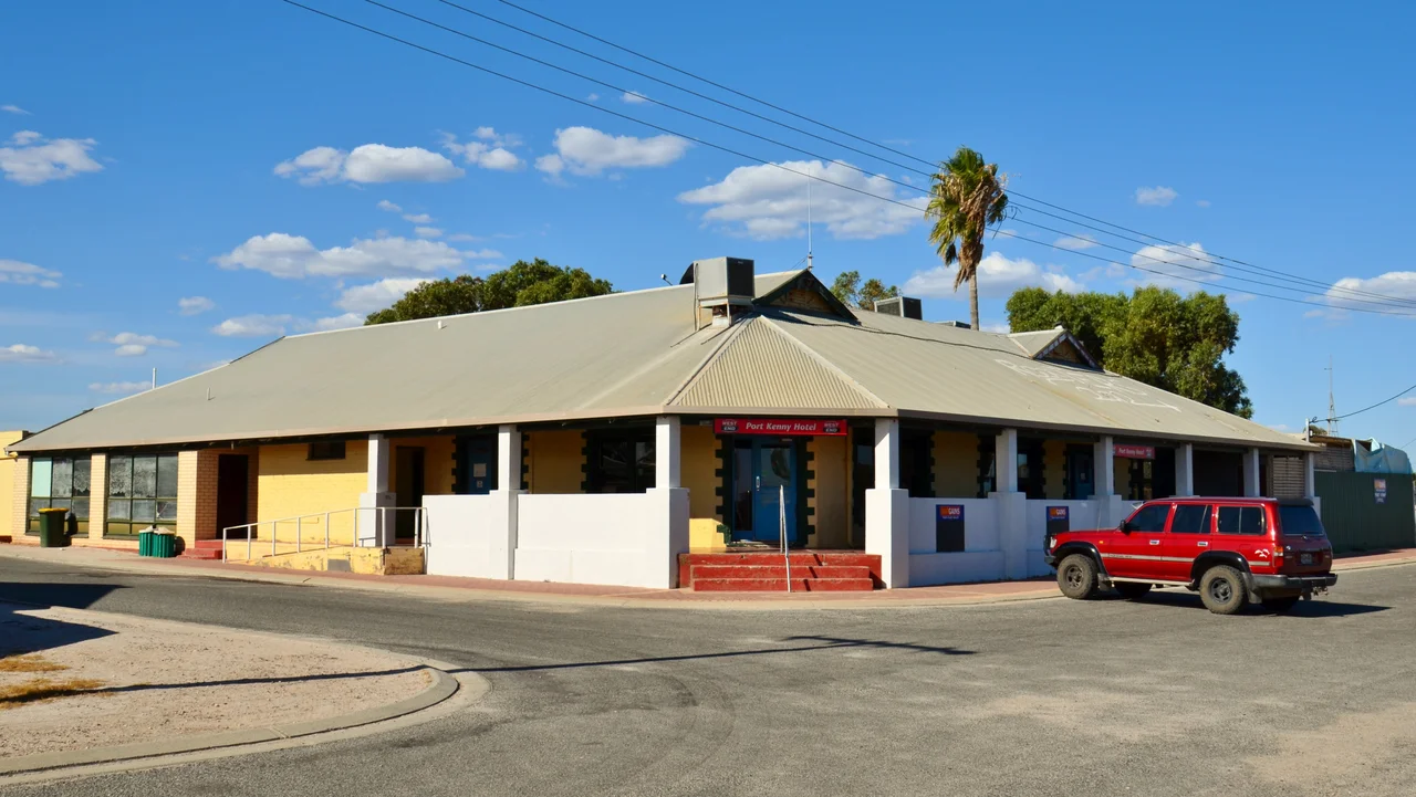
The township was surveyed in 1912, and Governor Bosanquet named it after a local landholder, Michael Kenny. For most of the twentieth century, Port Kenny was a working port in the literal sense. The wheat and wool grown across the surrounding hinterland came down to the bay to be shipped out, and grain was still leaving Port Kenny by sea as late as the 2000s. That is a remarkable run for a tiny outpost, decades of harvests funnelled through one small jetty on a quiet bay. The pub helped the town grow in its early years, and the hotel that still anchors the place opened in 1939. The grain ships are gone now, but the town that grew up to serve them remains.
The Bay That Shelters Everything
Venus Bay works the way the best natural harbours do, by trading the drama of the open ocean for safety. Its waters are highly protected, screened by land and shoal from the swells that pound the cliffs just kilometres away. The bay is shaped by tidal flats that empty and fill with the moon, by mangroves that root in the brackish edges, and by shallows warm enough to wade. Port Kenny sits at the northern head of it; the separate town of Venus Bay guards the entrance. The land around is flat and given over to agriculture, cereal crops and livestock, the same farming country that once filled the grain ships. It is a landscape of horizontals, all low water and lower land under a wide sky.
A Century of Anglers
Long before tourism was a strategy, people came here to fish. As early as the late 1920s the area had a reputation as a recreational fishing destination, with anglers making the trek to these tiny outposts to chase trevally and Australian salmon. That reputation never faded. The town jetty and the surrounding waters still draw line-fishers after whiting, flathead, trevally, and garfish, and the protected bay makes for forgiving conditions whether you are casting from the jetty or working a small boat. In a town where the big industry left by sea, fishing is the constant that stayed, a thread running unbroken from the anglers of the 1920s to the families on the jetty today.
Across the Bay at Venus Bay
Port Kenny shares its water with a near-twin. At the bay's entrance sits the town of Venus Bay, whose own arc-shaped jetty was built around 1924 to ship wheat and goods out through the same protected waters. The two settlements bookend the inlet, both small, both shaped by the same trades of grain and fish. Venus Bay grew into a base for commercial fishing, and the whole arrangement gives this corner of the coast a maritime heritage out of all proportion to its population. The bay's mangroves and tidal flats are not just scenery; they are nursery grounds, and the protected shallows that made the place useful for shipping make it just as useful for the fish, the wading birds, and the boats that still work the water today.
Small Town, Big Base
Today Port Kenny lives a quieter life. Agriculture remains the main economic engine, cereal crops and grazing on the surrounding flats, with tourism filling in around the edges thanks to the hotel and the caravan park. The town's real value now is as a base, a place to stop, refuel, and push out to everything around it: the dune-locked salt lakes of Lake Newland to the south, the sea-lion colonies of Baird Bay, the granite caves of the Talia coast. It is a small dot on the map of the western Eyre Peninsula, but a useful one, the sort of unhurried fishing town that the rush of the modern world mostly forgot to disturb.
From the Air
Port Kenny sits at roughly 33.17 degrees south, 134.68 degrees east, on the northern shore of Venus Bay on the western Eyre Peninsula. From the air, the standout feature is Venus Bay itself: a large, sheltered, shallow inlet laced with tidal flats and small islands, sharply calmer than the open Southern Ocean to the west. The town and its jetty are small; look for the bay first. Best viewed at 2,000 to 4,000 feet, with low tide exposing the flats for the most striking patterning. Nearest aerodrome is Streaky Bay (YKBY) to the north; Elliston (YELN) lies south and Wudinna (YWUD) inland to the east. The bay's protected waters stay calm in conditions that whip the outer coast, a contrast clear from above.
Nearby Stories
- Point Labatt 3.9 km away
- Lake Newland Conservation Park 4.1 km away
- Streaky Bay, South Australia 11 km away
- Poochera, South Australia 17 km away
- Ward Islands 38 km away
- Acraman Impact Structure 96 km away
- Port Augusta 237 km away
- Baudin expedition to Australia 290 km away