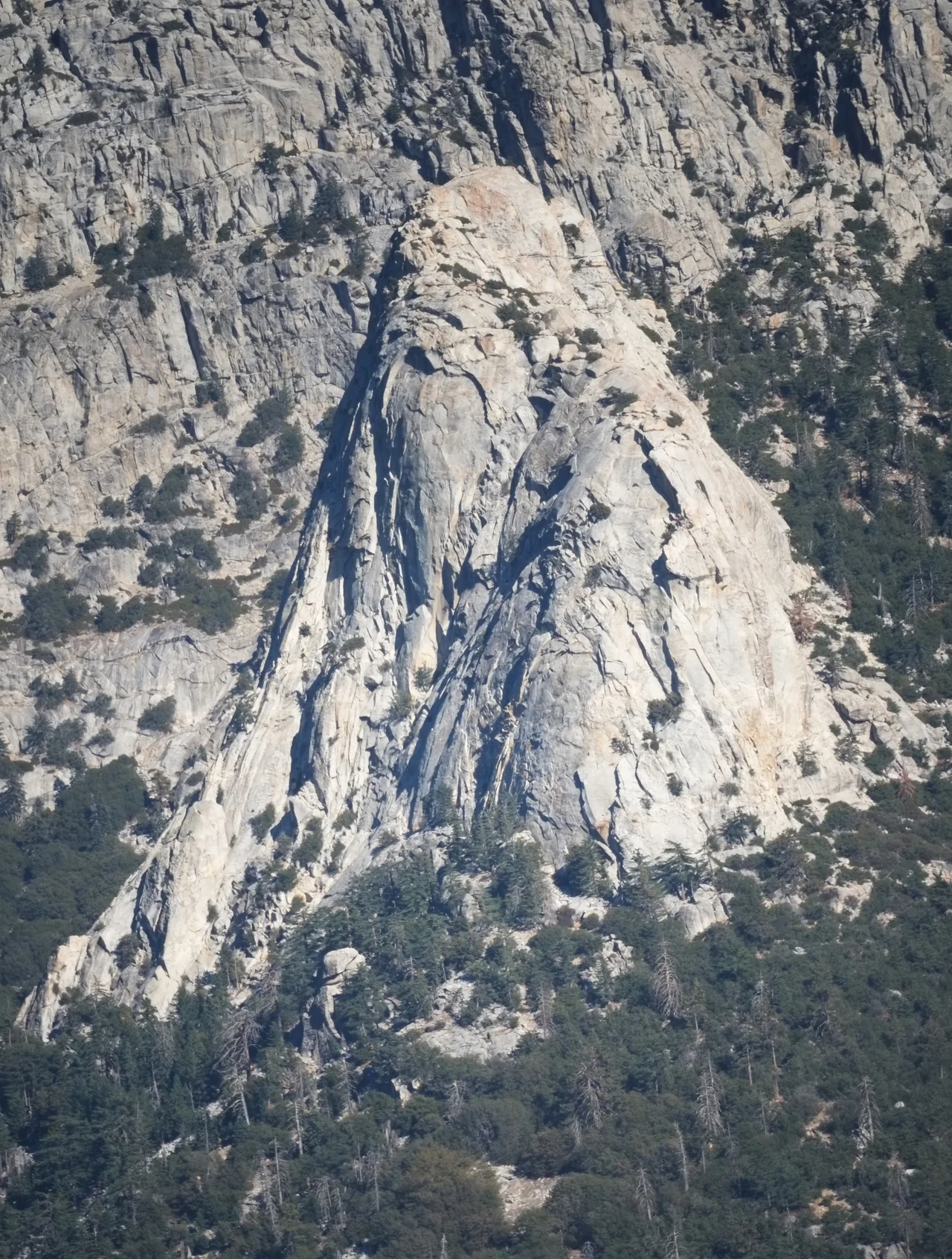
Tahquitz Peak
The Soboba people named it for Tahquitz, a spirit-demon they described as luminous — a being associated with lightning and death who inhabited the high granite peaks above the Coachella Valley. The name did not discourage climbers. In August 1936, a Sierra Club party made the first fifth-class ascent of the rock face that carries the spirit's name, completing a route they called 'The Trough.' What they were doing, though they may not have fully understood it at the time, was beginning the development of a difficulty rating system that would become the international language of rock climbing.
The Birthplace of a Rating System
The Yosemite Decimal System — the YDS — divides climbing terrain into five classes, with Class 5 representing technical rock climbing requiring ropes and protection. Within Class 5, the system uses decimal subdivisions from 5.0 to 5.15 to describe increasing difficulty. It is the rating language used on climbing routes across North America, referenced in guidebooks from Alaska to Patagonia, and its development is traceable to a specific place: the granite faces of Tahquitz Rock, in the San Jacinto Mountains above Idyllwild, where Sierra Club Rock Climbing Section members worked out the practical problem of describing routes that existing European and British systems could not adequately convey. Royal Robbins, who would go on to pioneering first ascents in Yosemite Valley, was among those who drove the system's elaboration through the 1950s.
Fire Watch at 8,846 Feet
Tahquitz Peak's summit hosts a fire lookout station staffed in late spring through mid-fall, the high-fire-risk period in Southern California's mountain forests. The lookout at 8,846 feet commands a 270-degree panoramic view of the surrounding landscape — the San Jacinto Wilderness immediately below, the Coachella Valley spreading eastward, the distant ranges of the Mojave Desert and the San Bernardino Mountains visible in clear conditions. Fire lookout duty is one of the more deliberately solitary occupations in the American West, and the Tahquitz Peak lookout requires both the capacity for extended isolation and the vigilance to spot, from a great distance, the first wisps of smoke that indicate a fire before it becomes something larger.
The Spirit in the Stone
The indigenous name Tahquitz — and the Soboba tradition that associated this peak with a powerful supernatural presence — reflects a relationship to the landscape that Western recreational climbers only partially reimagine when they speak of mountains as spiritual experiences. The Cahuilla and related peoples of the region understood the high peaks as inhabited places, animated by forces that demanded respect rather than conquest. When Anglo-American climbers arrived with their rope techniques and their numerical rating systems, they were working on terrain that already had a complete cultural life, one that had been developing for thousands of years before any European first attempted to categorize the difficulty of ascending granite. Both relationships to the rock — the indigenous one of reverence and the recreational one of technical challenge — coexist in the name that carries them.
A Peak That Trained a Generation
The routes on Tahquitz Rock — which lies just below the peak's summit — served as a training ground for the generation of American climbers who would go on to first ascents throughout Yosemite Valley and beyond in the 1950s and 1960s. The technical demands of the granite faces, combined with the relatively accessible location above the resort town of Idyllwild, made Tahquitz a proving ground for skills and systems that would later be applied at greater scale and altitude. Routes developed here were used to calibrate the YDS rating system; the climbers who perfected their techniques here became the leading figures of an era in American mountaineering that redefined what was considered possible.
From the Air
Located at 33.76°N, 116.68°W in the San Jacinto Mountains above the Coachella Valley. The peak is visible from cruising altitude as part of the dramatic mountain escarpment west of Palm Springs. Palm Springs International Airport (ICAO: KPSP) is approximately 12 miles to the northeast.
Nearby Stories
- Pioneertown, California 7.2 km away
- North Shore, California 11 km away
- Wonder Valley, California 11 km away
- Cholla Cactus Garden 12 km away
- Toro Peak 12 km away
- Tenaja Fire 20 km away
- San Bernardino Train Disaster 26 km away
- Bell Canyon 42 km away