Wonder Valley, California
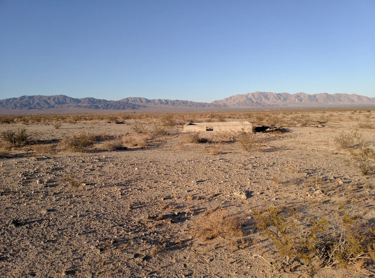
The federal government gave away this valley five acres at a time. The Small Tract Act of 1938 authorized the Bureau of Land Management to sell desert homesteads at low cost to anyone willing to build on them and live there for three years. Thousands of people came to Wonder Valley in the 1950s and 1960s, built the small structures required to prove their claim, and then — in most cases — left. The cabins stayed. They are still out there, scattered across the alluvial plain between the mountains, deteriorating at the pace that desert air allows.
Jackrabbit Homesteads
The Small Tract Act encouraged a particular kind of settlement: aspirational, minimally funded, and frequently temporary. The five-acre parcels in Wonder Valley were sometimes called jackrabbit homesteads — small enough that the land itself offered little agricultural potential, intended instead as weekend getaways or retirement retreats for working-class Californians who could not afford the coast.
The structures built to meet the Act's requirements were often simple: a single room, sometimes less. The materials available in the desert were limited; the water was scarce; the summers reached temperatures that made weekend occupation impractical. Of the thousands of cabins built during the homesteading years, the majority were eventually abandoned. The owners' plans — to retire here, to spend weekends here, to build something larger eventually — did not survive contact with the actual conditions of desert life.
The Valley's Geography
Wonder Valley occupies a flat basin at elevations ranging from approximately 1,200 to 1,800 feet, east of Twentynine Palms and south of the Sheep Hole and Bullion Mountains, with the Pinto Mountains forming a horizon to the north. Interstate 62 (Twentynine Palms Highway) runs through the valley, connecting it to Twentynine Palms roughly ten miles to the west and continuing east toward Parker, Arizona.
The terrain is open desert — creosote scrub, Joshua trees at the higher reaches, sandy washes that can fill with water during the infrequent rains that the Mojave delivers. The Marine Corps Air Ground Combat Center begins not far to the north; Joshua Tree National Park lies to the south. Wonder Valley sits between these controlled territories, neither park nor base, its abandoned cabins distributed across private parcels still technically owned by the descendants of the original homesteaders or by whoever purchased them since.
Arrival of the Artists
Beginning in the 1990s and accelerating through the 2000s, Wonder Valley attracted a different kind of settler: artists, writers, and the desert-drawn who found cheap land and isolation more appealing than liability. The abandoned cabins, available for low prices, became studios and residences. The same qualities that had defeated the original homesteaders — remoteness, heat, lack of services — became assets for people who wanted those conditions.
The community that has formed is loose, independent, and characteristically difficult to characterize. Some residents live there full time; others use cabins seasonally. The proximity to Joshua Tree National Park brings visitors who discover the valley's character in passing. The abandoned cabins continue to outnumber the occupied ones, but the ratio has been shifting.
From the Air
Wonder Valley runs east of Twentynine Palms along the Twentynine Palms Highway (SR-62), centered approximately 34.12°N, 115.90°W. The landscape is flat alluvial plain with scattered small structures visible from low altitude — the abandoned cabins are identifiable as irregular dark shapes on the pale desert. The Sheep Hole and Bullion Mountains rise to the north; the Pinto Mountains appear to the northwest. Nearest airports: Twentynine Palms (TNP) ~10 miles west, Blythe Airport (BLH) ~70 miles east.
Nearby Stories
- Joshua Tree National Park 5.4 km away
- Landers 8.8 km away
- Amboy Crater 11 km away
- Thousand Palms 12 km away
- Lavic Lake Volcanic Field 31 km away
- Poston War Relocation Center 87 km away
- London Bridge (Lake Havasu City) 89 km away
- Felicity, California 140 km away