Lavic Lake Volcanic Field
The lava field appears suddenly alongside the freeway between Barstow and Ludlow — a dark, flat expanse of basalt that contrasts sharply with the pale desert floor on either side. Pisgah Crater rises from the field's surface as a symmetrical cinder cone, dark against the sky, one of four Holocene volcanic features in the Lavic Lake Volcanic Field. Route 66 originally ran directly alongside it. Interstate 40 does the same.
What Pahoehoe Looks Like from the Air
The Lavic Lake Volcanic Field covers approximately 100 square kilometers of the central Mojave Desert in San Bernardino County. The dominant feature is basaltic pahoehoe lava — the smooth, ropy type of basalt flow that forms when lava with low viscosity moves slowly and cools from the outside in, developing a skin that wrinkles and folds as the interior continues to flow. Pahoehoe surfaces look like braided rope frozen in dark stone, or like the surface of a choppy sea caught at a single moment.
From altitude, the lava field is one of the most distinctive features in the Mojave — a dark, irregular mass against the lighter desert floor, its edges marking the extent of ancient eruptions. The field is flat where the lava flowed across level ground and slightly elevated where it banked against existing terrain.
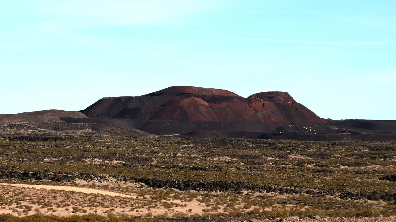
Pisgah Crater
Pisgah Crater is the most accessible of the field's four Holocene cinder cones. It stands approximately 100 meters tall and rises to an elevation of 2,545 feet above sea level, enough to make it visible from some distance in the flat Mojave terrain. The crater's age is estimated at around 25,000 years — young in geological terms, recent enough to leave a well-preserved cone without the erosion that would have reduced it to a lower profile.
The cone is named for Pisgah, the biblical mountain from which Moses viewed the Promised Land — a naming convention that found its way to this particular Mojave feature through the same process of biblical reference that scattered similar names across the American West. The crater can be reached by foot from a parking area off the old Route 66 alignment; the interior of the cone and the surrounding lava fields are accessible without technical equipment, though the jagged basalt surface makes for difficult walking.
Route 66 and the 1999 Earthquake
The historic Route 66 alignment passed directly alongside Pisgah Crater, making the volcanic field one of the more dramatic roadside features on the old highway between Chicago and Los Angeles. Travelers on the original road would have driven within a few hundred feet of the cone's base. Interstate 40, which replaced Route 66 through this corridor, follows a roughly parallel course, and drivers on the modern freeway still pass the crater on the south side.
The Lavic Lake volcanic field gave its name to the Lavic Lake fault, the fault system responsible for the 1999 Hector Mine earthquake. That magnitude 7.1 event produced extensive surface rupture across the volcanic field, visible as linear scars through the lava. The earthquake and the volcanic field share terrain — adjacent evidence that the Mojave's geological history is ongoing rather than settled.
From the Air
The Lavic Lake Volcanic Field lies between Barstow and Ludlow along Interstate 40, centered approximately 34.73°N, 116.39°W. The lava field is one of the most distinctive features in the Mojave from altitude — dark, irregular, unmistakable against the pale desert floor. Pisgah Crater is identifiable as a symmetrical cone at the field's center. Nearest airports: Barstow-Daggett Airport (DAG) ~25 miles west, Twentynine Palms (TNP) ~50 miles south.
Nearby Stories
- Tell Them Willie Boy Is Here 18 km away
- Project Carryall 22 km away
- Kelso, California 33 km away
- Wonder Valley, California 39 km away
- San Bernardino Train Disaster 43 km away
- Desert Studies Center 44 km away
- The Desert Tortoise Natural Area: Where the Slow Survive 74 km away
- Edwards Air Force Base 77 km away