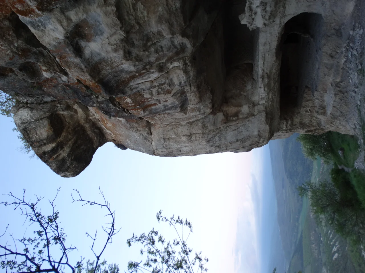

Tepe-Kermen
Someone named Manuel is remembered on the wall of a cave church atop this Crimean butte, in an inscription cut above a grave: a tomb dug "at my request" by a man whose name has partly worn away, its extension made "by the servant of God, the pious Manuel." More than a thousand years later, those few surviving words are among the most human things left on Tepe-Kermen - a lonely, flat-topped mountain riddled with over two hundred and thirty man-made caves, where a whole community once carved its shelter, its worship, and its dead directly out of the living rock.
The Fortress Without Water
Tepe-Kermen means, in Crimean Tatar, "hill-fortress" or "fortress on the top" - tepe for the peak, kermen for the stronghold - and the name fits the place exactly. It rises 544 meters, a butte standing seven kilometers southeast of Bakhchysarai, its steep sides climbable by two paths up the gentler northern slope. Though more than 230 caves crown its single hectare of summit, this was never quite a town in the ordinary sense. It had no water source, and that absence tells you what it really was: a refuge, a fortified castle where the people of the surrounding valleys fled when enemies came. You do not build a permanent city where there is nothing to drink. You build a place to survive a siege, and pray it does not last past your stored water.
A Byzantine Outpost on the Heights
The story of the summit reaches back to late antiquity. An unfortified settlement seems to have appeared in the fifth or sixth century, and the fortress itself was likely raised under the Byzantine administration of Chersonesus, the great Greek city on the coast, sometime between the late fifth and early seventh centuries. From the later seventh century, Tepe-Kermen may have held the residence of an archon, an official within the governing structure of the Dori region; by the eighth and ninth centuries, with its principal basilica, it served as a kind of ecclesiastical center for the district. Its greatest prosperity came in the twelfth and thirteenth centuries, when the honeycomb of caves reached its fullest extent. Then, by some accounts, it ended violently - swept away in the same 1299 raid of the Golden Horde commander Nogai that scoured this corner of Crimea.
The Church in the Rock
The jewel of Tepe-Kermen is a baptistery church hollowed into the western part of the summit, unusually large for a Crimean cave temple - just over ten meters long, five wide, its walls gently curving so no measurement holds quite steady. Inside, a cross-shaped baptismal font sinks into the floor by two steps. An altar wall carved from the rock and decorated with relief crosses separates the sanctuary, and three surviving columns - once six - rise before it, their capitals still bearing graceful ornament. These columns hold up nothing; the ceiling is solid stone. Their purpose was to divide the space into three aisles by the Byzantine custom: right for men, the middle for clergy, left for women. Researchers reading the "expressive features of the liturgical structure" have dated the church as early as the sixth or seventh century.
The Dead on the Edge
Death is written all through this place, plainly and without horror. Tombs are cut into the church floor - two beside the font, one south of the altar, and the grave in the western wall where Manuel is named. Just outside, along the very lip of the plateau where the mountain falls away, archaeologists excavated nine more tombs and five sepulchres. To be buried here was to rest at the edge of the sky, among the caves that had sheltered the living. Today the walls of the old fortress are gone entirely, their foundations lost among the bushes and grass; only the caves and the carved church endure. But that is enough to walk into a room a Byzantine congregation once filled, and to read, faint above a grave, a name someone wanted kept.
From the Air
Tepe-Kermen is a striking flat-topped butte at 44.715 N, 33.931 E, rising to 544 meters about 7 km southeast of Bakhchysarai. From roughly 4,500-6,500 feet its isolated mesa profile stands out sharply against the surrounding Crimean uplands, a clean tabletop ringed by cliffs; the neighboring butte of Kyz-Kermen lies 2 km to the southwest. Watch for mountain turbulence near the escarpments. Simferopol International (UKFF) is about 20 nm to the northeast.
Nearby Stories
- Battle of the Chernaya 6.1 km away
- Kalamita Bay 9.3 km away
- Taigan Safari Park 9.6 km away
- Saky Air Base 29 km away
- Soviet Destroyer Dzerzhinsky 32 km away
- Soviet Destroyer Otvazhny 33 km away
- Bilohirsk 37 km away
- Abkhazia 549 km away