Teresina
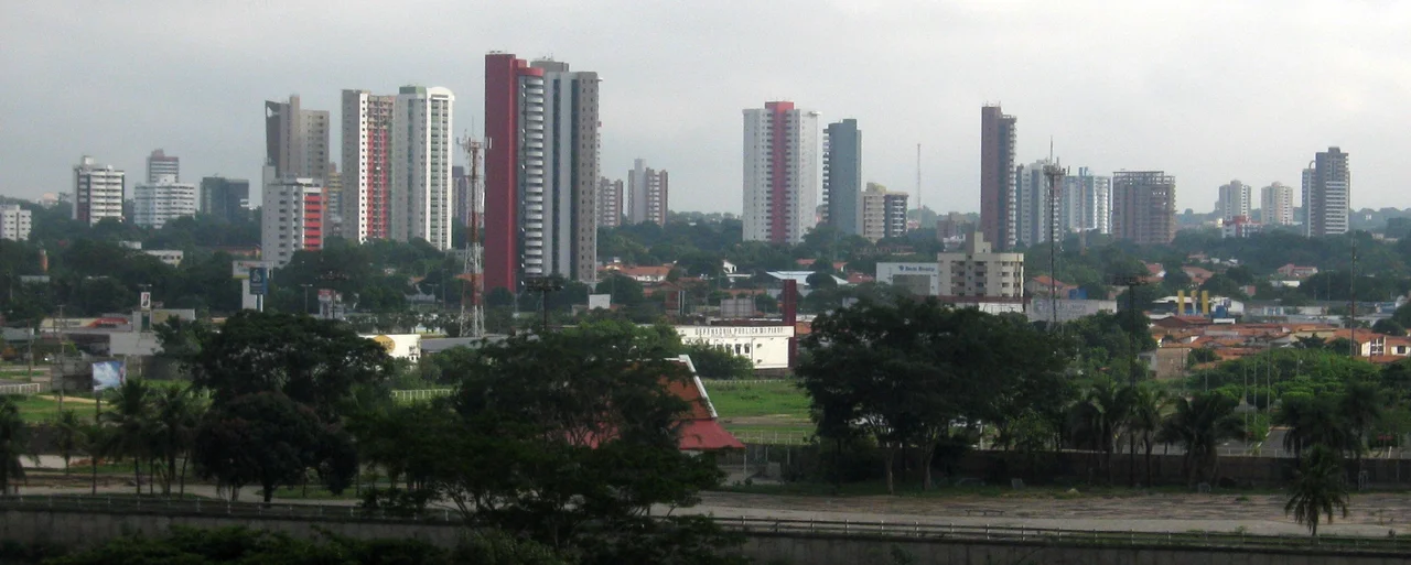
Teresina is the only state capital in Brazil's Northeast that the Atlantic never reached. While every other capital in the region - São Luís, Fortaleza, Natal, João Pessoa, Recife, Maceió, Aracaju, Salvador - grew on the coast with a port at its founding, Teresina grew 366 kilometers inland, on a triangle of dry land between the Parnaíba River on the west and the Poti River on the east. That geography explains most of what matters about the city. It is hot, reliably. It is not a tourist destination. It is nicknamed Chapada do Corisco - the Flash Lightning Flatlands - because the Parnaíba valley sees some of the highest densities of lightning strikes in Brazil. And when the rivers run low in the dry season, it gains a collection of "beaches" that exist nowhere else.
Named for an Empress
Until 1852, Piauí's capital was Oeiras - an interior town chosen for defensibility during the colonial era and later abandoned in favor of somewhere more commercially useful. That somewhere turned out to be Nova Vila do Poti, a small river settlement at the confluence of the Parnaíba and Poti that had been founded a few decades earlier. When the capital moved, the town was renamed Teresina, after Teresa Cristina of the Two Sicilies - the Italian-born wife of Emperor Pedro II, whose reputation for charitable work earned her the affectionate Brazilian nickname "mother of the Brazilians." The city she did not ask to be named for grew into one of the hotter and less celebrated of Brazil's state capitals. That is not a criticism. It is a geography.
The Rivers That Dry Up
Teresina's relationship with its two rivers is seasonal. During the December-to-May rainy season the Parnaíba and the Poti run full, the ferries work, and the Procissão de São Pedro - a penitential procession of boats on the Parnaíba - happens on June 29 as the rivers begin their retreat. From June through November the water levels drop, sometimes dramatically, and long sandy islands called "crowns of the rivers" - coroas - emerge in the riverbeds. The city's residents turn them into informal beaches, complete with lifeguards and vendors selling fried fish pulled straight from the water beside you. It is one of the quieter pleasures of living in an inland hot city: your beaches are half a year's worth, and they come to you.
The Heat and the Health Industry
Average daytime temperatures in Teresina run 32°C to 38°C across most of the year, with October the hottest month. The August-to-November stretch, when the Chapada do Corisco dries out and the air stills, regularly sends the thermometer above 38°C. That heat shapes a slower rhythm than the coastal capitals; mid-afternoon is for indoors; the city wakes up again after sunset. In parallel, Teresina has become one of the most important medical centers in the Brazilian Northeast, with hospitals that draw patients from across Piauí, Maranhão, and even neighboring states. The pensões along Avenida Frei Serafim near the hospital zone, Wikivoyage notes, often feel less like tourist accommodation than like lodging for families of the hospitalized. That is exactly what they are.
Cajuína, Cachaça, and a Songwriter's Tribute
Piauiense food leans on the interior: shrimp from the rivers, fried fish, and an occasional local specialty at restaurants like Camarão do Elias or O Pesqueirinho along the Poti. To drink, Teresina's signature is cajuína - a clarified golden soft drink made from the cashew fruit, pressed, decanted, and bottled without added color or preservatives. Caetano Veloso wrote a song called "Cajuína" in 1979 that fixed the drink in Brazil's cultural memory; the song was a tribute to his friend Torquato Neto, a Teresina-born poet and songwriter. The local cachaça brand is Mangueira. The main cultural months are February (Carnaval), June-July (the Micarana festival, drawing national acts and essentially no foreign tourists), and November, when the Salão Internacional de Humor fills the city with cartoons and caricatures from across Brazil and abroad. It is a city that takes its humor and its heat equally seriously.
Getting In and Out
Teresina sits at a road hub: BR-222 east to Fortaleza (via Piripiri and Tianguá), BR-316 southeast to Recife (via Salgueiro), and a cluster of BRs south-southwest to Brasília. Buses are the default long-distance option, with Expresso Guanabara running the nearby routes. An inland railway, converted to a 9-station light-rail system in 1991, is technically a metro - the first in the Northeast - but as Wikivoyage points out with unusual candor, the line serves mostly dead-end streets in poor neighborhoods and carries about 8,000 riders a day against the bus system's 225,000. Most travelers use it as a curiosity rather than transport. The most common reason to leave Teresina is to catch Sete Cidades National Park, 190 kilometers north, where weathered sandstone formations have carved what looks like a ruined stone city across the Piauí-Ceará border country.
From the Air
Teresina at 5.09°S, 42.82°W, in north-central Piauí between the Parnaíba River (west) and the Poti River (east). Cruise at 6,000-10,000 feet for a clear view of the two rivers' confluence and the urban grid spreading from it. Senador Petrônio Portella Airport (SBTE) lies on the city's west side. The city sits 366 km inland from the Atlantic - the only Northeast Brazilian capital not on the coast. During dry season (June-November), the exposed river sandbars are visible from altitude as bright channels in the riverbeds. Chapada do Corisco lightning activity peaks during the December-May wet season; expect active convective buildups, especially in the afternoon and evening.
Nearby Stories
- Chapada Limpa Extractive Reserve 95 km away
- Serra da Ibiapaba Environmental Protection Area 116 km away
- Parnaíba Thermal Power Complex 125 km away
- Serra das Almas Private Natural Heritage Reserve 143 km away
- Tianguá 222 km away
- Mirador State Park 260 km away
- Maranhão 335 km away
- Castanhão Ecological Station 410 km away