Serra da Ibiapaba Environmental Protection Area
On the Piauí-Ceará line, the land rises. Not sharply - this is not a range like the Andes or even the Serra da Mantiqueira - but decisively, enough that the Serra Grande complex creates its own small weather. Clouds catch on the tableland, rain falls where the lowlands go dry, and for a few hundred meters of elevation an entirely different world appears: taller trees, cooler air, the red-handed howler monkey calling at dawn. The Serra da Ibiapaba Environmental Protection Area - APA for short, pronounced ah-pah - is the federal government's attempt to keep some of this working. At 1,592,550 hectares, it is one of the larger protected landscapes in northeastern Brazil, covering parts of 20 municipalities in Piauí and another 6 in Ceará, wrapped around two national parks like a buffer.
Three Biomes in One Protection Area
Few protected areas in Brazil sit on a three-way ecological seam, and this one does. The APA contains fragments of cerrado - Brazil's great tropical savanna, whose twisted trees store carbon in roots as much as in canopy - alongside caatinga, the dry-thorn scrubland that defines the northeastern interior, and patches of Atlantic Forest, which once ran unbroken down Brazil's coast and now survives in islands. Via Rural classifies the area more specifically as caatinga biome at an ecotone with the Amazon rainforest. The elevation of the Serra Grande complex does the mixing. Where the land rises, rainfall rises with it, and the vegetation shifts from spiny caatinga on the lowland fringes to seasonal forest and transitional rainforest higher up. The result is one of the few places in northeastern Brazil where a naturalist can walk through several biomes in a morning.
A Ring Around Two Parks
The shape of the APA is not accidental. It surrounds the Sete Cidades National Park on three sides and adjoins Ubajara National Park to the east, acting as a federally recognized buffer between the two stricter reserves and the working landscapes of farms, towns, and roads around them. To the north it also adjoins the Delta do Parnaíba Environmental Protection Area, extending the protection continuum all the way to the coast where the Parnaíba River breaks into its famous delta. The APA sits about 340 kilometers from Fortaleza and 300 kilometers from Teresina, roughly halfway between the two northeastern capitals. Fly over this stretch of country and the APA reads as a softer green ribbon running between the paler caatinga flats and the deeper tropical green of the coast.
Howler Monkeys and a Vanishingly Small Frog
Among the endangered species the APA was created to protect, two deserve attention. The red-handed howler monkey - Alouatta belzebul - is a dark-furred primate with rusty forearms whose dawn roars can carry several kilometers through the forest canopy. The species has declined sharply across its northeastern range due to habitat loss and hunting, and the APA represents some of the better remaining habitat. Adelophryne baturitensis, a tiny ground-dwelling frog of the seasonal forest floor, is the more obscure story. It was described from nearby highland forests and depends on the kind of humid microhabitats only the higher wet pockets of the Serra can reliably provide. Protecting these species means protecting not the animals themselves but the entire system that produces the conditions they need - which is the logic of a landscape-scale APA rather than a small species reserve.
Working Landscape, Fragile System
Most of the people living inside the APA are rural families who farm. That fact shapes everything. The APA is classified IUCN Category V - protected landscape - which explicitly allows human use that is compatible with conservation, and the consultative council formed in 2012 by ICMBio (the Chico Mendes Institute for Biodiversity Conservation) has oriented its management plan around that reality. The threats are familiar to anyone who has worked in the Brazilian northeast: agricultural burning that escapes into the forest, chronic deforestation for pasture, illegal hunting, wildlife trafficking, over-applied pesticides, and badly managed water. The council's counter-proposals are the sustainable-development menu of the 2020s: ecotourism, handicrafts, agroforestry, agroecology, beekeeping, and a gradual shift from large livestock to smaller, less land-hungry animals. Whether any of that outruns the pressures on the land is an open question. The APA is a bet that it can.
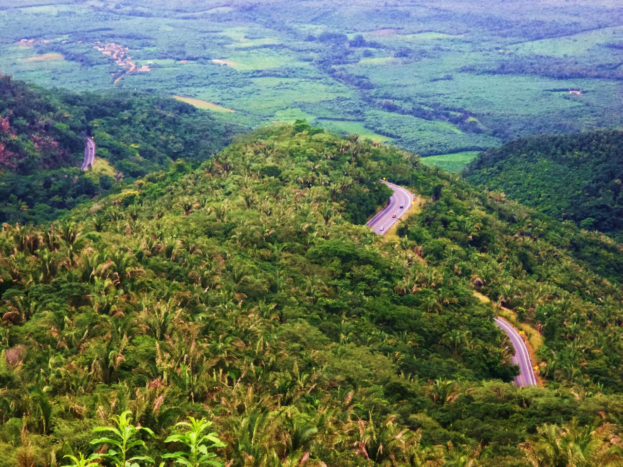
From the Air
Serra da Ibiapaba APA centered near 4.07°S, 41.39°W, spanning 1,592,550 hectares across the Piauí-Ceará border. Cruise at 8,000-12,000 feet for a view of the tableland and the greener forested canopy distinct from the paler lowland caatinga on either side. The Sete Cidades National Park sits within the APA; Ubajara National Park adjoins on the east. Closest significant airports are Teresina (SBTE) about 300 km southwest and Fortaleza (SBFZ) about 340 km east. Haze common in the July-December dry season from agricultural burning - expect smoke plumes visible on the tableland.
Nearby Stories
- Tianguá 38 km away
- Crateús 88 km away
- Serra das Almas Private Natural Heritage Reserve 94 km away
- Araioses 109 km away
- Jericoacoara Beach 123 km away
- Teresina 133 km away
- Jijoca de Jericoacoara 152 km away
- Paulino Neves 175 km away