Jericoacoara Beach
The Washington Post article changed everything. When the newspaper included Jericoacoara on its list of the ten most beautiful beaches in the world, the fishing village behind the dunes suddenly had a name that mattered to travelers on five continents. What they found when they arrived was a place that ran on diesel generators, where street lighting was only the moon and stars, and where the sand blew into the houses no matter how often anyone swept. Electricity reached the village in 1998. The first road built specifically to reach it came later. Even today, by local law, no electrical street illumination is permitted inside the village limits. The stars are part of the zoning code.
Lair of the Turtles
The name comes from Tupi. Iurukua means sea turtle, kuara means lair or hole, and Jericoaquara, later smoothed into Jericoacoara, meant the place where sea turtles came ashore to nest. The beaches around here are still part of sea turtle nesting habitat, though the modern form of protection arrived much later than the name. In 1984, federal authorities declared the surrounding area an environmental protection zone, restricting building and commercial activity. In 2002, those protections were strengthened when Jericoacoara National Park was created, preserving the dunes, freshwater lagoons, and adjacent stretches of coastline that give the beach its particular geography. The distance from major cities had already done most of the preservation work; the new rules kept that original distance from being erased by development.
The Pedra Furada and the Timing of Sunset
The beach's single most recognizable feature is a rock arch called Pedra Furada, pierced stone, about sixteen feet tall and worn through by centuries of Atlantic surf. For most of the year, the arch is just a dramatic natural sculpture visible on walks east of the village. But during a specific window from mid-June through late July, the sun sets exactly through the opening, dropping into the Atlantic framed by stone. Photographers time entire trips for that stretch. The walk out from the village takes about two hours along the shore, past Malhada Beach and over the rocky slopes of Serrote hill. Local guides know the tides; walking barefoot is a bad idea, and walking at night is worse. The rocks around the arch hide snakes that prefer to be left alone.
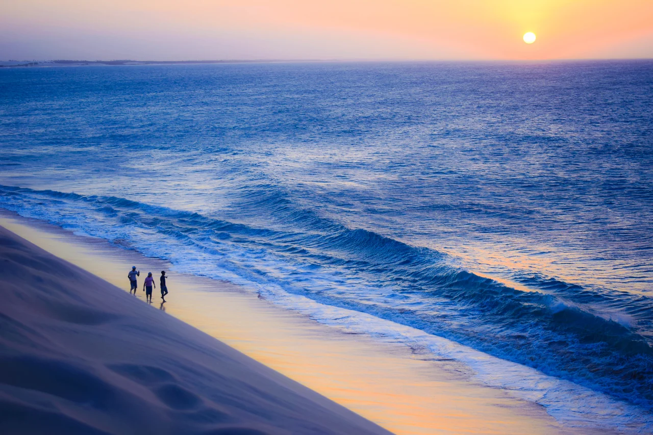
Sunset Dune
Every evening, a quiet migration happens. Visitors and locals start climbing the Duna do Por do Sol, the Sunset Dune, about an hour before the sun touches the horizon. It is one of several places in Brazil where the sun sets directly into the ocean rather than behind a mountain or an inland ridge, and the dune provides the best viewing angle the village offers. People sit in loose groups, trading caipirinhas, and watch the sky work through its colors. When the light is gone, the dune clears quickly. The walk back down in twilight ends on sandy streets where the absence of electrical lighting suddenly becomes the point: the stars emerge, the Milky Way is often visible, and the village takes on a quality that larger tourist destinations long ago traded for convenience.
Wind and Water
The easterly trade winds that have shaped this coast for millennia now power what is probably the single largest driver of Jericoacoara's modern economy: board sports. Windsurfing, kitesurfing, and sailing draw international competitors and casual visitors in roughly equal numbers, especially from July through December when the winds strengthen. Multiple schools along the main beach teach beginners and rent equipment to experienced riders. The water is usually calm enough for comfortable flat-water riding while the wind remains strong, an unusual combination that makes conditions excellent for learning. The national park's freshwater lagoons, hidden between the dunes and reached by 4x4 buggy, offer an even gentler introduction to the sports, with shallow sandy bottoms and steady crosswinds.
Sand Streets, and Keeping Them That Way
The laws that govern Jericoacoara are as unusual as the place itself. No street lights. No private cars allowed inside the village; the entrance has a parking lot where drivers are required to leave their vehicles. Building restrictions cap heights and materials. The combined effect is a village that remains recognizably the same place it was when the Washington Post discovered it decades ago, though the diesel generators have been replaced by grid power and the pousadas now come with air conditioning. The road from Fortaleza still requires the last 45 minutes to run off-pavement, through dunes and along the beach, in vehicles with enough clearance to handle soft sand. That difficulty of access is, in a sense, the reason the beach still feels like what brought people here in the first place.
From the Air
Jericoacoara Beach sits at 2.79 degrees south, 40.52 degrees west on the Atlantic coast of Ceara, Brazil, roughly 300 kilometers northwest of Fortaleza. Elevation is essentially sea level with surrounding dunes rising to about 30 meters. Best viewing altitude is 2,000-4,000 feet above the coast for clear views of Pedra Furada, Sunset Dune, and the village's sand-street layout. The nearest airport is Jericoacoara-Cruz Airport (SBJE), opened in 2017 and about 30 kilometers southwest. Pinto Martins International (SBFZ / FOR) at Fortaleza is approximately 150 nautical miles east. Strong easterly trade winds from July through December, weaker in the January-to-May rainy season.
Nearby Stories
- Parnaíba 74 km away
- Emboaca 89 km away
- Ubajara National Park 92 km away
- German submarine U-164 (1941) 96 km away
- Guajiru 109 km away
- Serra da Ibiapaba Environmental Protection Area 124 km away
- Ilha de Santana Lighthouse 278 km away
- Alcântara Space Center 421 km away