Ubajara National Park
Ten people step into a cable car on the rim of an 820-metre escarpment. The doors close. Then the car slides out over nothing - tree canopy hundreds of feet below, cloud sometimes drifting across the window, the green hem of the Caatinga rolling westward toward the flat light of the Sertão. Three minutes later the car docks at a platform on the cliff face, and from there a path leads, improbably, into the mountain itself. This is the way to the Ubajara grotto: the smallest national park in Brazil, and the only place in Ceará where limestone caves are open to the public.
A Small Park With a Big Escarpment
At 6,200 hectares, Ubajara is modest by Brazilian standards - the country has national parks hundreds of times larger - but much of its drama is stacked vertically. The Ibiapaba plateau ends here in a single 820-metre limestone cliff, and the park climbs and drops across that edge. The plateau side is cloud forest: humid, green, loud with birdsong. The lowland side shades quickly into Caatinga, the semi-arid scrubland that covers the Brazilian Northeast. Morning visitors often arrive in mist and leave in clear, searing sun, the two biomes stacked on top of each other within a single hike. The Tabajaras people named this country long before a park was drawn around it, and some still live in the mountainous jungle nearby. The park was created in 1959 and today is administered by the Chico Mendes Institute for Biodiversity Conservation.
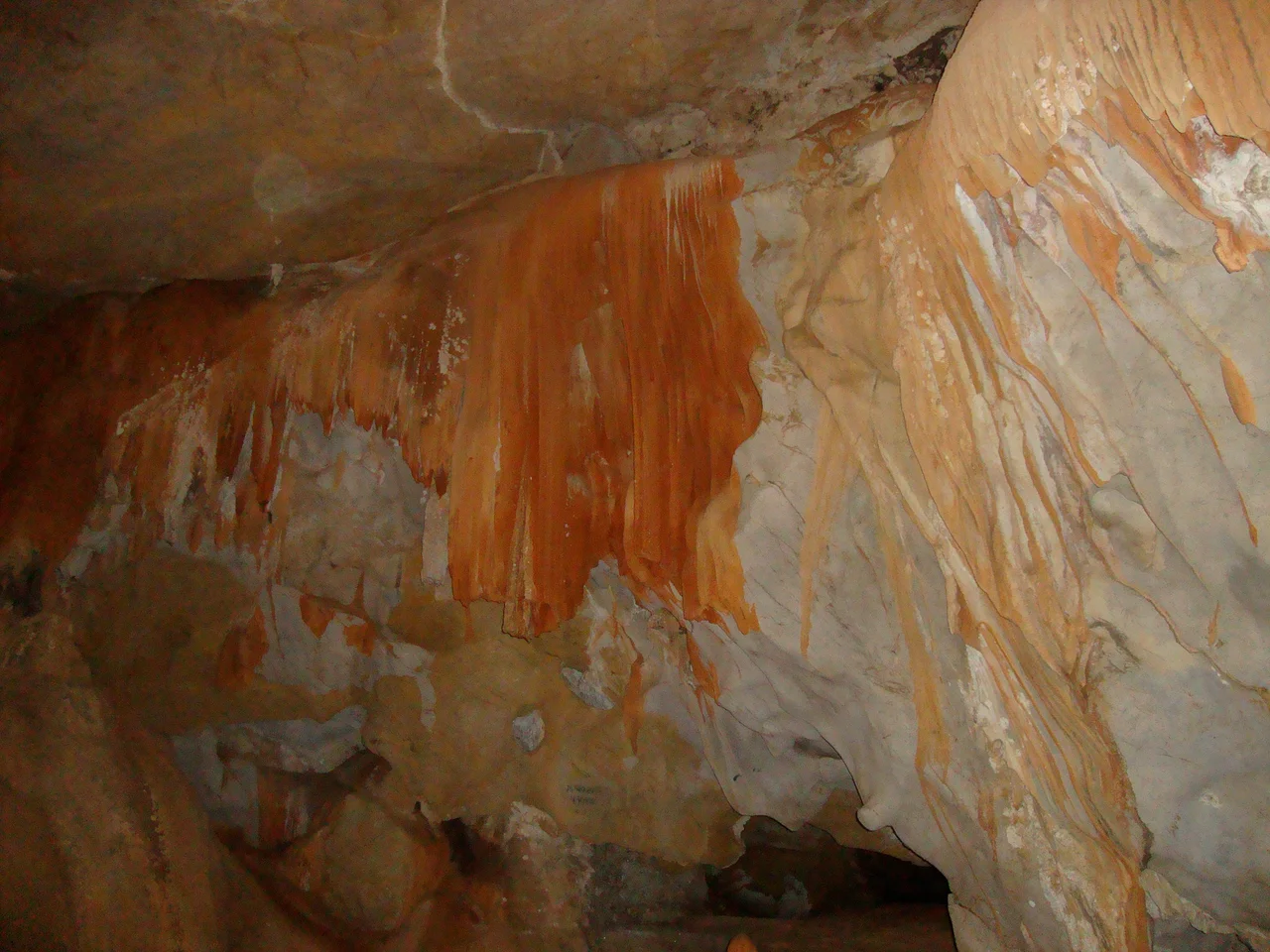
Into the Grotto
The grotto is what draws almost everyone. A hidden cave begins behind a waterfall and unfolds 500 metres into the mountain in a chain of nine chambers, each with its own character and its own old Portuguese name. The Pedra do Sino, the 'Stone Bell,' reverberates with the impact of water outside. The Gruta de Rosa blooms with formations the color of old roses. The Gruta do Cavalo holds a rock that visitors have always called the Horse. Dos Retratos - the 'Portrait Gallery' - is the one people photograph: a long corridor of stalactites and stalagmites shaped over millions of years, lit now by discreet electric lamps. The passage is smooth, guided, and surprisingly quiet, the kind of underground silence that makes your ears ring.
Cloud Forest and Cat Country
The plateau forest is a working ecosystem, not a showpiece. Colonies of bats live in the grotto chambers. Monkeys move through the canopy; tapirs, capybaras, anteaters, and deer use the streamside trails. The big cats are here too - pumas patrol the more remote draws - but the wildcat visitors are likeliest to hear about is the oncilla, a small spotted feline that looks like a short, lean leopard. The oncilla is classed as vulnerable and common across northeastern Brazil; you are unlikely to see one, but tracks in the mud tell you the forest still works as it should. Iguanas are the easy reptile sighting, lounging on trailside rocks in the sun. For birdwatchers there are more subtle rewards: the hooded gnateater, the threatened buff-breasted tody-tyrant, and the broad-tipped hermit, a hummingbird that darts through the cloud-forest canopy.
Waterfalls for the Ambitious
The park has at least three waterfalls over 70 metres high, and one - Gavião - drops almost 100. The easiest to reach is the Cafundó, a 90-metre fall at the end of the Samambaia trail, a three-kilometre walk each way that passes the Gameleira Viewpoint and the Fern Garden. The pools at the base of these falls are cold, clear, and exactly as refreshing as you want them to be after a humid morning on the trail. For the more ambitious, the seven-kilometre Ubajara Araticum trail climbs or descends the full escarpment, in place of the cable car. Guides accompany all hikers; they depart the park entrance at 8, 9, and 10 in the morning. Allow three hours, take water, and expect the last kilometre to feel longer than its distance on the map.
Getting There
The park is not quite remote, but it takes some effort. The nearest city with commercial flights is Fortaleza, about seven hours away by road. From Fortaleza, the Viação Princesa bus company runs frequent service - roughly every thirty minutes - to São Benedito, a trip of about six and three-quarter hours. From there it is another 20 kilometres to the town of Ubajara, where you will find lodging, restaurants, and guides. The park itself has no stores, snack bars, or restaurants, so bring water and something to eat. Weather almost never interferes: temperatures run between 19 and 28 Celsius year-round, and the park sits too far south for Atlantic hurricanes.
From the Air
Ubajara National Park is at 3.77°S, 40.90°W in the Serra da Ibiapaba of western Ceará. The 820-metre escarpment is the main visual landmark from altitude, standing above the flat Caatinga to the west. Fortaleza's Pinto Martins International Airport (SBFZ / FOR), roughly 320 km east-northeast, is the standard arrival point. Conditions are reliably warm and dry; morning cloud often wraps the escarpment, lifting by mid-day. Cruising flights passing over northeastern Brazil can pick out the cliff edge as a sharp line in the otherwise uniform plateau.
Nearby Stories
- Serra da Ibiapaba Environmental Protection Area 48 km away
- Parnaíba 75 km away
- Jericoacoara Beach 94 km away
- Emboaca 129 km away
- Guajiru 145 km away
- Ceará 180 km away
- Teresina 188 km away