Guajiru
Radiocarbon dates from the sand around Guajiru reach back to 3460 BCE. Before the wind turbines arrived in the 2010s, the crews clearing dune tops for foundations kept stumbling across the evidence: prehistoric weapons, fishing tools, layers of ash from fires that people had kindled on this stretch of Ceara coast more than five thousand years ago. The village today holds 958 people. Almost 700 of them identify as pardo, Brazil's category for mixed ancestry, and many of them still make their living from the same Atlantic that fed the first people to camp on these dunes.
A Name That Points to a Tree
Guajiru is a Tupi word. It refers to a coco plum, a low-growing coastal shrub with small purple fruit that thrives in sandy soil and tolerates salt wind. The plant grows in abundance around the village, which is why the indigenous peoples who named the place chose that specific word. It is one of thousands of Tupi place-names that survive in Brazilian Portuguese, a reminder that the language map of the country was written in multiple hands before the current one became dominant. The Tremembe, the indigenous group whose territory historically stretched along the coastline between the Trairi and Mundau river estuaries, knew this part of the coast intimately, and they called the beach Flecheirinha, little arrow place, a diminutive of the nearby beach that still carries the longer form.
Retreat to the Dunes
When the Dutch pushed along the Ceara coast during their 17th-century incursions, the Tremembe made a decision that shaped generations: they moved inland. They withdrew from the beaches themselves and established settlements back in the dunes, Curimas among them, a few kilometers from Guajiru. They kept coming back to the coast to fish, using the old beach as work rather than residence. The village of Guajiru as it exists today was permanently resettled only toward the end of the 19th century and the beginning of the 20th. Until that resettlement, the coast was a place you went to for the day; the dunes were where you slept. Modern Guajiru residents still carry family ties to Curimas. Many of them own land in the strip between the two places, and the first road connecting the two was only built in 2021.
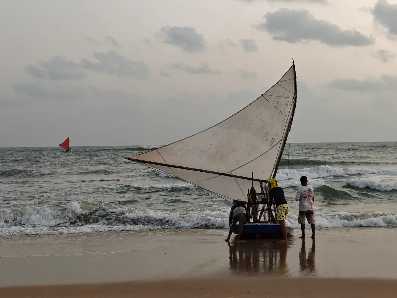
Jangadas at Dawn
Fishing is the economy of Guajiru. In 2009, 40 percent of the population depended directly on fishing for income, and 90 percent depended on it indirectly. The craft used is the jangada, a traditional wooden sailing raft that has defined the northeastern Brazilian coast for centuries: a small platform lashed over a few logs, a triangular sail, a crew of two or three. Jangadas leave before sunrise and come back loaded with whatever the night produced. Visitors staying nearby sometimes wake early just to watch a raft lean against the horizon and slide back toward shore on a breeze that has not yet strengthened. Every August, the village celebrates Our Lady of Navigators, the patron saint of fishermen, with a nine-day novena built around a chapel the community constructed itself in 1975.
The Chapel They Built Together
The chapel of Our Lady of Navigators is a small building, but it is a local institution. When Father Tomas and a neighbor called Zezeca proposed its construction in 1975, everyone in the community helped gather materials and raise the walls. It was refurbished dramatically between 2018 and 2021. Most Guajiru residents remain Catholic, but evangelical Christianity is growing here as it is across rural Brazil, a slow demographic shift that is reshaping weekend worship patterns in villages that were once unanimously Catholic. The chapel still anchors the August festival. Fishermen place models of their jangadas at the altar, a gesture that asks the patron saint to protect a way of making a living that has not changed fundamentally in a long time.
Winds, Tourists, and the Future of Small Places
Guajiru has something that the kitesurfing economy values highly: the same easterly trade winds that drive the turbines now drive the kites. Strong, stable, and reliable almost year-round, they make the beach an ideal training ground. Small pousadas and schools have arrived. Electricity reached the village only in the 1980s, and the first real road linking it to the outside world came in the 1990s. The changes that transformed Jericoacoara further along the coast are starting here more gently, and so far Guajiru has retained the scale that makes it feel like a village rather than a resort. The test for small coastal places is always whether the benefits of visitation reach the people whose ancestors fished these waters, or whether new arrivals simply replace them. In Guajiru, that question is still being answered.
From the Air
Guajiru sits at 3.24 degrees south, 39.24 degrees west on the coast of Ceara, Brazil, about 130 kilometers west of Fortaleza in the municipality of Trairi. Elevation is essentially sea level, with the surrounding dune fields rising to 30-50 meters. Best viewing altitude is 2,000-4,000 feet above ground for the village, the wind-turbine farm inland, and the jangada fleet on the beach. The nearest major airport is Pinto Martins International (SBFZ / FOR) at Fortaleza, roughly 80 nautical miles east. Constant easterly trade winds year-round with strongest conditions from July through December.
Nearby Stories
- Dragão do Mar Center of Art and Culture 28 km away
- VASP Flight 168 47 km away
- Pedra da Risca do Meio Marine State Park 49 km away
- Jijoca de Jericoacoara 90 km away
- Jericoacoara Beach 102 km away
- German submarine U-164 (1941) 115 km away
- Ubajara National Park 133 km away
- Nadir Crater 2760 km away