Pedra da Risca do Meio Marine State Park
The rock ridges run in parallel lines along the seabed, and the fishermen of Mucuripe named them riscas - stripes. Eighteen and a half kilometers northeast of the port, they drop into 16 meters of warm water that rarely falls below 27°C. Somewhere on the sand among them lies the broken fuselage of a Bandeirante twin-turboprop, now counted as an artificial reef and an item of underwater archaeological heritage. It is the only marine conservation unit in the state of Ceará.
Why the Park Exists
Before 1997, the reef had a different reputation: it was fished hard, and the numbers showed it. Fish populations declined. Lobster catches thinned. The decline sat uncomfortably alongside Ceará's tourism brand of pristine beaches and vibrant reefs. Government agencies and NGOs together pushed for protection, and on 5 September 1997 state law 12717 created the Pedra da Risca do Meio Marine State Park - 3,320 hectares of seabed with four stated missions: protect breeding grounds, rescue artisanal fishing, support research, and promote underwater tourism.
The Stripes Below
The riscas themselves are linear calcareous and rocky outcrops, typical of Ceará's near-shore geology, rising a meter or so above the sand. Diving the park means following these ridges and the gravel channels between them. Visibility runs from 15 meters on a good day to considerably less when swell stirs the bottom. The rocky formations host benthic communities - encrusting sponges, corals, sea fans - that attract every link of the food chain that depends on them.
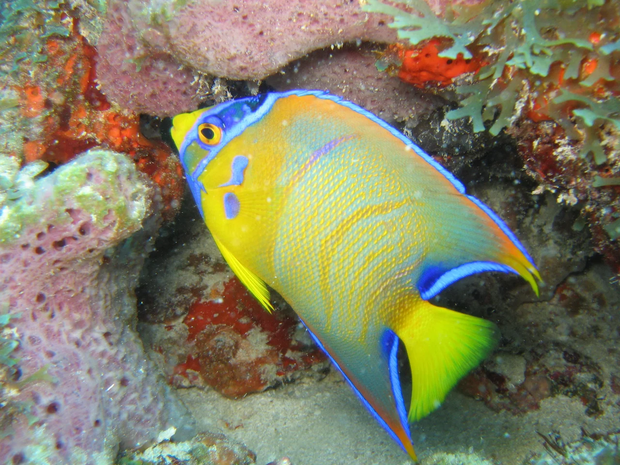
Life at 16 Meters
Researchers have identified 116 species of fish in the park, including six elasmobranchs - rays and small sharks. Common bottlenose dolphins pass through regularly. Three species of sea turtles have been recorded. A 2006 survey of sponges turned up something unexpected: Sigmaxinella cearense, an endemic species found nowhere else, and the genus Sigmaxinella was previously known only from the Pacific. Its presence here rewrites a small chapter of biogeography and hints at how much remains to be catalogued on these reefs.
Artisan Rules
The park permits line-and-hook fishing by artisan fishers and sport anglers. It also allows scientific collection and diving with prior authorization. What it bans matters more: trawl nets, spearguns, the capture of ornamental fish for the aquarium trade, and the dumping of any waste. The threats are persistent. Local artisan fishers report clandestine boats - many from other Brazilian states - arriving to strip the reef of ornamentals and sweep it with nets. The park's small scale and distance from shore make enforcement difficult. Its survival depends, as it has from the beginning, on the people who fish it legitimately and ask for the rules to be kept.
From the Air
Coordinates 3.60°S, 38.41°W. The park sits about 18.5 km offshore at a bearing of 60° from the Port of Mucuripe in Fortaleza (ICAO SBFZ). Passing the coast at altitude in clear conditions, the park shows as subtly different water color above the reef; the Bandeirante wreck is 16+ meters down and invisible from above. Fortaleza's international airport handles the full range of domestic and international traffic. Dive operators run 50-minute boat transfers from Mucuripe. Best conditions October through January, calmest seas outside the rainy season.
Nearby Stories
- Maracanaú 14 km away
- Guajiru 26 km away
- Prainha do Canto Verde Extractive Reserve 48 km away
- Emboaca 54 km away
- Canoa Quebrada 107 km away
- Ceará 151 km away
- German submarine U-164 (1941) 181 km away
- Nadir Crater 2713 km away