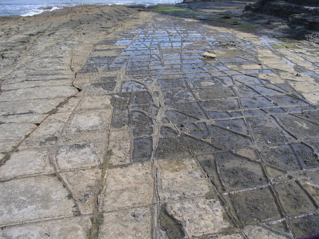

Tessellated Pavement
At first glance it looks paved. A broad shelf of grey rock runs down to the sea at Pirates Bay, divided into neat rectangular blocks like the floor of some drowned cathedral. The Tessellated Pavement at Eaglehawk Neck is so regular, so deliberate-looking, that visitors have long struggled to believe nature made it without help. But no mason laid these tiles. The pattern is the work of stress, salt, and the sea, acting on stone laid down before the dinosaurs, and it produces one of the most photographed natural surfaces in all of Tasmania.
Cracks Older Than the Dinosaurs
The story begins around 260 to 290 million years ago, in the Permian period, when fine-grained siltstone settled in layers on an ancient sea floor. Over the eons that followed, the Earth flexed and the rock was put under enormous stress. Rather than shattering randomly, it fractured along clean, intersecting lines, a process geologists call jointing. Those joints form the grid you see today. The same phenomenon produces the polygonal columns of places like the Giant's Causeway, but here the result is rectangular rather than hexagonal, a tiled floor rather than a honeycomb. The pavement is, in effect, a map of the hidden tensions inside the rock, drawn in straight lines and exposed at last by the retreating tide.
Pans and Loaves
Look closer and you will notice the tiles are not all shaped the same way, and the reason is the sea. Geologists describe two formations here. The pan formation appears farther from the shore, where the rock dries out more fully between tides. Salt crystals grow in the centre of each block and slowly eat it away, leaving shallow, dish-like hollows: the pans. Closer to the water, the loaf formation does the opposite. These tiles stay wet longer, so less salt collects on top. Instead, sand-laden water scours along the joints, cutting the grooves deeper while the centres remain proud, leaving raised, rounded humps that genuinely resemble loaves of bread set out in rows. One pattern, two opposite sculptors, separated by nothing more than how long the tide lingers.
A Form Found Around the World
Tessellated pavements are rarer than they sound, and geologists recognise several distinct ways they can form. Some are born of cooling lava that contracts into columns, some of drying mud that cracks and is later filled and turned to stone, and some, like this one, of solid bedrock fractured along its joints. Similar surfaces appear in the Hawkesbury sandstone around Sydney, at archaeological sites in the sandstone of Queensland, and as far away as the Cretaceous rocks near Boulder, Colorado. Yet the Eaglehawk Neck pavement remains the textbook example, the one that appears in geology references when the term needs a picture. Part of that fame is the setting. Few of its rivals sit on a wild ocean shore beneath the cliffs of a convict peninsula, where the science of deep time happens to be spectacularly photogenic. Visitors have walked down to wonder at it since the 19th century, when it sat almost within sight of the prison settlements, an accident of geology beside an accident of history.
Best Seen at the Edges of the Day
Timing is everything here. At high tide the pavement vanishes beneath the swell, just another stretch of restless water. At low tide it emerges fully, the grid running out toward the breakers, often with shallow water still pooled in the pans to mirror the sky. Photographers favour sunrise and sunset, when low light rakes across the surface and throws every joint and ridge into sharp relief, turning a flat grey shelf into a field of glowing geometry. Check a tide chart before you go, because the difference between a memorable visit and an empty one is measured in hours of the moon's pull. It is an easy walk down from the road near Lufra, and an oddly humbling one. You are standing on a sheet of rock older than almost anything alive, reading the strain it carried written plainly underfoot, while the sea that revealed the pattern keeps slowly working to erase it.
From the Air
The Tessellated Pavement sits at roughly 43.01 degrees S, 147.93 degrees E, on the northern shore of Pirates Bay just north of the Eaglehawk Neck isthmus on the Tasman Peninsula, about 50 km south-east of Hobart. From the air, find the long sweep of Pirates Bay on the eastern side of the peninsula; the pavement lies at its northern end below the coastal road, exposed at low water and submerged at high tide. The nearest major airport is Hobart International (ICAO YMHB), about 45 km north-west; light aircraft use Cambridge Aerodrome (YCBG). The site reads best on the ground at low tide near dawn or dusk; from altitude the bay and the cliffs to the south are the key visual markers.
Nearby Stories
- Cascade Brewery 9.2 km away
- Bruny Island 14 km away
- Maria Island 23 km away
- Mount Field National Park 59 km away
- Snowy River 547 km away
- Bundian Way 668 km away
- 2003 Fiordland Earthquake 1492 km away
- Doubtful Sound 1541 km away