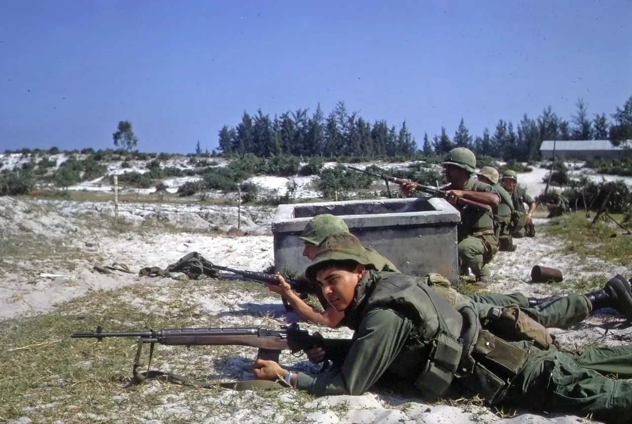

Tet Offensive attacks on Da Nang
The Vietnamese Lunar New Year, Tết Nguyên Đán, was supposed to bring a ceasefire. Both sides had agreed to observe a truce; soldiers on leave had traveled home to be with their families. Then, in the early hours of 30 January 1968, coordinated attacks erupted across more than a hundred cities and military installations in South Vietnam. In Da Nang — the second-largest city in South Vietnam and the hub of American military operations throughout I Corps — North Vietnamese planners had been preparing since October 1967. The attacks that struck the city between 29 January and 11 February 1968 were ultimately repulsed, but the assumption behind the Tet Offensive was itself the damage: the war that American officials had declared was going well was not going well. Da Nang's defenders held their lines. The political ground shifted anyway.
A City Built for War
By January 1968, Da Nang had become one of the largest military installations in Southeast Asia. Da Nang Air Base was a major hub for offensive air operations across South Vietnam. Naval Support Activity Danang operated logistics facilities on the Tiên Sa peninsula east of the city. Marble Mountain Air Facility supported Marine helicopter operations across southern I Corps. III Marine Amphibious Force had its headquarters at Hill 327, west of the air base. The city's military infrastructure was layered and redundant — the product of years of buildup. But it was also thinly spread. With the 5th Marine Regiment redeployed north to support operations elsewhere in I Corps, and the 2nd Battalion, 5th Marines gone to Phu Bai Combat Base in mid-January, Colonel Ross R. Miner's 7th Marine Regiment was responsible for the northern, western, and southwestern sectors of an enormous tactical area of responsibility. His three battalions covered it; then they were asked to cover more.
The Night of 29–30 January
The attacks on Da Nang began on the night of 29–30 January. PAVN and Viet Cong forces struck the city and its military installations, including the I Corps headquarters at Hòa Vang. North Vietnamese commanders had been frank in their own after-action accounts about what went wrong on their side: preparations had been cursory, the movement of forces forward had not been well organized, and Allied defenders were too numerous and responded too fiercely for the attackers to seize their assigned objectives. This was not the narrative that played out on American television screens, where the sight of simultaneous attacks across a hundred targets overwhelmed the question of tactical outcome. In Da Nang itself, Major General Donn J. Robertson, commanding the 1st Marine Division, held direct control of two battalions positioned between the Cầu Đỏ and Thanh Quýt Rivers — the last line of defense before the city's vital core.
The Fight at Hòa Vang
At the I Corps headquarters in Hòa Vang, the fighting was sharp. The VC attacked the headquarters and the surrounding village. A Marine military police platoon was part of the defense; Lieutenant Manning was among the two Marines killed in the action, along with six others wounded from the 1st MP Battalion. Elsewhere in the sector, Allied losses in the initial fighting totaled nine dead and several wounded. Marine fixed-wing aircraft and helicopter gunships struck the Viet Cong positions in Hòa Vang. The VC resistance broke. In the initial fighting for Hòa Vang, defenders accounted for 25 enemy dead; in the subsequent pursuit — which became a rout — nearly 100 more were killed as they withdrew. Robertson had prepared for exactly this kind of counterattack, and his 120-plus artillery pieces, ranging from 4.2-inch mortars to 175mm guns, gave him the firepower to exploit the collapse.
The Shape of the Tet Offensive
The attacks on Da Nang ran until 11 February 1968. Across that period, the combined American, South Vietnamese, and Republic of Korea Marine Corps forces repulsed every major assault. The PAVN and Viet Cong suffered heavy losses across the Da Nang tactical area of responsibility. By the purely military measure of who held what ground at the end of the fighting, the offensive at Da Nang was a failure for the attackers. But the Tet Offensive was not designed to win militarily — it was designed to demonstrate that the war was not winding down, that the Viet Cong could strike anywhere, that the optimistic assessments coming from American commanders were disconnected from reality. On that measure, the attacks on Da Nang, like the simultaneous assaults on Saigon and Huế and dozens of other cities, landed exactly as intended.
Da Nang After Tet
The city endured. Da Nang today is a modern coastal metropolis, rebuilt and expanding, its wartime geography softened by decades of development. The air base that was the operational center of American military power in I Corps is now Da Nang International Airport, one of the busiest airports in Vietnam. Marble Mountain — the distinctive cluster of limestone outcroppings south of the city — is a tourist attraction. Hill 327, where III MAF had its headquarters, is forested hillside. The Han River Bridge spans the river the Marines once watched from defensive positions. What the Tet Offensive attacks of January and February 1968 meant to the people who lived through them — both the soldiers and the civilians who shared the city during the fighting — is woven into the fabric of a place that has been rebuilt many times, over many centuries, and is still in the process of becoming itself.
From the Air
Da Nang lies at 15.85°N, 108.20°E on the central Vietnamese coast, anchored by the Han River estuary. Da Nang International Airport (VVDN/DAD) occupies the site of the former Da Nang Air Base on the western edge of the city. The Marble Mountains — five prominent limestone hills — are a distinctive landmark 8–10 km south of the airport. Tiên Sa Peninsula, where Naval Support Activity Danang operated, is visible to the east. Hill 327, former headquarters of III Marine Amphibious Force, rises to the west of the airport. Bà Nà Hills, at 1,500 meters, is visible on clear days approximately 42 km to the west-southwest. The approach from the north over Da Nang Bay gives the clearest overview of the city's geography: the arc of the bay, the Han River, and the broad coastal plain spreading south toward Hội An.
Nearby Stories
- Hải Vân Tunnel 1.7 km away
- Chàm Islands 7.1 km away
- War of the Flags 12 km away
- Chu Lai Air Base 28 km away
- Tomb of Tự Đức 29 km away
- A Sầu Valley 55 km away
- Dong Ampham National Biodiversity Conservation Area 62 km away
- Battle of the Paracel Islands 322 km away