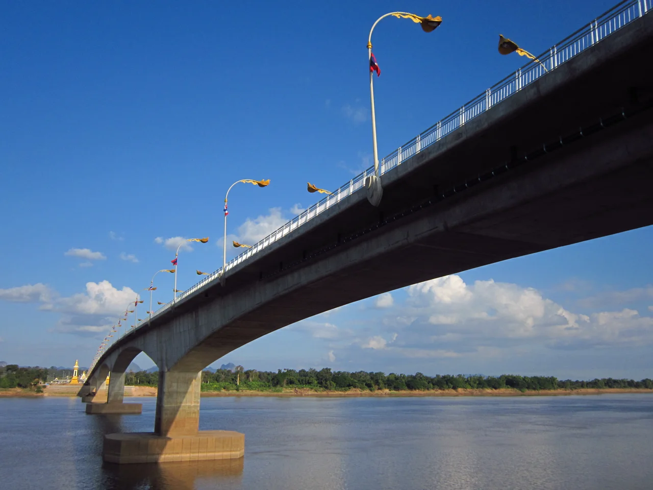

Third Thai–Lao Friendship Bridge
The ribbon was cut at 11:11 in the morning on 11 November 2011. Somebody in the Thai Department of Highways had clearly enjoyed the arithmetic, and the schedule was arranged to land on it: 11:11, 11/11/11. Princess Maha Chakri Sirindhorn, who had laid the foundation stone thirty-two months earlier, presided alongside Bounnhang Vorachit, then vice president of Laos. Below the platform ran the Mekong, brown and wide and — until that morning — a river you could only cross here by boat.
Nine Hundred Days
The foundation stone went down on Friday 6 March 2009 at Ban Hom, in At Samat sub-district of Mueang Nakhon Phanom, and construction proper began that May. The contract ran 900 days. Italian-Thai Development built it under the supervision of the Bureau of Bridge Construction, and the Thai government paid the entire bill — 1,723 million baht — for a bridge whose far end lands in another country, at Ban Vern Tai on the Thakhek side. The result is a prestressed concrete box girder 1,423 metres long and 13 metres wide, carrying two lanes of traffic and no railway. It is not a dramatic structure. It is a long, low, deliberately plain piece of engineering, and it does exactly what it was paid to do.
The Bridge That Changed Its Number
There is a small confusion in the paperwork worth knowing about. For years, the name "Third Thai–Lao Friendship Bridge" was attached to a completely different crossing — a planned span far to the northwest, from Chiang Khong in Thailand to Houayxay in Laos. That project slipped, this one overtook it, and the northwestern bridge is now the Fourth. Anyone reading pre-2010 documents about the third bridge may well be reading about a different river bend altogether, several hundred kilometres upstream. The Mekong now carries a numbered series of these Friendship Bridges, and the numbers reflect the order of completion rather than any plan drawn up in advance.
Where the Traffic Swaps Hands
Here is the genuinely strange part. Thailand drives on the left. Laos drives on the right. A bridge between them has to resolve that, and this one does it by keeping Thai practice all the way across: vehicles run on the left for the full 1,423 metres, and the changeover happens on the Lao side, past the far abutment. Drivers therefore spend a minute or two on Lao soil still driving on the wrong side for the country they are in, until the road formally swaps them. You cannot walk it. Pedestrians are not permitted, so crossing means the international shuttle bus, which runs between the Nakhon Phanom and Thakhek bus stations roughly eight times a day from 08:00 to 17:30, and which wants Thai baht — not kip, not dollars. Budget around an hour and a half for immigration and customs at both ends.
What It Was Built to Carry
The bridge was never really about Nakhon Phanom and Thakhek, two provincial towns that had faced each other across the water for a very long time. It was about the line drawn through them. The span carries Thai Highway 295 and forms part of Asian Highway 15, joining the Thai road network to Lao Route 13 and, beyond it, to the passes east into Vietnam and the ports on the South China Sea. Thailand built it as a trade corridor toward Vietnam and southern China, timed for the ASEAN Economic Community of 2015. The stated aim was to cut travel and cargo-delivery times between the two countries and lift both trade and tourism. For the towns themselves, the change is more ordinary and harder to put in a ministry document: the other side stopped being a view and became somewhere you can simply go.
From the Air
The bridge crosses the Mekong at 17.4925°N, 104.7283°E, about 10 km north of Thakhek town and a similar distance north of Nakhon Phanom. From the air it is unmistakable — a pale, dead-straight 1,423-metre line across a broad brown river that curves everywhere else, with customs compounds and truck parks anchoring each end. Nakhon Phanom Airport (KOP / VTUW) lies roughly 12 km southwest on the Thai bank; Thakhek Airport (THK / VLTK) is on the Lao side. Best viewed between 1,500 and 3,000 ft AGL, ideally in the hours after sunrise when low sun rakes across the deck and throws the pier shadows onto the water. Remember that the international border runs down the river itself: the bridge is literally the line, and Lao airspace begins mid-span. In the wet season, from May to September, the Mekong here runs high, fast and heavily silted, and the sandbars that define the channel in March vanish completely.
Nearby Stories
- Renu Nakhon District 21 km away
- Khammouane Province 23 km away
- Tham Kong Lo 29 km away
- Arem language 53 km away
- Ban Chiang 75 km away
- National Route 9 (Vietnam) 87 km away
- Vientiane 153 km away
- Si Thep Historical Park 367 km away