
Khammouane Province
In 1996 the biologist Robert Timmins was walking through a market in Thakhek when something on a meat stall stopped him: a dead rodent with long whiskers and a heavy, drooping tail, of no species he recognised. It was formally described in 2005, and within a year palaeontologists had reassigned it to Diatomyidae - a family known only from fossils and assumed to have gone extinct around eleven million years ago. One of them called it the coelacanth of rodents. The people selling it had known about it for generations and had a perfectly good name for it: kha-nyou. That is Khammouane in one anecdote. The province keeps things, quietly, in rock nobody has finished looking inside.
Sixteen Thousand Square Kilometres of Limestone
Khammouane covers 16,315 square kilometres of central Laos, wedged between Bolikhamsai to the north, Savannakhet to the south, Thailand across the Mekong to the west and Vietnam over the Annamite crest to the east. Most of it is forested mountain. Between the river and the range lies the Khammouane Plateau, a landscape of gorges, grottoes, jungle and limestone towers where the Xe Bang Fai runs 239 kilometres, the Nam Hinboun cuts through the hills, and the Nam Theun drains the high plateau to the north. Just under 400,000 people live here, by the 2015 census, and the province scores 0.602 on the human development index against a national figure of 0.620. Khammouane is not poor by Lao standards so much as it is steep, wet, and difficult to build a road through.
Seven Kilometres in the Dark
At Ban Khonglor, about 130 kilometres north of Thakhek, the Nam Hin Bun river does not go around the mountain. It goes through it. Tham Kong Lo carries the river for roughly seven and a half kilometres beneath Phu Hin Bun, through chambers reaching 90 metres wide and 100 metres high - a cathedral scale that only reveals itself in the sweep of a boat's headlamp. Partway in there is a pool of startling emerald water that villagers hold sacred, saying it shows the colour of the god Indra's skin. In 1920 five volunteers rowed the whole passage by torchlight, and the villages at either end suddenly had a route between them. A century later you emerge blinking at Ban Natan, in Nakai district, with rice fields where the darkness stops.
The Caves Became a World Heritage Site
The eastern edge of the province is Hin Nam No, declared a national park by prime ministerial decree in January 2020 and inscribed on the UNESCO World Heritage List in 2025 as an extension of Vietnam's Phong Nha-Kẻ Bàng, which lies directly across the border. Together they form one of the largest protected karst regions on earth. Forest covers more than three-quarters of the park - home to 1,520 species of vascular plant, 536 vertebrates, seven species of diurnal primate all of conservation concern, along with the sooty babbler, François' langur and the giant muntjac. Beneath it runs the Xe Bang Fai River Cave, thought to be among the largest river caves in the world: a subterranean channel some seven kilometres long, with passages reaching 200 metres wide and 120 metres tall. A river the size of a highway, in the dark, with no one watching.
The River They Moved
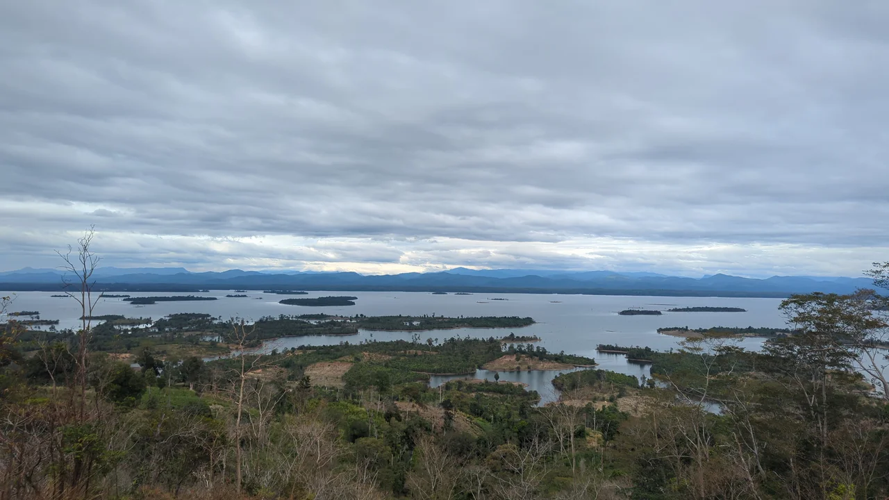
Nam Theun 2 is the largest hydropower project in Laos and one of the most closely watched dams ever built. Commissioned in April 2010 at a cost of around US$1.3 billion, its 1,075 megawatts are generated by taking water off the Nam Theun, dropping it 350 metres through the mountain, and releasing it into a different river system entirely, the Xe Bang Fai. Nearly all the electricity is sold to Thailand. Filling the reservoir flooded 450 square kilometres of the Nakai Plateau, and 6,300 people from seventeen villages had to leave land their families had farmed and hunted for generations; new villages were built for them, and their incomes were meant to double by 2012. The project marked the World Bank's return to funding large infrastructure after a decade away, which is why so many observers came to check the arithmetic. Their verdicts on how well the promises were kept remain sharply divided.
Thakhek and the Railway That Wasn't
The provincial capital sits on the Mekong looking straight at Nakhon Phanom in Thailand, its centre still lined with French colonial villas, shophouses and administrative buildings going gently chalky in the heat. In the Lan Xang era the town went by Sikhottabong, Muang Kabong and Lakhon; That Sikhottabong, the 29-metre stupa on the riverbank with a pinnacle shaped like a banana flower, still carries the oldest of those names. The colonial period left a stranger mark: by 1943, 85 percent of Thakhek's residents were Vietnamese, brought in under French policy. The French also began cutting a railway east through the Mụ Giạ Pass toward Tân Ấp in Vietnam, gave up on it in 1950, and left the idea lying around for seventy-five years - until a concession was finally signed in March 2026 for the first 147 kilometres. Meanwhile the caves do the earning. Khammouane hosted over 800,000 visitors in 2024, worth more than US$46 million.
From the Air
Khammouane centres near 17.50°N, 105.33°E, spanning the Mekong at Thakhek eastward to the Vietnamese border. The province reads clearly from altitude: the Mekong on the west, then a band of paddy and plateau, then abrupt grey karst towers and forested limestone escarpments rising toward the Annamite crest. The 450 km² Nakai reservoir behind Nam Theun 2 is a prominent inland water body in the northeast. Nearest airfields are Nakhon Phanom, Thailand (VTUW/KOP) directly across the river from Thakhek, Savannakhet (VLSK/ZVK) to the south, and Đồng Hới, Vietnam (VVDH/VDH) beyond the mountains to the east. Karst terrain and ridgelines demand at least 6,000 ft AGL over the eastern half. Dry-season haze is common from February to April; the May-October monsoon brings heavy rain and low cloud clinging to the limestone.
Nearby Stories
- Third Thai–Lao Friendship Bridge 4 km away
- Hin Namno National Park 13 km away
- Renu Nakhon District 21 km away
- Tham Kong Lo 23 km away
- Nakai-Nam Theun National Park 25 km away
- Tân Ấp station 31 km away
- Grès supérieurs Formation 32 km away
- Xe Bang Fai River 66 km away