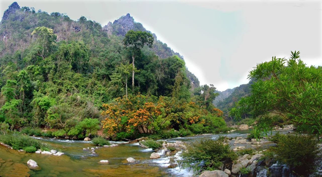

Xe Bang Fai River
For seven kilometres, the Xe Bang Fai has a roof. Somewhere in the limestone of Khammouane province the river stops being a river in the open air and becomes something else entirely, sliding into a mountain through an entrance arch sixty metres high and travelling in the dark beneath a ceiling that in places lifts 120 metres above the water. The Lao call the passage Tham Khoun Xe. It is reckoned to be one of the largest river caves in the world, and the odd thing about that claim is how recently anybody outside the immediate valley was in a position to test it.
The Dimensions of the Dark
Numbers do more work than adjectives here. The subterranean channel runs about seven kilometres. Passages average roughly 76 metres across and widen to 200 at the extreme; the average ceiling height is about 53 metres and the tallest chambers reach 120. The water itself is comparatively shallow, four to twelve metres, which is what makes the place navigable by paddle. Stalagmites stand more than twenty metres tall. Cave pearls, those improbable polished spheres that form where dripping water keeps a grain of sediment turning in a hollow, have been measured here at 32 centimetres across. At the downstream end the limestone opens into an amphitheatre over 150 metres high.
Who Knew It First
Lao villagers had been going into the cave mouth for generations before anyone drew a map of it, fishing the entrance reaches and harvesting birds' nests from the walls. The first European survey came in 1904, followed the next year by a second attempt led by the French explorer Paul Macey, who went in on bamboo rafts. Then the record simply stops. For roughly ninety years no one appears to have pushed the passage again, and the area stayed closed to outsiders. Not until 2005 and 2006 did access reopen, and it was kayakers, French and North American, who brought back the first modern accounts. Two centuries of European mapping in Indochina, and one of the planet's great caves went unmeasured because the people who already knew about it had no reason to publish.
From the Annamites to the Mekong
The river begins high on the Annamite Range at the Lao-Vietnamese border, around 17 degrees 3 minutes north and 106 degrees 21 minutes east, and runs 239 kilometres west and south through Khammouane and Savannakhet provinces. It is a working river the whole way, its banks lined with the fishing and gardening that a Lao floodplain supports. The finish is unexpectedly grand. The Xe Bang Fai joins the Mekong on the Lao side almost exactly opposite That Phanom, so that the last of its water passes within sight of the most venerated Buddhist stupa on the Thai bank. Thakhek, Khammouane's riverside capital, sits upstream on the Mekong, linked to Thailand since 2011 by the 1,423-metre Third Thai-Lao Friendship Bridge.
The Water That Was Sent Here
Since April 2010 the Xe Bang Fai has carried water that never used to be its own. The Nam Theun 2 hydropower project takes water from the Nam Theun, a separate Mekong tributary, drives it through turbines rated at 1,075 megawatts, and releases it into the Xe Bang Fai down a 27-kilometre artificial channel. Nearly all the electricity, 995 megawatts of it, is sold to Thailand; 75 megawatts stays in Laos. Seventeen villages, some 6,300 people, left the Nakai Plateau for purpose-built settlements when the reservoir filled behind them. Downstream, the counting gets contentious. The project company put the number of affected people along the Xe Bang Fai at 40,000; the campaigning group Environmental Defense argued for as many as 150,000. The gap between those figures is really a disagreement about how far downstream a changed river is still a changed river, and the households in between are the ones living with the answer.
Recognised at Last
The cave lies inside Hin Nam No National Park, 941 square kilometres of limestone declared a national park by prime ministerial decree in January 2020. In 2025 it went further, inscribed on the UNESCO World Heritage list as an extension of Vietnam's Phong Nha-Ke Bang National Park, which had been listed since 2003 and extended once already in 2015. The two parks share a border and, more to the point, the same enormous body of karst. Joined on paper, they form one of the largest protected limestone landscapes anywhere. The Xe Bang Fai simply carried on doing what it had done for a very long time before any of that: draining a mountain range, and going indoors on the way.
From the Air
The Xe Bang Fai reaches the Mekong at 16.946 N, 104.745 E, on the Lao bank directly across from That Phanom in Thailand. Following it upstream takes you east-northeast into Khammouane province; the river rises on the Lao-Vietnamese frontier at roughly 17.05 N, 106.35 E. The great visual event is the karst: from 6,000 to 10,000 ft the limestone towers of Hin Nam No rise abruptly out of forest in a landscape with no visual equivalent in Thailand, and the cave sector shows as a valley where the drainage pattern simply stops. Nakhon Phanom (VTUW) is about 50 km north of the river mouth on the Thai side and Savannakhet (VLSK) about 100 km southeast; Thakhek (VLTK) serves Khammouane. Lao airspace begins at the middle of the Mekong. Fly it in the November-to-March dry season, when the karst is clear of cloud; from June to September the ranges are routinely obscured and the river runs high and brown.
Nearby Stories
- Nakhon Phanom Royal Thai Navy Base 18 km away
- Second Thai–Lao Friendship Bridge 19 km away
- Khammouane Province 38 km away
- National Route 9 (Vietnam) 59 km away
- Nguồn Language 69 km away
- Ban Chiang 83 km away
- Vientiane 189 km away
- Si Thep Historical Park 340 km away