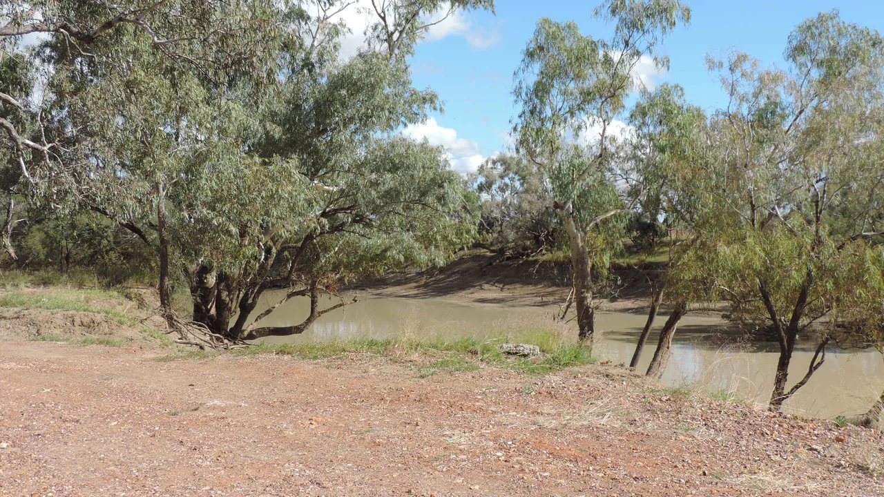

Thomson River (Queensland)
Here is a geographic riddle that sounds like a joke until you check a map. Two rivers meet. What do they form? Almost anywhere on the planet, the answer is a bigger river. But 40 kilometres north of the dusty town of Windorah, the Thomson River runs into the Barcoo, and the two of them together become Cooper Creek. It is, as far as anyone can tell, the only place in the world where the confluence of two rivers makes a creek, and it is pure outback Queensland to demote a thing rather than promote it.
Kuungkari Country
Long before surveyors gave the river an English name, this was Kuungkari country, and the language, also written Kungkari or Koonkerri, belonged to the landscape around what are now the Longreach and Blackall-Tambo shires. The river carries the deep-time memory of the people who knew its waterholes as reliable, life-giving places in a country where reliability is everything. Names matter on a river like this, where for much of the year there is no flowing water at all, only a strung-out line of billabongs holding what the last flood left behind. Fifteen of those billabongs are named. To know which holes keep water through a dry year is, here, a kind of survival knowledge older than any map.
A River That Forgets to Flow
The Thomson begins modestly, draining the Alma Range on the western fall of the Great Dividing Range. Its northernmost headwaters start as Torrens Creek, inland from Charters Towers, and only become the Thomson proper near Muttaburra, where three watercourses braid together. From there it gathers strength the outback way, by collecting tributaries: 41 named ones over its 350-kilometre course. It slides past Longreach, where the Landsborough Highway crosses it, then Stonehenge and Jundah, before the famous meeting with the Barcoo. But to call it a river for most of the year flatters it. The country is so flat that when the Thomson does run, it stops behaving like a river and spreads many kilometres wide, a vast shallow flood creeping across the blacksoil plains rather than rushing between banks.
The Plains It Waters
This is semi-arid blacksoil country, the kind that turns to glue in the wet and to a fractured grey crust in the dry, and the life on it follows the water. Sheep and beef cattle are the mainstays, grazing the plains that the river's floods periodically renew. The Thomson is part of the great Lake Eyre Basin, the inward-draining heart of the continent where rivers run not to the sea but toward the lowest dry salt pan in Australia. So much water flows nowhere, and matters enormously, that the river has long fired the imaginations of engineers. The Bradfield Scheme, a grand and never-realised plan to divert inland-flowing rivers like the Thomson toward drier country, still surfaces in Australian debate whenever drought bites, a reminder that the Thomson's wasted floods have tempted dreamers for the better part of a century.
From the Air
The Thomson River winds through central-west Queensland; its lower reaches and the famed Barcoo confluence lie near 25.17 degrees south, 142.89 degrees east, about 40 km north of Windorah, where the two rivers join to form Cooper Creek. From the air, the river is best read as a braided, billabong-studded watercourse threading flat semi-arid blacksoil plains, often dry and beaded with isolated waterholes, but spreading kilometres wide when in flood. Longreach (YLRE), which the river passes, is the major regional aerodrome and a useful navigation anchor; smaller strips lie at Stonehenge, Jundah, and Windorah (YWDH). Visibility is typically excellent in the dry season with heat haze over the plains; in flood, the shining sheet of water makes the channel system a dramatic and unmistakable landmark.
Nearby Stories
- Cooper Floodplain below Windorah 15 km away
- Tenham (meteorite) 28 km away
- Canterbury, Queensland 52 km away
- Yaraka 66 km away
- Thylungra 67 km away
- Warbreccan 73 km away
- Hell Hole Gorge National Park 80 km away
- Palparara 93 km away