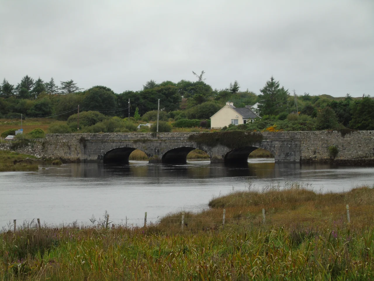

Toombeola
Fr. John Tully was one of the last Dominican brothers serving at Toombeola Abbey when English soldiers came in 1558 or 1559 to drive the order out. He ran. He reached the Owenmore River and swam, the cold water pulling at his robes, the far bank promising escape - and from that bank, soldiers shot him. Locals buried him close to where he fell, but no trace of the grave survives. Today no one knows precisely where Fr. Tully rests. The abbey he served is in ruins. The cemetery around it is still in use, four and a half centuries later, by the descendants of the people who buried him. Eighteen people live in Toombeola townland as of the last census.
Tomb of Beola
The name Toombeola is the anglicisation of Tuaim Beola, meaning 'tomb of Beola' or 'Beola's tumulus'. Beola was an ancient chieftain in the Connemara area, ancient enough that no clear date attaches to him. A tumulus is a burial mound, the kind of structure that pre-Christian Ireland raised over its honoured dead. Whether Beola's actual mound still survives somewhere under the surrounding land or whether the name is older than the landscape's memory of the man it commemorates - this is the kind of question that goes back further than written records can settle. What remains certain is that this place has been associated with a name and a burial for as long as anyone has lived nearby.
The Bridge and the Abbey
The Owenmore River, draining from Ballynahinch Lake to the sea, enters the Atlantic at Toombeola Bridge. The bridge was completed between 1828 and 1831 as part of Alexander Nimmo's massive programme of Connemara road improvements - the same Scottish engineer who laid out the village of Roundstone a few miles southwest. The bridge is a piece of working infrastructure, two centuries old, still carrying traffic across the river that Fr. Tully tried to cross by other means. The local nickname for the area is The Fishery, and the salmon and trout fishing on the Owenmore at Ballynahinch upstream is famous enough to draw anglers from far away. Forty-four miles separate Toombeola from Galway City to the east, four miles from Roundstone to the west, ten miles from Clifden to the northeast.
The O'Flahertys, Dispersed Stones
The abbey at Toombeola was built with the help of a local O'Flaherty chieftain - the same fierce western clan that ruled most of Connemara until the time of King James II of England. The Dominicans occupied it until the late 1550s, when English soldiers attacked and the friars were driven out or killed. After the abbey was abandoned, its stones did not stay where they had been laid. According to local memory, Tadgh na Buile O'Flaherty - 'Tadgh of the Fury' - used stones from the ruined abbey to build a castle on a small island in Ballynahinch Lake. The reuse was practical: dressed stone was expensive and the abbey was no longer functioning. It was also, in its quiet way, the kind of thing that started feuds. A dispute over the ownership of that lake-island castle led, eventually, to a long quarrel between Tadgh na Buile O'Flaherty and his cousin Teige O Flaithbheartaigh. Stones do not forget which buildings they belonged to. People who remember them sometimes do not either.
What Eighteen People Hold
A townland of eighteen people is not a community in the usual sense. It is more like a custodianship - a thin scattering of households keeping watch over the abbey ruins, the cemetery, the bridge, the riverbank where a friar drowned in his own blood at the close of one Ireland and the start of another. The cemetery remains in use. People still bury their dead in the ground that has held Toombeola's dead since the abbey stood whole. The Connemara wind blows through the empty doors of the ruined church. The river runs under Nimmo's bridge. Eighteen people, today, hold the keys to a story this long.
From the Air
Located at 53.43 N, 9.87 W, in west Connemara, County Galway, where the Owenmore River meets the sea between Roundstone (4 mi west) and Clifden (10 mi northeast). Toombeola Bridge crosses the river at this point. The Twelve Bens rise to the north. Nearest airports: Connemara Regional (EICA) at Inverin, about 40 km east; Galway (EICM) further east. Atlantic weather dominates; in clear conditions the abbey ruins and the river course are visible from cruise altitude.
Nearby Stories
- County Galway 3.2 km away
- Uggool Beach 9.7 km away
- Doolin 11 km away
- Aughagower 17 km away
- RMS Carinthia (1925) 17 km away
- Inishmaan 29 km away
- Action of 7 May 1794 92 km away
- Inishtooskert 106 km away