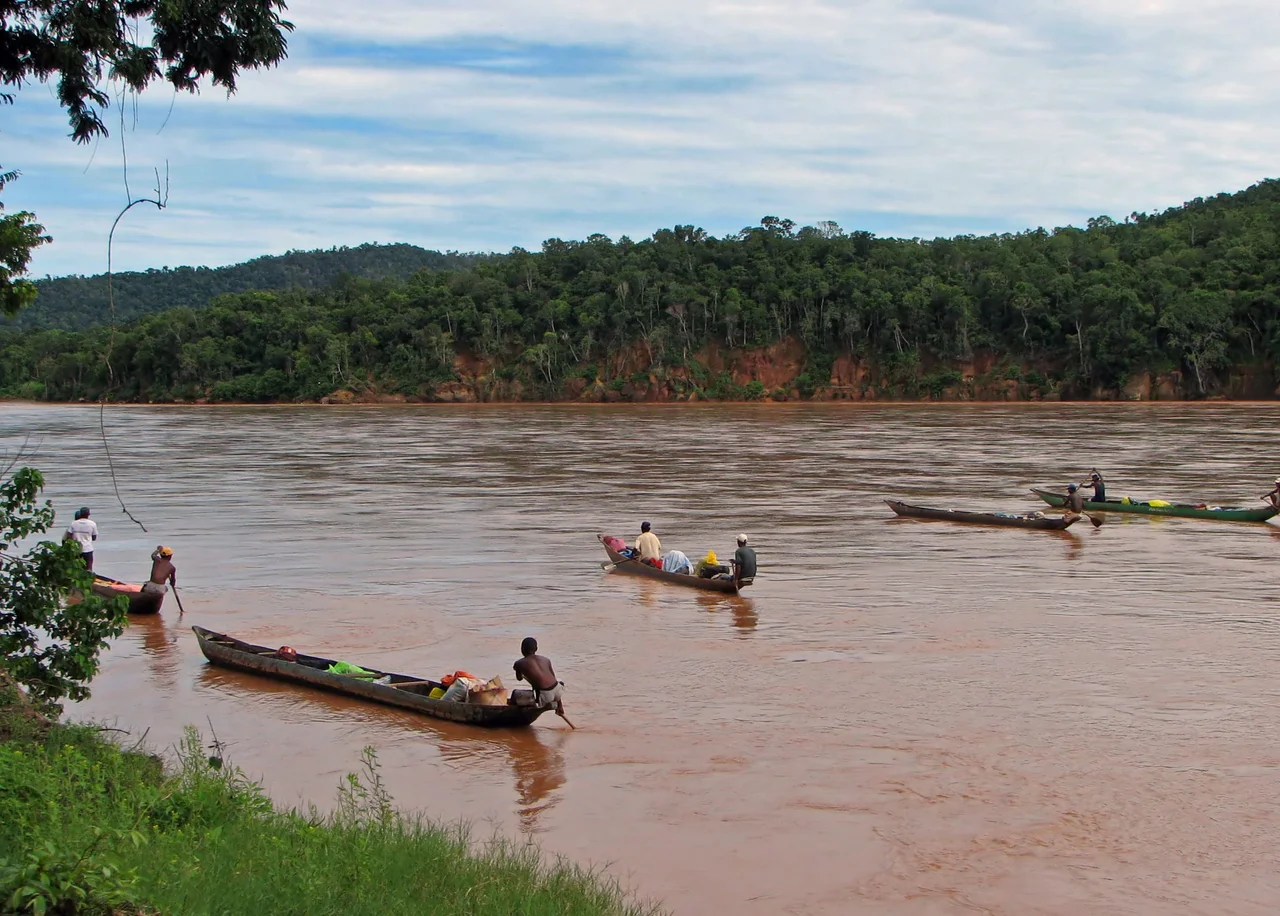

Tsiribihina River
There is no road that does it justice. To truly know the Tsiribihina, you climb into a pirogue - a dugout canoe carved from a single tree - and let the current of western Madagascar carry you west for three days toward the sea. There are no engines if you choose the old way, only the slap of paddles and the silence of cliffs sliding past. By nightfall your boat noses onto a sandbank the size of a field, and you sleep under stars on the river's own shifting floor. This is one of the great slow journeys left on Earth.
The Descent
The trip begins at Miandrivazo, the launching point for the roughly 160-kilometer drift down to Belo sur Tsiribihina. Most travelers take three days, sometimes a half-day more, drifting through landscapes that grow wilder by the hour. You can hire a motorized pirogue and shave off a day - fast, but loud enough to scatter every animal on the bank. The traditional paddled pirogue moves quietly, which is the point: it lets you slip up on the river's residents. Between stretches of water you pass the villages of the Sakalava people, who have farmed and fished this valley for generations and who watch the boats go by as they always have.
Through the Stone Gorge
For much of its length the Tsiribihina meanders lazily across the rich alluvial soils of the Betsiriry Plain, some of the best farmland in western Madagascar. Then the river meets the Bemaraha Plateau - a great wall of limestone running north to south - and cuts straight through it. Here the water narrows into a steep, winding gorge, the canoe threading between rock faces while the current quickens. Waterfalls spill down the cliffs, and natural pools invite a swim in water surprisingly cool. Emerging on the far side, the river exhales, widens, and resumes its unhurried wandering toward the coast.
A River of Birds
The Tsiribihina is one of the richest bird rivers in Madagascar, an island where the birds are like nowhere else on the planet. Eighty-two species have been recorded along the river and its delta, and twenty-two of them exist nowhere outside Madagascar. The critically endangered Madagascar fish eagle - one of the rarest raptors on Earth - keeps a few breeding pairs along these banks. Bernier's teal nests in the mangroves of the delta; Madagascar pratincoles gather on the river's edges in great numbers. Lemurs flit through the gallery forest, chameleons clutch the branches, and crocodiles bask where the channel slows.
Nights on the Sandbank
What people remember most about the Tsiribihina is not a sight but a feeling - the rhythm of camp. Each afternoon the pirogues pull onto one of the immense sandbanks that split the channel, and the crew makes a bivouac on the bare sand. There are no lodges out here, no electricity, no signal. Dinner is cooked over a fire; the guide and the piroguier, often Sakalava, know every bend and every village. After dark the sky over western Madagascar opens into a depth of stars rarely seen in the modern world, and the only sounds are the river and the night birds. A few days of this strips away the noise of ordinary life. It is why travelers come, and why so many never forget it.
Where the River Meets the Sea
The journey ends in a vast mosaic of wetland. The lower Tsiribihina spreads into a delta of channels and mangroves protected within the Menabe Antimena reserve, and the whole delta is recognized as a wetland of international importance under the Ramsar Convention - and as an Important Bird Area by BirdLife International. It is a fitting finale: after the gorge and the villages and the long quiet days, the river loosens into a labyrinth of green where fresh water finally mixes with the Mozambique Channel. From here, most travelers carry on overland to the stone forests of Bemaraha, the river having delivered them to the threshold of one of Madagascar's strangest landscapes.
From the Air
The Tsiribihina runs across western Madagascar near 19.88 degrees S, 44.45 degrees E, flowing west into the Mozambique Channel. From the air, trace its broad, braided, sediment-brown channel and the sandbanks that split it - then watch it knife through the pale limestone of the Bemaraha Plateau before fanning into a green delta at the coast. Morondava Airport (ICAO FMMV) to the southwest is the regional gateway; the dirt airstrip at Belo sur Tsiribihina sits near the river's lower reaches. Best viewing is the April-to-December dry season, when skies are clear and the river runs lower and calmer.
Nearby Stories
- Avenue of the Baobabs 6.9 km away
- Tsingy de Bemaraha National Park 95 km away
- Makay Massif 126 km away
- Velondriake 219 km away
- Lemurs' Park 261 km away
- Mikea Forest 300 km away
- Juan de Nova Island 320 km away