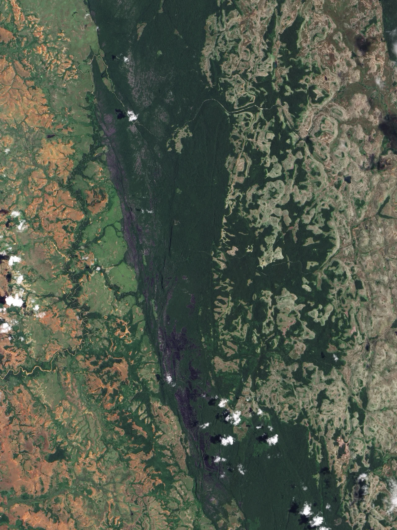

Tsingy de Bemaraha National Park
The Malagasy gave this place a name that doubles as a warning: tsingy, meaning roughly 'where one cannot walk barefoot.' Stand at the edge of the Tsingy de Bemaraha and you understand instantly. Before you stretches a forest made not of trees but of stone - thousands upon thousands of gray limestone needles, some as tall as buildings, their edges honed by rain into blades that can slice through boot leather. It is one of the most alien landscapes on Earth, and it sits in the dry west of Madagascar, an island already famous for looking like nowhere else.
A Forest of Knives
The tsingy began as an ordinary thing: a thick bed of limestone, laid down on a shallow sea floor in the Middle Jurassic some 170 million years ago from the skeletons of corals and marine life. Then water went to work. Rainfall, slightly acidic, attacked the rock from above, carving deep vertical grooves; groundwater hollowed it out from below, gouging caves and fissures. Where the two erosion patterns met, they left behind a labyrinth of pinnacles - the 'Great Tsingy' and the smaller 'Little Tsingy' - separated by chasms and slot canyons. To cross it, visitors clip into via ferrata cables and rope bridges strung across the gaps, inching through a maze that seems designed to keep humans out.
Life Between the Blades
Almost nothing should be able to live here, and yet the tsingy brims with it. The stone forest is so vertical that a single needle holds several worlds: the sun-blasted summit, the shaded slope, the cool damp base each shelter different plants and animals found nowhere else. The star performer is Decken's sifaka, a snow-white lemur that bounds across the gaps between pinnacles like a trapeze artist, somehow landing on razor edges without ever cutting its hands or feet. Eleven to thirteen lemur species share the park. It is this concentration of life clinging to an impossible landscape that earned Tsingy de Bemaraha its inscription as a UNESCO World Heritage Site in 1990.
The River and the Ancestors
Slicing through the park is the Manambolo River, which over the ages has carved a gorge some 300 meters deep, exposing the layered limestone in towering walls. Glide its waters by pirogue and the cliffs reveal something more than geology: caves that hold the tombs of the Vazimba, remembered as among the earliest inhabitants of Madagascar. To the Sakalava people who live in this region, these burial sites are fady - sacred and taboo, places to be honored rather than disturbed. The stone forest, for all its scientific wonder, is also a cathedral of memory, layered with the dead as densely as it is layered with rock.
A Geological Heritage
Scientists treasure the tsingy for reasons beyond its beauty. It is one of the finest examples on the planet of dissected karst - the technical name for limestone landscapes carved by water - and the way its erosion has stacked vertical grooves over horizontal hollows to produce these needle forests is studied around the world. The international body that defines geology recognized Tsingy de Bemaraha among the first hundred geological heritage sites it named. The limestone itself, hundreds of meters thick, records an ancient warm sea that once covered this part of Madagascar. Every pinnacle is a slice through deep time, the fossil floor of a vanished ocean lifted into the African sky and then whittled into stone lace.
Reaching the Stone Forest
Getting here is part of the legend. Tsingy de Bemaraha lies deep in western Madagascar, reached by rough tracks that wash out in the rains, which is why the park effectively closes for much of the wet season. Many travelers arrive by descending the nearby Tsiribihina River, then pressing on overland to the gateway village of Bekopaka. The reward for the effort is a place that feels prehistoric - silent except for wind threading through the pinnacles and the occasional leap of a sifaka overhead. Together with its adjacent strict nature reserve, the park guards a wilderness that has stood, sharpening itself grain by grain, since long before anyone walked these blades.
From the Air
Tsingy de Bemaraha sits at 18.90 degrees S, 44.81 degrees E in the Melaky region of western Madagascar. From altitude the park reads as a vast, fractured gray plateau - a tilted slab of limestone scored by the deep, dark line of the Manambolo gorge and ringed by dry deciduous forest. Morondava Airport (ICAO FMMV) to the south is the usual gateway; small airstrips serve Antsalova and Maintirano nearby. Fly it in the April-to-November dry season for clear skies and firm light on the stone; the December-March wet season brings cloud, heat, and impassable roads below.
Nearby Stories
- Tsiribihina River 90 km away
- Antsirabe 193 km away
- Lemurs' Park 211 km away
- Juan de Nova Island 242 km away
- Baie de Baly National Park 287 km away
- Ankarafantsika National Park 324 km away
- Velondriake 342 km away
- Mikea Forest 422 km away