.jpg)
Juan de Nova Island
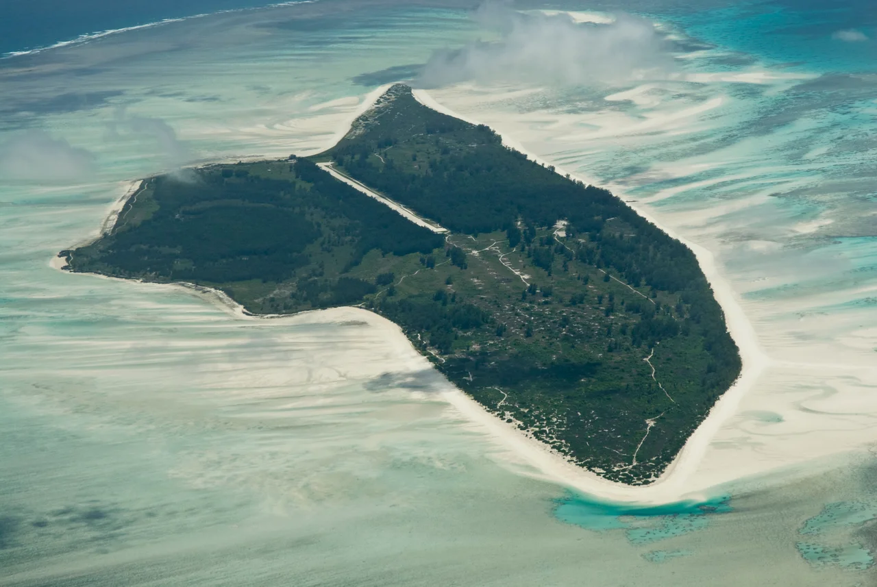
Two million pairs of sooty terns wheel above a scrap of sand barely six kilometers long. When they lift off together, the noise is a single rolling roar and the sky over Juan de Nova darkens as if a storm had blown in from the Mozambique Channel. This is the largest tern colony in the Indian Ocean, crowded onto an island so low and flat that its tallest feature is a ten-meter dune. Beneath the birds lie the ruins of something far less innocent: rail lines vanishing into scrub, a roofless prison, a small cemetery the French still tend.
A Speck on the Spice Route
Juan de Nova sits about a third of the way from Madagascar to the African mainland, in the narrowest stretch of the Mozambique Channel. A Galician admiral sailing for Portugal, João da Nova, stumbled across the uninhabited island in 1501 while bound for India, and his name stuck through centuries of misspelling on European maps. The island lay squarely on the spice route, yet no colonial power wanted it. It was too small, too low, too useless as a harbor. Reefs ring nearly the whole coast, leaving a single navigable pass; ships that misjudged it broke apart on the coral. The wreck of the steamer Tottenham, run aground on the southern reef in 1911, still rusts where it died. For most of recorded history, the only people who came were Malagasy fishermen, arriving each year when the sea turtles hauled out to lay their eggs.
The Phosphate Years
France claimed the island in 1897, and around 1900 leased it to a Frenchman who began digging its guano. Centuries of bird droppings had built rich phosphate deposits, and by 1923 the operation shipped 53,000 tons a year. The real machinery of misery arrived later. From 1952, a concession run by Hector Patureau worked the phosphate with laborers brought from Mauritius and the Seychelles, far from home and with no way to leave. Each man was made to dig a full metric ton of phosphate a day to earn three and a half rupees. Those who broke the rules were flogged or jailed in the island's own prison. In 1968 the Mauritian workers finally revolted. Their uprising forced the abuses into the open, including a foreman who claimed sexual rights over the laborers' families, and several managers were dismissed. When phosphate prices collapsed, the work stopped; the last laborers left in 1975, leaving warehouses, houses, and the prison to the salt and the sun.
Soldiers, Oil, and a Disputed Flag
Today a small French garrison rotated in from Réunion holds the island, resupplied by air roughly every six weeks alongside a lonely weather station built in 1973. Their presence is as much about sovereignty as science. Madagascar has claimed Juan de Nova since 1972, arguing the Scattered Islands should have come with its independence, and the dispute sharpened after Britain agreed in 2024 to hand the Chagos Archipelago back to Mauritius. There is treasure under the disputed water, too: in 2008 France granted offshore oil-exploration permits across some 62,000 square kilometers around the island, with companies pledging roughly 100 million dollars to drill. Madagascar contested the eastern boundary, and when the island was declared a nature reserve, the drilling plans were shelved by 2019.
A Laboratory Left to the Birds
Cut off from almost all human traffic, Juan de Nova has become an accidental sanctuary. Casuarina forest covers roughly half the island, green sea turtles still nest on the beaches, and the reefs that doomed so many ships now shelter coral that scientists prize precisely because no city, farm, or factory drains onto it. Researchers visit only a few times a year, by permit. BirdLife International lists the island as an Important Bird Area for its colossal sooty tern colony, and biologists from Réunion have come to study why the birds choose this particular sandbar. Yet even here, isolation is no shield. The reefs feel the warming sea, and invasive mosquitoes have reached the shore. What endures is the strangest of contrasts: a place where empire's cruelty rusted into silence, and the birds simply took it back.
From the Air
Juan de Nova lies at 17.05°S, 42.73°E, in the narrowest part of the Mozambique Channel, roughly 140 km west of the Madagascar coast near Tambohorano. The island is a low, pale ellipse about 6 km east-to-west, ringed by a vivid turquoise reef and quasi-lagoon roughly 30 km around — a striking visual target against deep blue water. A 1,300 m military airstrip runs along the southwest end near the weather station; the island is a restricted French military zone, not a public landing site, so treat it as a visual waypoint only. Best viewed from medium altitude (4,000-8,000 ft) in the clear, dry cool season. Nearest mainland civil fields are in western Madagascar (e.g., Morondava, FMMV); the garrison stages from Réunion's Roland Garros Airport (FMEE). Expect tropical haze and scattered convective cloud in the rainy season.
Nearby Stories
- Baie de Baly National Park 229 km away
- Tsingy de Bemaraha National Park 235 km away
- Tsiribihina River 331 km away
- Kirindy Forest 359 km away
- Bombetoka Bay 397 km away
- Bassas da India 525 km away
- Quelimane 568 km away
- Mount Mabu 621 km away