
Tuy Hoa Air Base
Walter Kidde Constructors broke ground in June 1966 on what everyone in the chain of command had argued about for months. CINCPAC wanted the base; MACV didn't — too expensive, too hard to secure, too much competition for scarce construction crews. Then Air Force Secretary Harold Brown went directly to Defense Secretary Robert McNamara, the contractor got its orders, and by the following year North American F-100 Super Sabres were rolling down a runway carved from the flat alluvial plains south of Tuy Hòa. That is how things moved in the II Corps Tactical Zone: slowly through committees, then all at once.
A Base Built Against Better Judgment
The debate over Tuy Hoa was not unusual for a war that generated constant arguments between theater commanders, Washington administrators, and field engineers about where to put airpower. The site had geography in its favor — flat land near the coast, good weather windows, proximity to the South China Sea — but MACV initially prioritized Phù Cát Air Base instead. When the decision finally swung in Tuy Hoa's favor in late 1965, the project was handed to a private contractor rather than military engineers, partly because military construction capacity was already stretched thin across Southeast Asia. The gamble worked: Walter Kidde completed the work on schedule and within budget, a small miracle in a theater where cost overruns and delays were the rule rather than the exception.
The Shadow Gunships
By early 1969, the base had taken on a specialized character. Flight A of the 71st Special Operations Squadron arrived from Nha Trang Air Base, flying AC-119G Shadow gunships — twin-boom propeller aircraft packed with sensors and miniguns, built for the slow, grinding work of interdicting supply lines at night. They were an unusual sight on a field more accustomed to fast jets. The AC-119G was itself an improvisation, a Cold War-era transport converted for combat because dedicated gunship production could not keep pace with demand. When Flight A transferred to the 17th Special Operations Squadron and then moved on to Phù Cát in April 1970, it marked the beginning of the end for American operations at Tuy Hoa. South Vietnamese forces assumed control of the facility on January 15, 1972.
Four Years, Then Silence
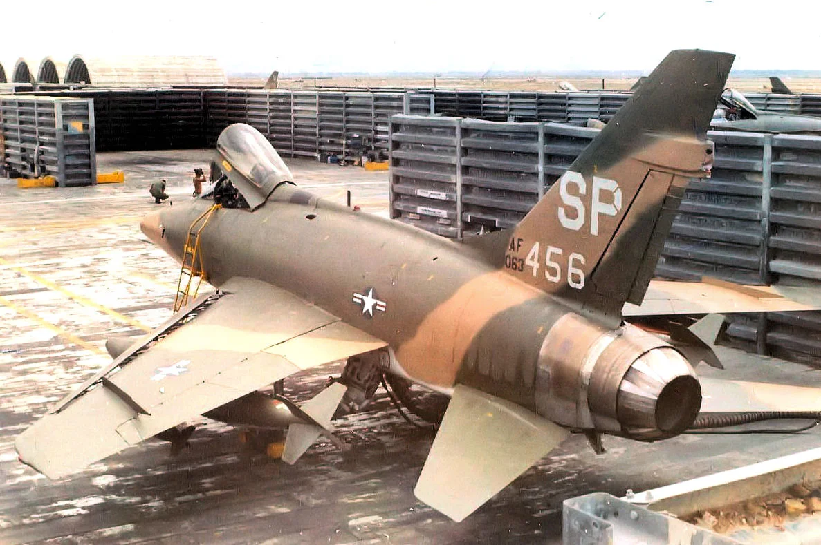
The base's operational life lasted barely four years under American command — 1966 through 1970 — a timeline that mirrors the broader American escalation and drawdown in the region. Photographs from 1968 and 1969 show the ramp crowded with F-100Ds from units including the 306th, 308th, and 309th Tactical Fighter Squadrons, and National Guard aircraft from the New Mexico Air National Guard's 188th TFS. In April 1975, People's Army of Vietnam forces captured the facility. For several decades the runways went largely unused, a long quiet after years of noise. The site was eventually redeveloped as Đông Tác Airport — now Tuy Hoa Airport — serving commercial routes along the central Vietnamese coast.
What Remains of the Record
Almost nothing physical survives from the American-era base. The runway alignment persists because runways are expensive to relocate, but the hardstands, fuel farms, operations buildings, and revetments that defined the wartime installation have been replaced or demolished. What survives is documentary: unit histories, tail-code registers, accident reports, and a handful of reunion websites maintained by veterans who served there. One entry in the Aviation Safety Network's records notes that on April 22, 1970 — ten days after the Shadow gunships departed — a Douglas C-47A operated by Winner Airways overran the runway on landing and was damaged beyond repair. Small footnotes of a war catalogued in thousands of such entries.
From the Air
Tuy Hoa Airport (IATA: TBB, ICAO: VVTH) sits at approximately 13.05°N, 109.33°E on the coastal plain just south of the Đà Rằng River mouth. Approaching from the south along the coast, pilots today follow essentially the same final approach path used by F-100 Super Sabres in the late 1960s. The terrain is flat and unobstructed, with the South China Sea visible to the east and low hills to the west. Nearby ICAO references: VVPQ (Phù Cát, ~90 km north) and VVNT (Cam Ranh, ~130 km south). Recommended viewing altitude: 1,500–3,000 feet for a clear look at the runway layout and surrounding plains.
Nearby Stories
- Sông Cầu 12 km away
- Chư Yang Sin National Park 32 km away
- Bidoup Núi Bà National Park 47 km away
- Central Highlands (Vietnam) 60 km away
- Po Nagar 63 km away
- South-East Asian Theatre of World War II 317 km away
- Kashmir Princess 380 km away
- Battle of the Paracel Islands 407 km away