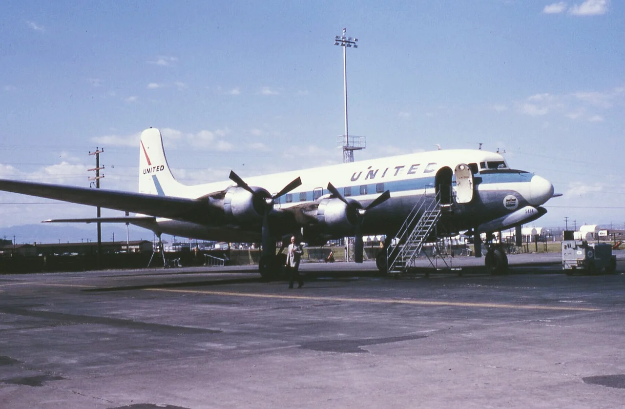
United Air Lines Flight 615
At 4:25 a.m. on August 24, 1951, United Air Lines Flight 615 received clearance for a straight-in approach to Oakland Airport. It was the last radio transmission anyone would hear from the Douglas DC-6. Minutes later, the aircraft careened into Tolman Peak, 15 miles southeast of the airport, scattered across the downslope, and exploded into Dry Gulch Canyon below. All 44 passengers and 6 crew members died.
A Transcontinental Route
Flight 615 was a transcontinental east-west service connecting Boston, Hartford, Cleveland, Chicago, Oakland, and San Francisco. The aircraft had departed Chicago at 10:59 p.m. Central time for the overnight leg to Oakland. At around 4:16 a.m. Pacific time, pilot Marion W. Hedden of Los Altos made contact with the Oakland control tower, preparing for his landing approach. He mentioned no trouble. The night was routine, the kind of early-morning arrival that airline crews completed thousands of times without incident. Nine minutes later, the aircraft was cleared for approach, and then silence.
Three Miles Off Course
The Civil Aeronautics Board investigation revealed that the crash was caused by the pilot's decision to abandon prescribed instrument landing procedures. Instead of following the established approach path, Hedden relied on visual reference and used the copilot's automatic direction finder. The ADF, a navigation instrument that points toward a radio beacon, guided the aircraft three miles off the correct course and below the prescribed minimum altitude of 3,500 feet. At that altitude and in that position, the mountainous terrain southeast of Oakland became a wall. Tolman Peak, rising from the East Bay hills, was directly in the path of the deviated approach.
The Mountains Remember
The crash site on Tolman Peak, in the hills between Oakland and Union City, remains accessible to hikers who know where to look. Fragments of the aircraft are still scattered across the remote canyon, slowly being absorbed by the chaparral and live oaks of the East Bay hills. The disaster occurred in the early years of commercial aviation's rapid expansion, a period when accident investigation was still developing the systematic approach that would eventually make air travel the safest form of transportation. The lesson of Flight 615, that instrument procedures exist because mountains do not move, was learned at the cost of 50 lives on a hillside that most residents of the Bay Area have never visited.
From the Air
The crash site is located at 37.61°N, 121.99°W on Tolman Peak in the East Bay hills, approximately 15 miles southeast of Oakland International Airport (KOAK). Hayward Executive Airport (KHWD) is approximately 5 miles west. The terrain is mountainous and rises steeply from the valley floor. Pilots approaching Oakland from the east should note the elevation of the East Bay hills, which reach over 2,000 feet in this area.
Nearby Stories
- Joaquin Miller Park 2.8 km away
- The Kilns That Never Burned 22 km away
- South Pacific Coast Railroad 23 km away
- Altamont Free Concert 24 km away
- The Farallon Islands: California's Forbidden Rock 33 km away
- Cleveland Elementary: The Shooting That Changed the Law 37 km away
- Kesterson National Wildlife Refuge 66 km away
- ʻAkaka Falls State Park 3686 km away