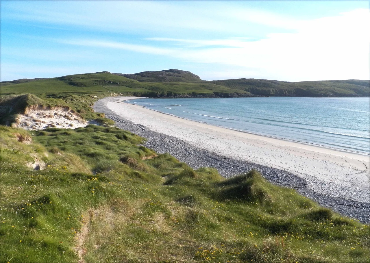

Vatersay
On 28 September 1853 a three-masted migrant ship called the Annie Jane struck rocks off Vatersay's West Beach during a storm. Within ten minutes the ship was breaking up, casting about 450 people into the sea. The islanders did what they could in conditions that were beyond what anyone could do. Only a few survivors made it ashore. The inscription on the cairn that now marks the burial site reads with terrible plainness. About 350 emigrants from Liverpool bound for Quebec drowned in that bay, and their bodies were interred there.
The Shape of the Island
Vatersay is a tombolo. Two rocky islands, north and south, joined by a sandy isthmus. On either side of the isthmus stretch large white-sand beaches. Bagh Siar, West Bay, opens to the Atlantic. Bagh Bhatarsaigh, Vatersay Bay, faces east towards the Sea of the Hebrides. Sand dunes back both beaches. The settlement of Caolas on the north coast holds the distinction of being the westernmost permanently inhabited place in Scotland. The main village, also called Vatersay, lies in the south. To the south stretch the uninhabited Barra Isles, Pabbay and Mingulay and Sandray, with Berneray at the chain's end.
Brochs, Cairns and the Deep Past
The island has remains of an Iron Age broch at Dun a' Chaolais, overlooking the Sound of Vatersay. A nearby passage grave dates to the third millennium BC. A Bronze Age cemetery lies at Treseabhaig, south of Heiseabhal Mor. A cairn built around 1000 BC stands west of the village. The offshore islet of Bioruaslum carries a walled fort that may be of Neolithic provenance. Vatersay's archaeological record is dense, layered, and very old. People have been making homes and graves on this small island for at least five thousand years. The Bonnie Prince Charlie flower, Calystegia soldanella, grows here and on Eriskay. Local tradition holds that the seeds came from a French ship in 1745.
The Vatersay Raiders
At the end of the nineteenth century the existing landowner evicted all the crofter inhabitants. They wanted the whole island for their own farming. The crofters had been there for generations, and they took their displacement hard. Between 1902 and 1906 some of the men, who became known as the Vatersay Raiders, returned and seized land. They claimed an ancient Highland law allowed a man to acquire land by building a wooden dwelling and lighting a fire on its hearth within a single day. Lady Cathcart, the absentee landlady who had inherited the estate from Colonel John Gordon of Cluny, took them to court. The Raiders were imprisoned. The verdict outraged the public. After much protest, in 1909 the Congested Districts Board for Scotland purchased Vatersay for 6,250 pounds and broke it up for crofting. The raiders' descendants still farm the land they reclaimed.
Wrecks on the Western Shore
The Annie Jane was the worst disaster but not the only one. Two Chinese seamen from the SS Idomeneus, which sank on 28 September 1917, are buried near the Annie Jane monument. A commemorative headstone stands in Cuier Churchyard. A Catalina flying boat crashed on the slopes of Heiseabhal Beag in 1944, the wreckage scattered in a stream bed near the shore. Vatersay's western coast catches the worst of the Atlantic, and over centuries it has caught ships and aircraft alike. The monument above West Bay is small. The story it carries is enormous. Hundreds of people set out for a new life in Quebec, did not make it past Hebridean rocks, and now lie buried under turf on an island they had never heard of.
Causeway Era
Since 1991 Vatersay has been connected to Barra by a 250-metre rock causeway across the Sound of Vatersay. Castlebay is only two miles by road from the northern end of the causeway, then about a fifteen-minute drive north to Barra Airport. Vatersay is no longer the difficult-to-reach end of the inhabited Hebrides. The connection has stabilised the small population, which had fallen to 65 in 1988. Eurasian otters work the coast. Grey seals haul out on the beaches. Atlantic puffins nest in the cliffs. The Bonnie Prince Charlie flower still grows in the dunes. The Annie Jane cairn still stands above West Bay, with the wind, the gulls, and the long memory of an island that has been many things and is still inhabited.
From the Air
Vatersay is located at 56.9306 N, 7.5394 W, the southernmost and westernmost inhabited island of the Outer Hebrides. The distinctive double-island shape with the central isthmus is the easiest identifying feature. The Vatersay Causeway to Barra is visible to the north. The Annie Jane monument lies above West Bay on the western shore. Recommended altitude 1,500-3,000 ft for island detail. Nearest airports: Barra (EGPR) approximately 4 nm north on Traigh Mhor, Benbecula (EGPL) approximately 52 nm north. Expect Atlantic conditions and brisk westerlies.
Nearby Stories
- German submarine U-722 7.3 km away
- Cladh Hallan 10 km away
- HMS Sturdy (1919) 13 km away
- SS Polonia 28 km away
- Canna 36 km away
- SS Athelstane (1941) 78 km away
- St Kilda, Scotland 82 km away
- German submarine U-516 102 km away