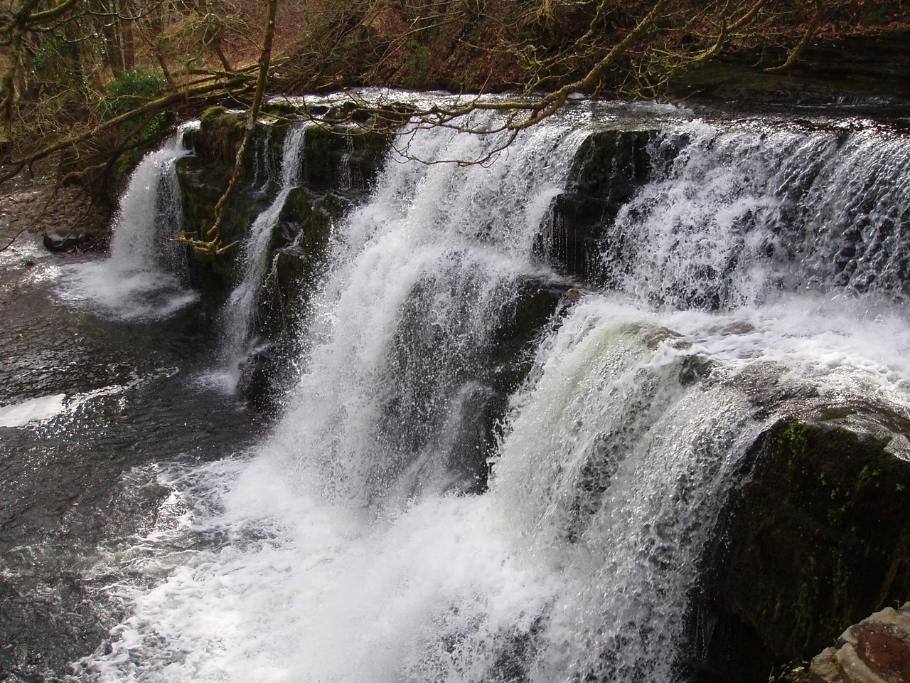

Waterfall Country
Walk behind a waterfall and the world inverts. The roar surrounds you, the daylight comes through curtains of water, and the rock above your head is the only reason you do not drown. Sgwd yr Eira - the fall of snow - is the only major waterfall in Britain you can walk behind, a hard sandstone overhang sheltering the path while the Afon Hepste pours over it. The locals figured this out centuries ago. The drovers walked their cattle behind it on the way to market. At the upper reaches of the Vale of Neath, where four small rivers cut through soft mudstone to reach hard sandstone they cannot easily wear away, the Welsh have a name for what nature did here: Bro'r Sgydau. The country of the falls.
Why So Many
Glaciers carved the Vale of Neath deeper than its tributaries could keep up with. When the ice finally retreated, the small rivers feeding the main valley found themselves perched too high, and they have spent the last ten thousand years cutting down through their beds, trying to catch up. The rock beneath them is a layered cake of Carboniferous sandstones and mudstones, dipping gently southward, formerly known as the Millstone Grit Series and now classified as the Marros Group. The mudstones erode quickly under flowing water. The sandstones do not. So the rivers wear pockets into the soft beds, leaving the resistant sandstone as stepped lips, and waterfalls form. Faults running northwest to southeast bring different rock types into sharp contact, and the waterfalls cluster where they meet. The geometry of the falls is the geometry of the geology - you can read the faults in the cliffs.
On the Mellte
Three named falls step down the Afon Mellte in quick succession, each formed where the riverbed crosses a band of harder rock. Sgwd Clun-gwyn - the fall of the white meadow - sits at the top, formed by a fault bringing sandstone up against mudstone. Below it Sgwd Isaf Clun-gwyn, the lower white-meadow fall, breaks into multiple stages over a more complex outcrop. Lowest is Sgwd y Pannwr, the fall of the woollen washer or fuller, named for the medieval cloth workers who once pounded wool in moving water like this. The Welsh names carry their craft history forward: the meadow, the woollen-washer. A morning walk takes in all three falls and ends at Sgwd yr Eira on the neighbouring Afon Hepste, where the cattle drovers' path runs behind the curtain of water. The Forestry Commission and the Brecon Beacons National Park Authority closed that path in 2007 after rocks came loose. After stabilisation works the route reopened in 2008, and people walked behind a waterfall again.
Hidden and Famous
Some of the falls are easy. Henrhyd Fall on the Nant Llech drops ninety feet in a single plunge over the Farewell Rock - a hard sandstone that marks the base of the Coal Measures - and the National Trust manages access with footpaths and signage. The gorge below it has appeared in films, including a scene from The Dark Knight Rises where Batman emerges from a cave behind it. Other falls are harder. Sgwd Einion Gam, the fall of crooked Einion, drops seventy feet into a plunge pool ringed by dark cliffs furred with moss and liverwort. Legend pairs it with the nearby Sgwd Gwladus and her lover Einion. The path to Einion Gam is rough and requires several tricky crossings of the Pyrddin, and the reward at the end is one of the most spectacular and least visited cascades in the area. Above Sgwd Gwladus, the patterned sandstone preserves fossil roots of trees that grew here three hundred million years ago - the same Carboniferous forests that became the South Wales coal.
Turner Came Here
Further west, Melincourt Falls on the Melin Court Brook drops eighty feet at the head of its small tributary valley. Melincourt is the unusual one. J.M.W. Turner painted it in 1795, finding what other Romantic artists also sought in this corner of Wales: the sublime in miniature, the picturesque framed in trees. Two hundred years later, the falls still draw walkers up the footpath from Resolven, the modern car park sitting where Turner once had to scramble. The Wildlife Trust of South and West Wales manages the surrounding nature reserve. Even further west, Aberdulais Falls combines waterfall and industrial heritage - the rushing water of the Dulais once powered a tinplate works whose ruins are now in the care of the National Trust. The point where industry met landscape is preserved as both.
Loving It Too Much
Waterfall Country has a problem common to beautiful places: it is being loved into damage. Most of the falls sit within Sites of Special Scientific Interest or Special Areas of Conservation, designations meant to protect their biodiversity and geodiversity, but the visitors come anyway. Paths erode. Vegetation is trampled. The Brecon Beacons National Park Authority opened a visitor centre at Pontneddfechan in 2008 to channel and inform the crowds, then closed it in 2016 after a funding cut. The building is now a cafe that still offers some local information. Cwm Porth, near Ystradfellte, runs a smaller centre. The walks remain free, the falls remain spectacular, and the work of keeping them that way continues - erosion control, path repairs, the constant negotiation between access and preservation. The country of the falls endures, more or less, in the gap between the rocks that wear away and the rocks that will not.
From the Air
Located around 51.75°N, 3.59°W in the upper Vale of Neath, between Pontneddfechan and Ystradfellte in the Brecon Beacons / Bannau Brycheiniog National Park. The four-river waterfall cluster threads through wooded gorges in a tight area roughly five miles across. Cardiff (EGFF) is approximately 35 miles southeast; Swansea (EGFH) is about 25 miles south. Best viewed at 2,500-3,500 feet AGL with the green Beacons rising to the north and the Vale of Neath opening southwest toward Swansea Bay. The faulted geology shows from above as a clear northeast-southwest grain across the landscape.
Nearby Stories
- Big Pit National Coal Museum 4.1 km away
- Mumbles Lifeboat Disaster 4.1 km away
- Murder of Lynette White 4.3 km away
- Craig Gwrtheyrn 4.7 km away
- Hay Castle 5.4 km away
- Kidwelly Castle 6.8 km away
- Battle of Orewin Bridge 21 km away
- Lundy 49 km away