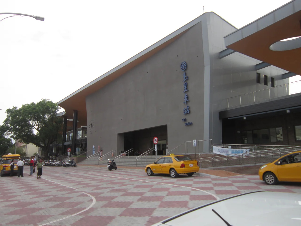

Yuli
The pomelos start appearing just outside the station exit, piled in crates on folding tables, their thick yellow-green skins giving off a faint citrus smell in the warm air. Yuli (玉里) is the kind of town where the best orientation tool is not a map app but the tourist board in front of the railway station—a hand-drawn thing that shows where the noodle shops cluster, which road leads to the hot spring, and roughly how far the mountains are before the path gets serious. This is the central township of the Huatung Valley in Hualien County, caught between the Central Mountain Range and the Coastal Mountain Range, a farm town with a historic trail threading into the high country and a railway line threading through toward the coast. It is not a destination that announces itself loudly. But people who stop here—and most visitors do not, rushing through on the way between Hualien and Taitung—tend to find it sticks.
The Walami Trail and the Mountains
The main draw for hikers and history seekers is the Walami Trail, a path that follows an old Japanese administrative route into the mountains east of the valley. During the colonial period, Japanese authorities used it to maintain surveillance of indigenous villages in the high country—a history that the trail carries quietly, in the character of the path itself more than in any signage. Today, much of the trail has been reclaimed by forest and erosion, but the accessible sections offer serious hiking through subtropical vegetation, with a cabin at the highest point reachable in a day that allows for an overnight stay. The permit and police registration requirements are not bureaucratic nuisances but genuine necessities: the mountains above Yuli are remote, and the trail is a real backcountry route rather than a manicured park walk. For those who complete even the lower sections, the views back over the valley floor and its patchwork of rice fields are reward enough.
Yushan National Park at the Doorstep
Yuli serves as one of the access points to Yushan National Park, one of Taiwan's nine national parks. Yushan—Jade Mountain—is the highest peak not only in Taiwan but in all of East Asia outside of the Himalayas and Central Asian ranges, reaching 3,952 metres. The park encompasses a vast area of the Central Mountain Range, and while Yuli is not the only approach to the park, it lies on the eastern edge of the protected zone, making it a logical staging point for hikers heading into the high country from the east. The park's designation reflects Taiwan's commitment to protecting one of the island's most dramatic natural environments—a zone of endemic species, high-altitude grasslands, and peaks that gather cloud and snow in winter while the valley below remains subtropical.
Yuli Mian and the Food of the Valley
Ask for the local specialty and you will be pointed toward Yuli mian—Yuli noodles—a dish that inspires a certain gentle local pride without necessarily overwhelming visitors who expected something more dramatically different from noodles found elsewhere in Taiwan. The distinction is in the texture and the preparation, subtle enough that the experience of eating a bowl in a Yuli noodle shop matters more than the technical description of what sets the noodles apart. Alongside the noodles, the town's other food identity is in fresh fruit. The grapefruit and pomelos sold outside the station are a genuine pleasure during the hot valley summers, their bitterness and sweetness balanced in a way that makes them feel medicinal as well as delicious. Night markets in the township, though modest by Taiwanese urban standards, offer the usual repertoire of grilled things and cold drinks in an atmosphere that is relaxed and unhurried.
Getting Around a Valley Town
Yuli is a railway town, which shapes how both residents and visitors move through it. The Taiwan Railway station connects it to Hualien to the north and Taitung to the south, but the countryside around the township—the waterfalls, the hot spring, the hiking trailheads—requires a bicycle or scooter. Rental shops cluster near the station for this reason. The hot spring is about 6 kilometres southeast of the large bridge, past a sign that would be easy to miss if you were moving quickly and not paying attention. Two waterfalls and several short hiking routes are scattered in the surrounding hills, the kind of sights that reward a half-day of slow, directionless exploration more than targeted seeking. Ruisui to the north has hot springs of its own, along with the famous Tropic of Cancer marker. Hualien to the north is the county's touristic centre and the base for Taroko Gorge. Taitung to the south—the youngest city in Taiwan, developed during Japanese colonial administration, with a strongly indigenous, Hoklo, and Hakka population—is the other anchor of the valley's long axis.
From the Air
Yuli sits at approximately 23.39°N, 121.38°E in the central Huatung Valley, Hualien County. From the air, the township is identifiable as a small urban cluster on the valley floor, flanked tightly by mountain ridgelines on both sides. The railway line is visible threading through from north to south; the large bridge southeast of town marks the road toward the hot spring. Nearest airport is Hualien Airport (RCYU), roughly 60 km to the north. At 3,000–4,000 feet, the full valley setting is visible: the Central Mountain Range rising steeply to the west, the Coastal Range to the east, and the agricultural plain between them. Yushan National Park's high terrain is visible on clear days to the west-southwest, its peaks among the highest visible from this section of Taiwan's east coast.
Nearby Stories
- Lulin Observatory 6.6 km away
- Sanxiantai 10 km away
- Ci En Pagoda 13 km away
- 2024 Hualien Earthquake 14 km away
- Baolai Spring Park 26 km away
- Twin Forts of Romblon 1182 km away
- Sinking of MV Sewol 1228 km away
- Sibuyan Island 1230 km away