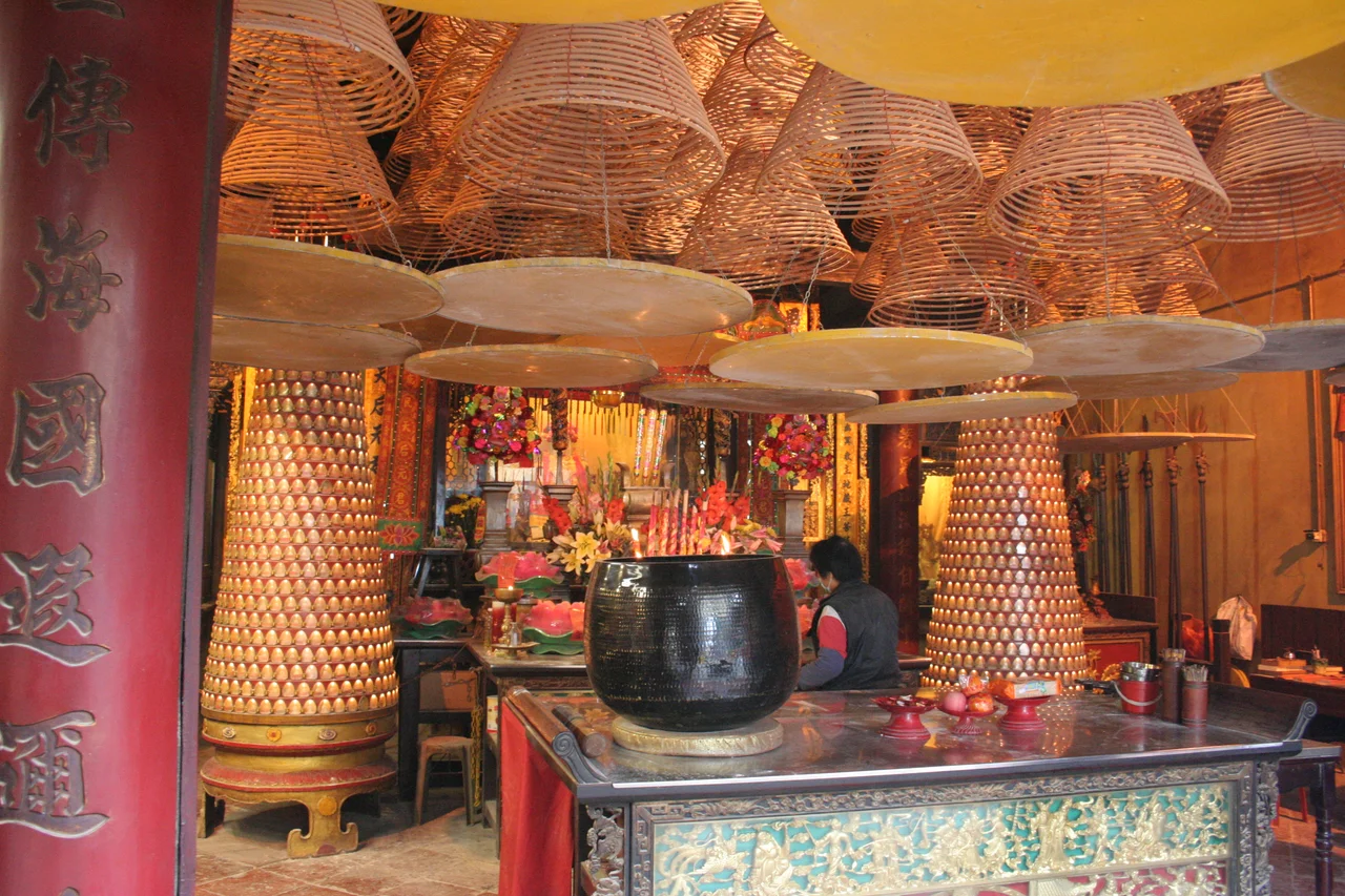

A-Ma Temple
When Portuguese sailors landed on the peninsula in the sixteenth century and asked the local people what the place was called, the answer they received was A-maa-gok — the name of the nearby temple, meaning roughly 'bay of A-Ma.' The Portuguese wrote it down, adjusted the spelling across generations, and eventually dropped the first syllable. The name of a goddess's shrine became the name of a city. That temple, built in 1488, still stands.
The Goddess Who Names the Sea
Mazu — also written Ma Tsu — is the patron deity of sailors and fishermen across southern China and Southeast Asia. Worshipped for her power to calm storms and guide vessels safely home, she appears in hundreds of temples along the South China coast. The A-Ma Temple in São Lourenço predates the Portuguese settlement by decades; it was here when the first European ships arrived, and it has outlasted four and a half centuries of colonial rule. Incense has burned in its halls almost without interruption since the Ming Dynasty. Devotees still come to pray before long sea voyages, and the scent of sandalwood drifts down the hillside toward the waterfront below.
Six Halls on a Hillside
The temple is not a single building but a complex of six interconnected parts climbing a rocky slope: the Gate Pavilion at the entrance, a Memorial Arch, the Prayer Hall, the Hall of Benevolence (the oldest surviving section), the Hall of Guanyin, and the Zhengjiao Chanlin Buddhist Pavilion. The layering of Buddhist and Taoist practice within a single sacred compound is characteristic of Chinese folk religion, where the boundaries between traditions are porous. Each hall has its own atmosphere — the lower halls open and busy, the upper ones quieter, more worn, more intimate with the hillside rock. Stone carvings of boats are cut into the boulders near the top, left by grateful sailors over many generations.
A Misunderstanding Frozen in Maps
The story of the name is delightfully complicated. After hearing 'A-maa-gok,' the Portuguese transcribed the place in more than a dozen different forms over the centuries: Amacão, Ama Cuão, Amaquão, Amangão, Amaquam. Eventually the initial A was misread or elided, and the forms Macão, Macao, and finally Macau took hold. Chinese texts had described the temple centuries before any European cartographer attempted to render its name in Roman letters — the temple appears in paintings and chronicles that predate the Portuguese settlement. It is one of the first sites photographed in Macau, a distinction that underscores how persistently this small complex has attracted outside attention.
Heritage and the Weight of Recognition
In 2005, the A-Ma Temple was designated one of the sites of the Historic Centre of Macau, a UNESCO World Heritage property that encompasses twenty-five buildings and public spaces across the peninsula. The inscription recognized the territory's unique position as a meeting point of Eastern and Western cultures — four centuries in which Chinese and Portuguese traditions shared, and sometimes collided within, the same small space. For the temple, the designation changed little in practice. Worshippers continued to arrive; offerings continued to be made. The stone stairs that lead up from the waterfront are polished by feet, not by renovation crews, and that smoothness tells a truer story about the place than any official plaque.
From the Air
The A-Ma Temple sits at the southwestern tip of Macau Peninsula at 22.186°N, 113.531°E, visible from the water below. At 1,500–2,500 feet approaching from the southwest over the Pearl River estuary, the rocky promontory and temple rooflines are distinguishable against the dense urban hillside. Macau International Airport (VMMC) is about 4 km to the southeast on Taipa Island. The Governador Nobre de Carvalho Bridge and the Friendship Bridge span the water between the peninsula and Taipa and are useful orientation landmarks. Haze from Pearl River Delta traffic reduces visibility in summer; autumn and winter months are clearest.
Nearby Stories
- 2024 Shenzhen Stabbing 0.8 km away
- Lantau Peak 1.5 km away
- Kweilin Incident 2.4 km away
- Taishan City 7 km away
- Wanshan Archipelago Campaign 38 km away
- Hong Kong 12 68 km away
- Battle of Nanpeng Island 82 km away
- Erhai Lake 1335 km away