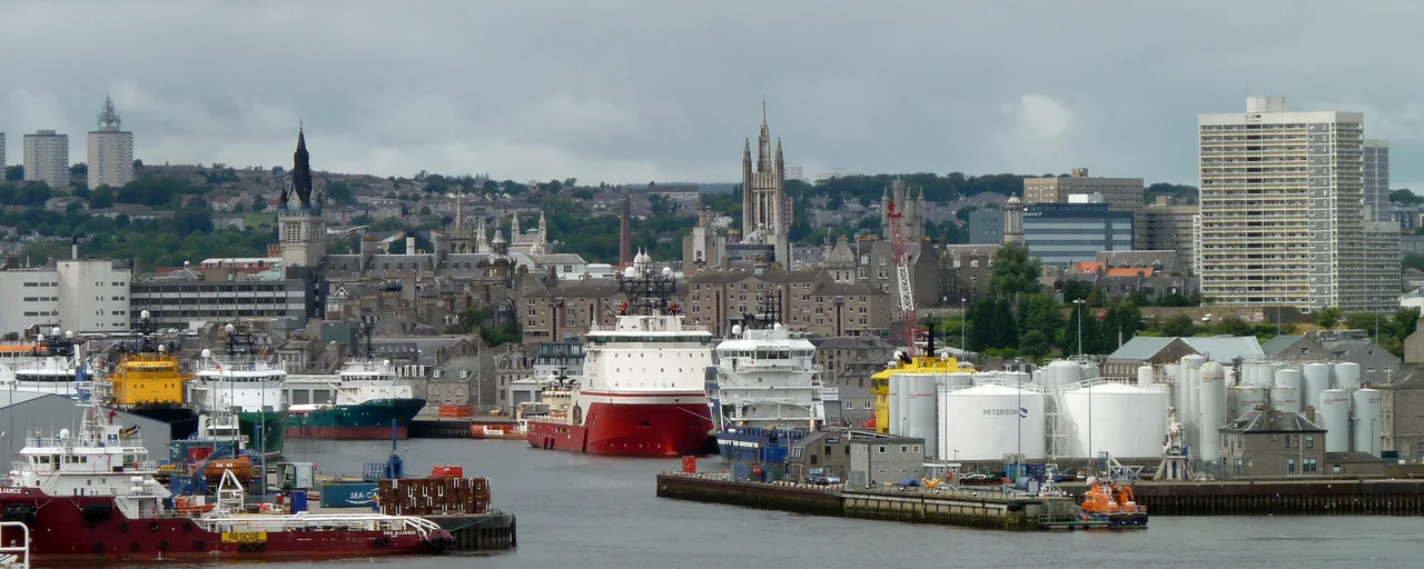

Aberdeen Harbour
In 1136 King David I of Scotland granted the Bishops of Aberdeen the right to charge a tithe on every vessel visiting the port at the mouth of the Dee. That charter is the founding document of what would become Aberdeen Harbour, and it makes the harbour, by continuous operation, the oldest existing business in the United Kingdom. Eight hundred and ninety years later the docks still run. Container ships replace clippers; offshore supply vessels replace steam trawlers; the cargo changes; the work continues. Rebranded as the Port of Aberdeen in 2022, the harbour is now the largest in Scotland by berthage and area, and busier by vessel visit than any other Scottish port. Stand on the North Pier and you are standing on a breakwater first laid in 1775 by John Smeaton, the man who also built the third Eddystone Lighthouse. The pier is still there. So is the trade.
The Bishops' Port
The medieval Dee did not flow where the modern Dee flows. It came down from the southwest, turned eastward, and reached the sea through a tangle of channels, sandbanks, and small islets the locals called inches. Ships threaded through this maze to the northernmost channel, where the port lay just south of the town. The arrangement was unreliable. Coastal currents and northerly winds threw sandbars across the harbour mouth and left the inner channel only a few feet deep. In 1595 King James VI issued a charter to fund improvements, and over the next century the burgh patched together piers, bulwarks, and shore defences as best it could. The real transformation began in 1770, when planning started for the construction that would create the modern layout. John Smeaton oversaw the North Pier between 1775 and 1781 - 457 metres of rubble masonry with ashlar facing, built at Sandness, now called Footdee or locally Fittie. The pier's job was to scour the entrance with the river's flow, sweeping deposits out to sea instead of letting them silt the harbour.
Telford, Trawlers, and Tall Ships
Thomas Telford came in 1802 and recommended extending Smeaton's pier to 610 metres, past the rocks that had wrecked at least five ships at the harbour mouth. The work was finished in 1816 by John Gibb, the resident engineer who also built the wet dock and rerouted the Dee. James Abernethy followed in the 1840s with the Victoria Dock - 13.8 hectares of enclosed water finished in 1848 - and a pair of cast-iron leading lights on the Torry side to guide ships through the now narrow entrance. The fishing fleet grew with the docks. A herring station opened in 1835, and when the railway reached Aberdeen in 1850, overnight fish trains began running to Billingsgate in London. Steam trawlers arrived in 1882; by 1912, over 230 of them were based in Aberdeen, working the North Sea while a fish-processing industry of mostly women - working in teams of three to a boat, gutting and curing - filled the quayside sheds. The North Pier got its final 152-metre concrete extension in the 1870s, reaching its present 792.7 metres.
Oil Comes Ashore
By the late 1960s Aberdeen's fishing fleet was ageing and shipbuilding was sliding. Then in 1973 Shell signed the partnership that changed everything: an oil and gas supply base at Maitlands Quay on the Dee. The old village of Torry, on the south shore, was demolished to make room - only a few pre-19th-century houses survived. The Victoria Dock tide locks came out in 1975 and the whole harbour became tidal again, dredged as needed. Within a decade Aberdeen had become the principal European port serving the North Sea offshore oil and gas industry. Platform supply vessels, dive support ships, anchor handling tugs, survey vessels, and emergency response craft began making up between sixty-five and seventy-five percent of marine traffic by 2015. The fish market closed in the mid-1990s. The trade had moved from herring barrels to drilling muds, but the docks were full.
South Harbour
The Port of Aberdeen was running out of room. In 2017 construction began on a new £350 million harbour at Nigg Bay, immediately south of the existing port - the largest marine infrastructure project in the United Kingdom. It opened in 2023 as South Harbour, adding 1.5 kilometres of deep-water berthage capable of taking cruise ships, cargo vessels up to 300 metres long, and the heavy fabrication shipments the offshore wind industry needs. Four new quays carry the names of nearby castles - Balmoral, Dunnottar, Crathes, Castlegate - and bring the total to one of the most flexible port facilities on the British coast. Aberdeen now generates an estimated £1.5 billion a year in gross value added and supports over twelve thousand jobs. The 1136 charter is still, in a sense, in force: a port at the mouth of the Dee, charging dues on shipping, working continuously through nine centuries of changing trade. Few institutions anywhere have lasted that long.
From the Air
Aberdeen Harbour sits at 57.14N, 2.08W at the mouth of the River Dee on Scotland's east coast. From altitude the port is unmistakable: the long curved North Pier reaching east into the North Sea, the Victoria and Albert Docks immediately inland, and the new South Harbour at Nigg Bay to the south. Aberdeen International (EGPD) lies 4nm northwest. Best viewed at 2,000-3,500 ft AGL in clear conditions; look for the dense quayside cluster of orange offshore supply vessels alongside the cruise terminal on Jamieson's Quay, and the granite city stretching west toward Union Street and Marischal College's silver crown.
Nearby Stories
- Monymusk Priory 3.9 km away
- Deer Abbey 8.6 km away
- Glendronach Distillery 9.8 km away
- Fettercairn Distillery 13 km away
- Dunnottar Castle 16 km away
- Piper Alpha 146 km away
- German submarine U-1274 151 km away
- HMS Nottingham (1913) 192 km away