
Abernethy, Perth and Kinross
In 1072, William the Conqueror brought an army to a small Perthshire village. He had taken England six years earlier at Hastings. Now he wanted Scotland to acknowledge his overlordship, and Malcolm III of Scotland - Malcolm Canmore - met him at Abernethy and gave it. The Treaty of Abernethy was signed beneath what was already an ancient site: a Pictish religious centre on land granted by King Nechtan, a parish church dedicated to Saint Brigid of Kildare, and the round tower that still stands today. Most villages in Britain do not have an entry in eleventh-century European geopolitics. Abernethy does.
Mouth of the River Nethy
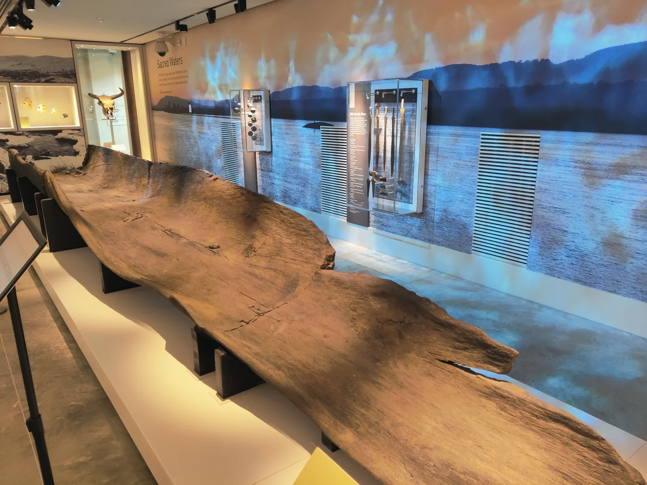
The name itself tells the oldest story. Abernethy, recorded in the tenth century as Aburnethige, comes from the Pictish word aber meaning 'river mouth' and the Celtic root nect meaning 'pure' or 'clean.' The Nethy Burn still flows down from the Ochil Hills past the present village to join the River Earn, which meets the River Tay just east of town. The Gaelic form is Obar Neithich. The Pictish kingdom centred here had its capital - or one of them - at Abernethy. Castle Law above the village began as an Iron Age hillfort and was later reoccupied as part of what archaeologists call the Abernethy complex of Roman sites. In 2001 a Bronze Age log boat was pulled out of the mud at Carpow, dating from around 1000 BC. It is the second-oldest boat ever recovered in Scotland.
The Saint and the Tower
The parish church sits on land that, according to medieval sources, was granted by Nechtan, king of the Picts. It is dedicated to Brigid of Kildare, the Irish saint who lived from around 451 to 525, and is said to have been founded by Dairlugdach, second abbess of Kildare itself. That an Irish abbess crossed the sea to found a Pictish church at the head of the Tay estuary tells you something about the connectedness of early Christian Britain and Ireland. The round tower beside the church is the visible inheritance of that connection - one of only two Irish-style round towers in Scotland. Even some early Arthurian literature appears to mention the place, identifying it as 'Afarnach's Hall' in the oldest layer of the legends. Abernethy was a Pictish bishopric for centuries before the seat moved west to Muthill and then Dunblane.
From William the Conqueror to Winston Churchill
After Malcolm Canmore met William here in 1072, the village settled into a quieter life as a small Augustinian priory founded in 1272, then a collegiate church under the Douglas Earls of Angus, then - in 1802 - a plain red sandstone parish church when the medieval remains were finally cleared from the churchyard. In October 1909 the future Prime Minister Winston Churchill came to give a political speech and was protested by suffragettes, among them Adela Pankhurst. In the Second World War, the village hosted Polish forces and took in evacuees. In 2012, the London Olympics torch relay passed through. The Museum of Abernethy, opened in May 2000 by the broadcaster Magnus Magnusson, holds the key to the round tower and celebrated its twenty-fifth anniversary in 2025.
A Burgh of 700 Souls
Abernethy became a burgh in 1476, became a police burgh in 1877, and gained a town council in 1901. In 1947 the Perth MP Alan Gomme-Duncan told the House of Commons that 'Abernethy is probably one of the best examples in Scotland of an extremely efficiently run burgh of 700 inhabitants, with a live, wide-awake spirit.' The burgh was abolished in 1975 along with most of Scotland's small councils, but the village kept its character. Soft fruit and salmon were the old industries, weaving the other. A general store still trades on Main Street. The Gala and Fete Day each June still includes a race to the top of Castle Law the following day, up the same Iron Age hill where the Picts once watched for trouble. Trouble, for once, has not come for a while.
From the Air
Abernethy lies at 56.326 north, 3.311 west, in Strathearn at the foot of the Ochil Hills, about 8 miles south-east of Perth in Perth and Kinross. From the air the village appears as a tight settlement on the northern edge of the Ochils, near the confluence of the River Earn with the River Tay, with the Firth of Tay opening eastward toward the North Sea. The round tower is a distinctive vertical landmark. Best appreciated from 2,000 to 4,000 feet. Dundee Riverside (EGPN) lies roughly 14 nm east-northeast. Edinburgh (EGPH) is about 33 nm south, Glasgow (EGPF) 55 nm south-west. The M90 motorway and A913 road are clearly visible from the air.
Nearby Stories
- Drummond Castle 0.4 km away
- St Andrews 0.8 km away
- Aberfeldy 2.2 km away
- Yellowcraig 2.7 km away
- Fordell Castle 3 km away
- Battle of Sauchieburn 3.2 km away
- Battle of Dun Nechtain 3.3 km away
- Airlie Castle 13 km away